Graz, Austria • January 12, 2023: Vexcel Imaging today releases the latest version of its all-in-one photogrammetric software suite UltraMap, with sophisticated and best-in-class water handling features, an enhanced Ortho module performance and a redesigned Ortho reprocessing workflow. UltraMap v6.0 introduces True Pixel Processing (TPP), a proprietary raw data processing approach in the Essentials module and supports professional data production for the recently launched UltraCam Eagle 4.1.
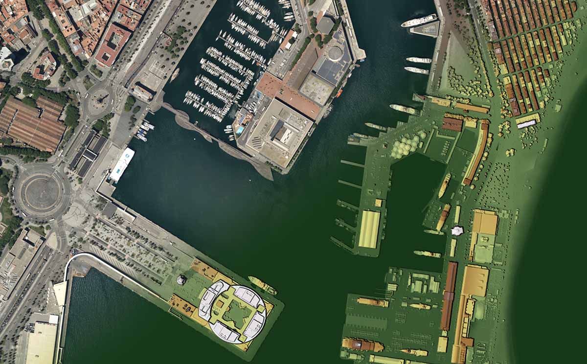
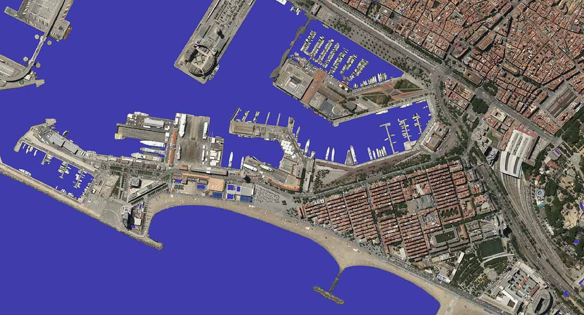
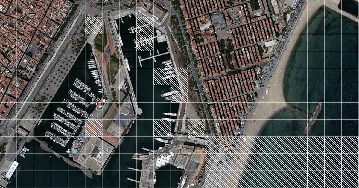
The new highly automated features for water handling are enhancing the quality of nearly every product throughout the workflow. This includes tools like the new Water Mask & Geometry Editor to efficiently quality control and edit water masks as well as the updated Seamline & Blending Mask Editor for intuitive generation of homogenous water surfaces in orthomosaics. With UltraMap version 6.0, customers obtain highly accurate, more robust and automatically generated DSM and DTM results plus seamless orthomosaics over land and water for any project size.
In addition, performance for most efficient large-scale data production has been optimized by introducing more effective file management, leading to faster loading times, viewing speeds, saving and export of products in the Ortho Viewer.
For best data interaction and processing, the UltraMap team redesigned the Ortho reprocessing workflow. It now allows customers to reprocess edits across all ortho products in an even more concise and targeted manner by automatically identifying tiles that are outdated and need automated reprocessing. New features like the processing queue or undo/redo edit options support straightforward data production.
Industry-leading, high-resolution imagery with even greater sharpness and reduced noise in shadows are the result of the new proprietary True Pixel Processing (TPP), an innovative approach to process raw imagery in UltraMap Essentials.
“This new version covers everything from optimized performance to new data interaction and processing to better overall quality of the final products, making professional data production even more efficient for our customers”, states Alexander Wiechert, CEO of Vexcel Imaging. “The results are really impressive. I am already excited – soon our customers will be as well.”
Released today, UltraMap version 6.0 fully supports UltraCam Eagle 4.1 data production. It includes a customer preview of the water handling features. The final release of the software in the complete functionality scope is planned for March 2023.
Learn more about the new features at the UltraMap v6.0 webinar, held on March 1, at 8 am GMT & 4 pm GMT.
About Vexcel Imaging
Vexcel Imaging, a global leader in aerial imaging, develops cutting-edge large-format aerial cameras and photogrammetric software with innovative approaches, and places an emphasis on continuing product upgrades and world-class support. The broad UltraCam aerial camera portfolio covers all applications in airborne photogrammetry—from nadir to oblique to wide-area data collection. UltraCam data is processed with the UltraMap photogrammetry software, providing an end-to-end processing workflow for highly automated, quality data products that include point clouds, digital surface and terrain models, orthophotos and 3DTINs. Learn more about Vexcel Imaging under vexcel-imaging.com.
