Archaeology has always been the way to bridge the past with the future. Without learning from the past, we can’t advance architecture, engineering and construction. But we also have to be sure we can preserve the past. Now, with newer technologies that integrate sensors into robotics carriers, exploring and protecting ancient ruins is less dangerous and the results from the expeditions are more accurate. Consider the work currently underway in Pompeii.
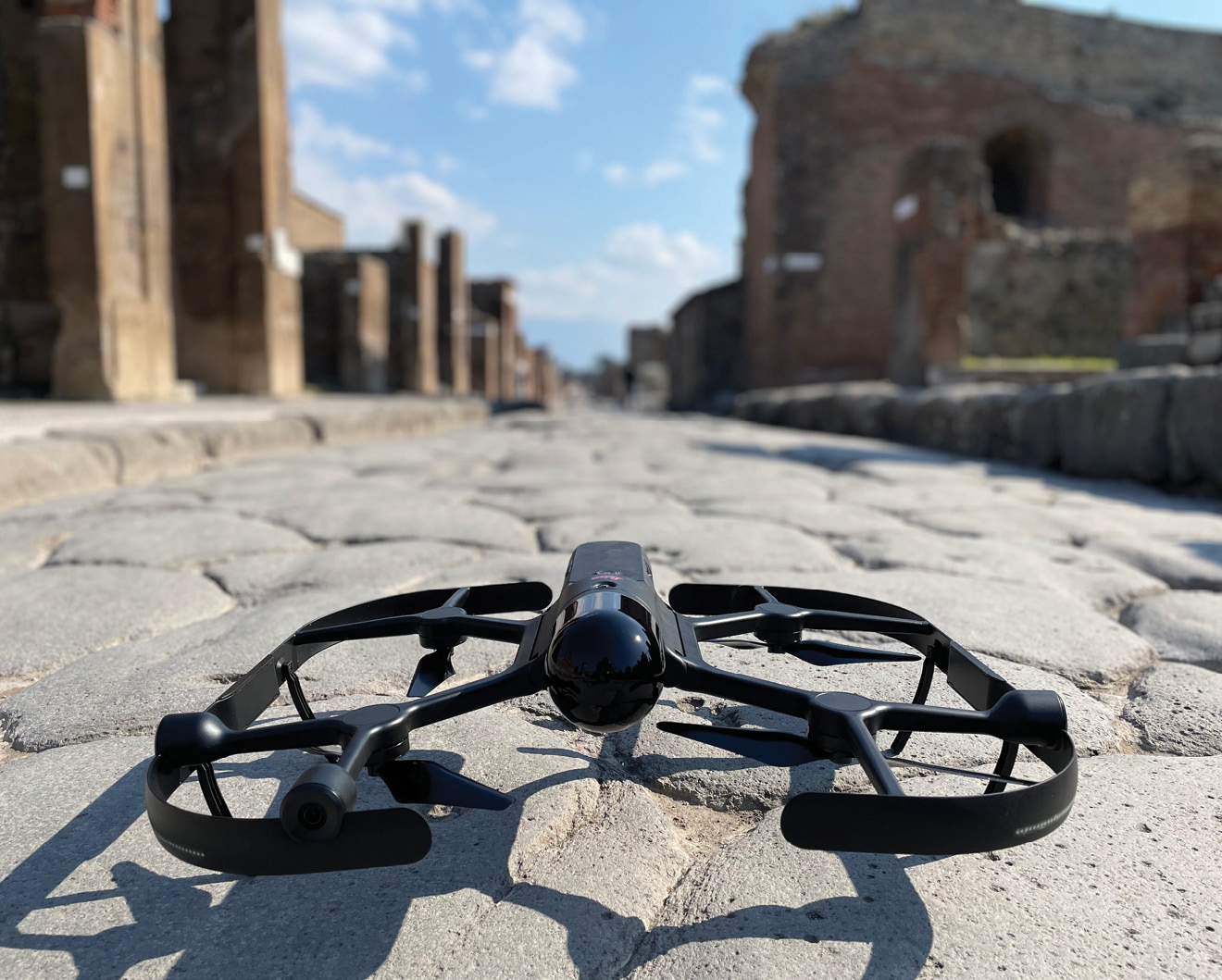
Leica BLK2FLY ready for work in Pompeii.
Most people are aware that the ancient city of Pompeii was destroyed by the eruption of the Mount Vesuvius volcano in 79 CE. As a UNESCO World Heritage Site, Pompeii has been preserved under the ashes. Each year, more than 2.5 million tourists come to see the ruins of the streets and houses and imagine what life was like in the once thriving city with its luxurious homes and public buildings. Its current estimated value is EUR 986 billion.
Yet Pompeii is at risk. Through the years, archaeologists and historians have been warning about the negative impact of neglect and mismanagement of the site. In 2008, the Italian government declared Pompeii a state of emergency and UNESCO started to consider adding the entire area to a list of World Heritage Sites that are in peril.
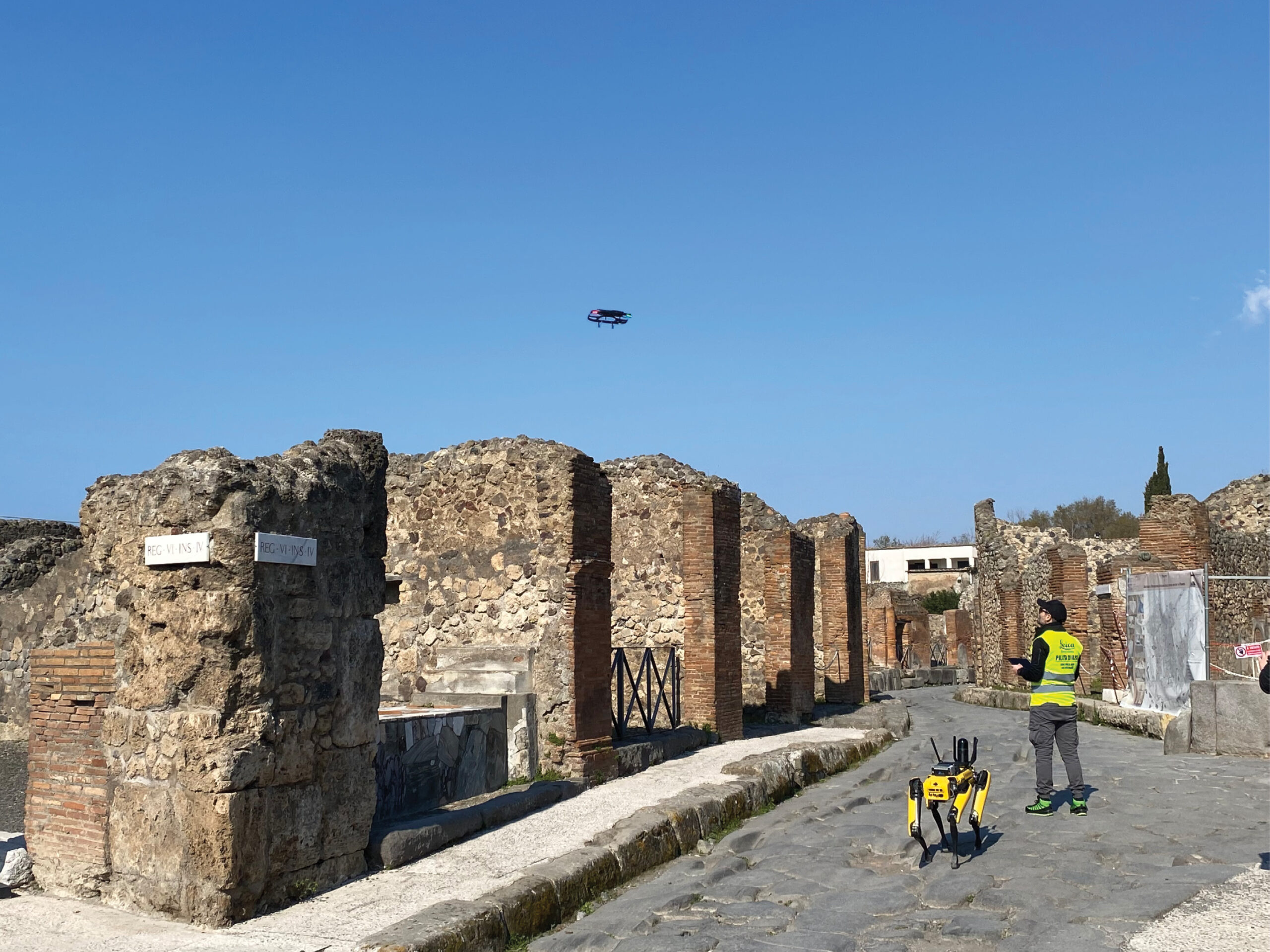
Leica BLK2FLY in the air, Boston Dynamics “Spot” with CAM+ and Leica BLK ARC in Pompeii with their handler.
Unfortunately, another force is at play. Given the high value of Pompeii, the ancient city attracts some nefarious characters. Thieves have learned to excavate tunnels under the city at night to steal valuable artifacts, including frescos, statues and ornaments, from ancient homes and buildings. The extensive network of looters smuggles the goods overseas or creates fake documentation to resell the expensive artifacts Recently, police have been cracking down on looters by more carefully monitoring what’s happening underground, in the nearby waters, and in the air around Pompeii.
Protecting and preserving Pompeii
The high levels of looting have made preserving and protecting the city an imperative. One of the most prominent efforts to support this is led by Archaeological Park of Pompeii and is known as Smart@POMPEI.
The Smart@Pompei project is using innovative technology to improve the quality of monitoring of the existing areas, and to further knowledge regarding the progress of recovery or restoration. It also improves the quality of exploration and digital representation of unknown areas.To achieve its goals, researchers are using a combination of hardware and software, including integrated sensors and robotics, to scan and capture areas on the ground, in the tunnels, and from the air, continually and accurately.
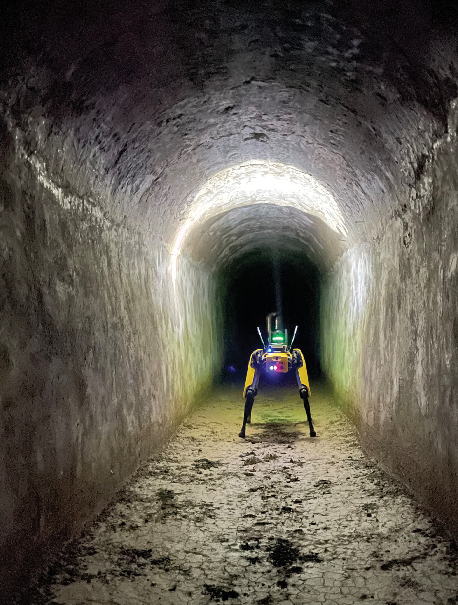
“Spot” at work in one of Pompeii’s tunnels.
Specifically, the Park is collaborating with Leica Geosystems, part of Hexagon, and Sprint Reply, a Gruppo Reply company that specializes in systems integration, robotics and process automation.
The initial phase of experimentation, which is currently underway, uses the Leica BLK2FLY and the Leica BLK ARC. The BLK2FLY is an autonomous, flying laser-scanner that captures exteriors, structures and environments to create 3D point clouds while in the air. The BLK ARC is an autonomous laser-scanning module designed to be integrated with robotic carriers. The result is autonomous mobile laser-scanning with minimal or no human intervention.
At Pompeii, the BLK2FLY autonomously conducts 3D scans from the air, while the BLK ARC is attached to “Spot” by Boston Dynamics. Additionally, the Spot CAM+ sensor adds a pan-tilt-zoom camera. This supports image capture and processing optimized for high-resolution monitoring of artifacts and objects. These integrated sensor solutions are used to explore and scan tunnels and other hard-to-reach areas, automate routine inspections and safely collect data. Sprint Reply’s smart platform for data analysis is used to make sense of the data gathered from the robot inspections.
The data collected from the ground and the air allows scientists, researchers and technicians at the Park to create 3D point clouds. By studying the data and creating digital twins of the environment, they can proactively identify any areas that are at risk for damage or collapse. Furthermore, the 3D scans enable them to know if something has been moved. Arguably, just the presence of the technology is helping to deter theft.
Until now, robotics and autonomous reality-capture products were often seen as solely for the industrial and manufacturing world. However, the ability to safely enter and exit hard-to-reach areas, and scan and capture them in detail is proving to be beneficial to the preservation and protection of historical sites as well.
Valerio Brunelli holds a PhD in environmental and geological sciences. He joined Leica Geosystems, part of Hexagon in 2012 and is responsible for business development in scanning technology and monitoring solutions. His background includes roles as a geologist, CAD (2D/3D) & GIS expert, and land/geomatics surveyor (3D modelling, topographic and bathymetric). Brunelli has also worked as an independent technical consultant, a senior surveyor and a remote sensing/designer/GIS expert for several global environmental engineering companies. He has expertise in natural hazards, risk and vulnerability assessments, and engineering designs.