Join the live AMA to hear how the new drone is augmenting traditional earth measuring.
 [Tyler, TX, Nov 9th, 2022] — SmartDrone, a manufacturer of small industrial drones and aerial mapping service provider, is unveiling its newest product, the Discovery 2 LiDAR+RGB mapping drone, during their live AMA on Dec. 2nd at 10 AM central time.
To register CLICK HERE
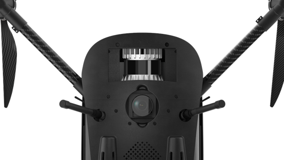 The Discovery 2 is the second iteration of the company’s Discovery platform. It introduces a brand new 12.3-megapixel RGB camera for detailed and accurate orthomosaics alongside a powerful Ouster lidar sensor for generating 1-foot contours, orthomosaics, and speeding time to linework deliverables.
 Hear from SmartDrone Field Application Specialist (FAS) Team Lead Michael Ash, Phoenix, Arizona FAS Kris Brandt, and Austin, Texas FAS Jesse Hocker who will introduce SmartDrone’s Discovery 2 platform as well as their Professional Services options. They will provide an overview of SmartDrone’s hardware and software solutions and will be prepared to answer your questions on the use of lidar for topographic workflows.
About SmartDrone Corporation
SmartDrone is a leader in drone surveying innovation technology, with U.S.-manufactured aerial LiDAR hardware and software to collect and process data. Land surveyors, civil engineers, and earth workers trust SmartDrone solutions to improve efficiency and speed to completion, delivering increased capacity, margins, and profits. More information about SmartDrone can be found on their website, YouTube, and LinkedIn.
