Maysville, Kentucky, USA (November 1, 2022)– Carlson’s latest releases of their CAD software line, including Survey, Civil, Hydrology, GIS, and Point Cloud, bring IntelliCAD 11 and AutoCAD® 2023 compatibility, new features, and numerous improvements to make you more efficient in the office.
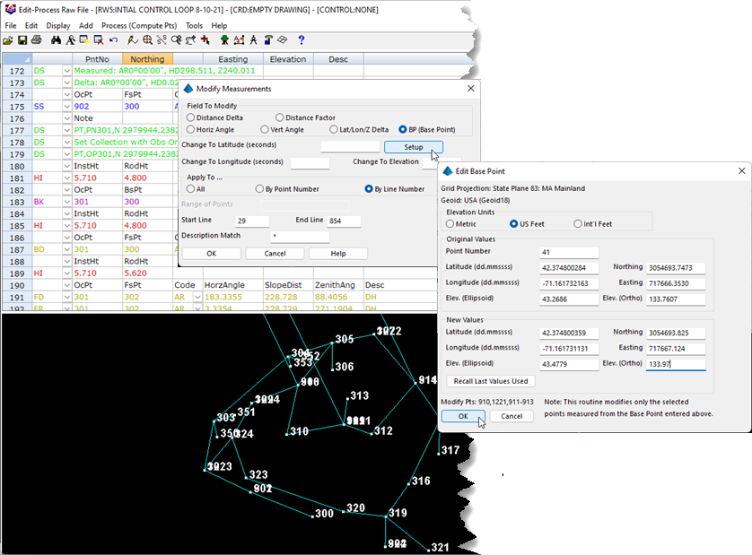
A few of the new features in Carlson Survey include added ability to work with multiple centerline files, GNSS Base Point Adjustments,
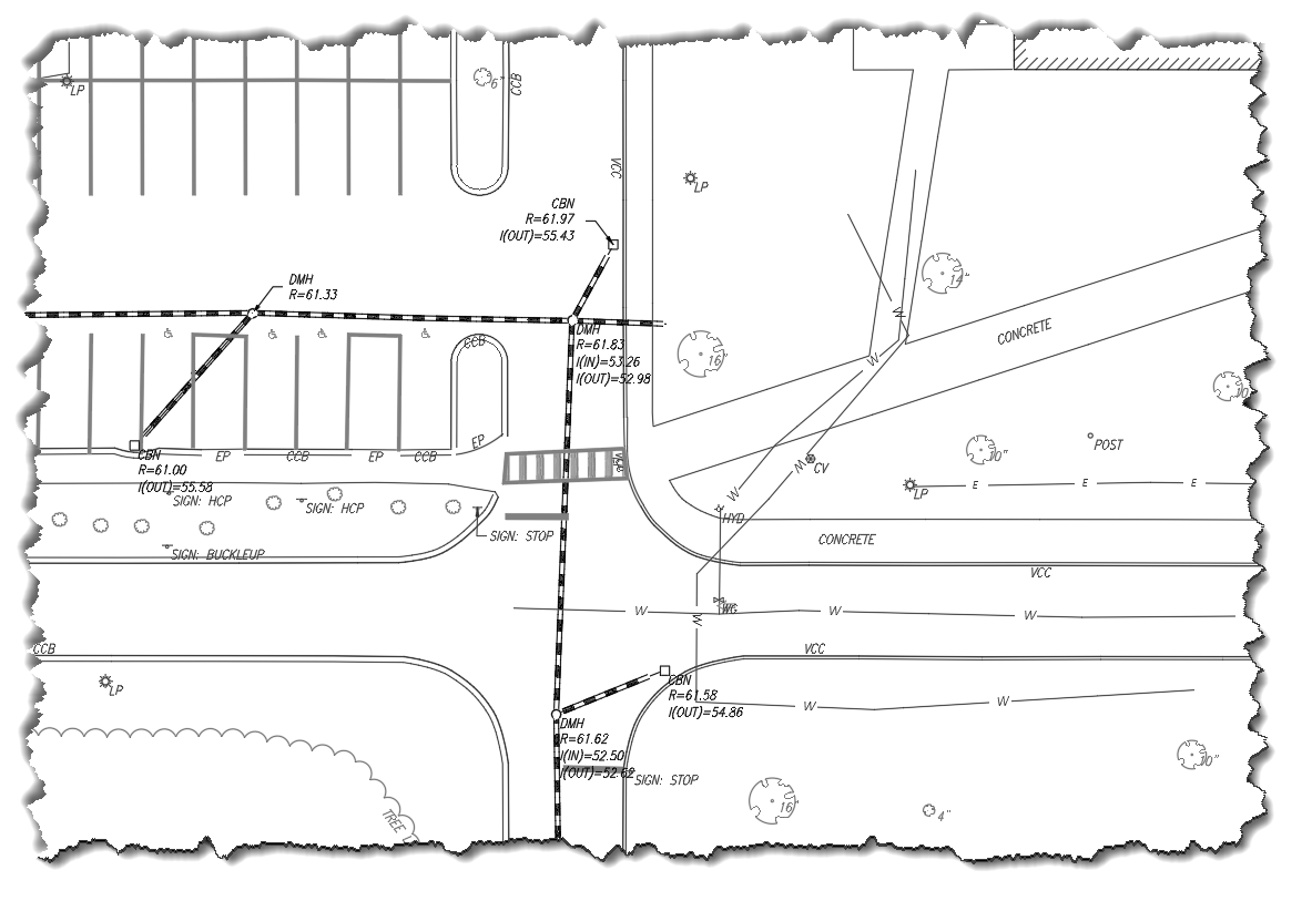
and several Field-to-Finish improvements:
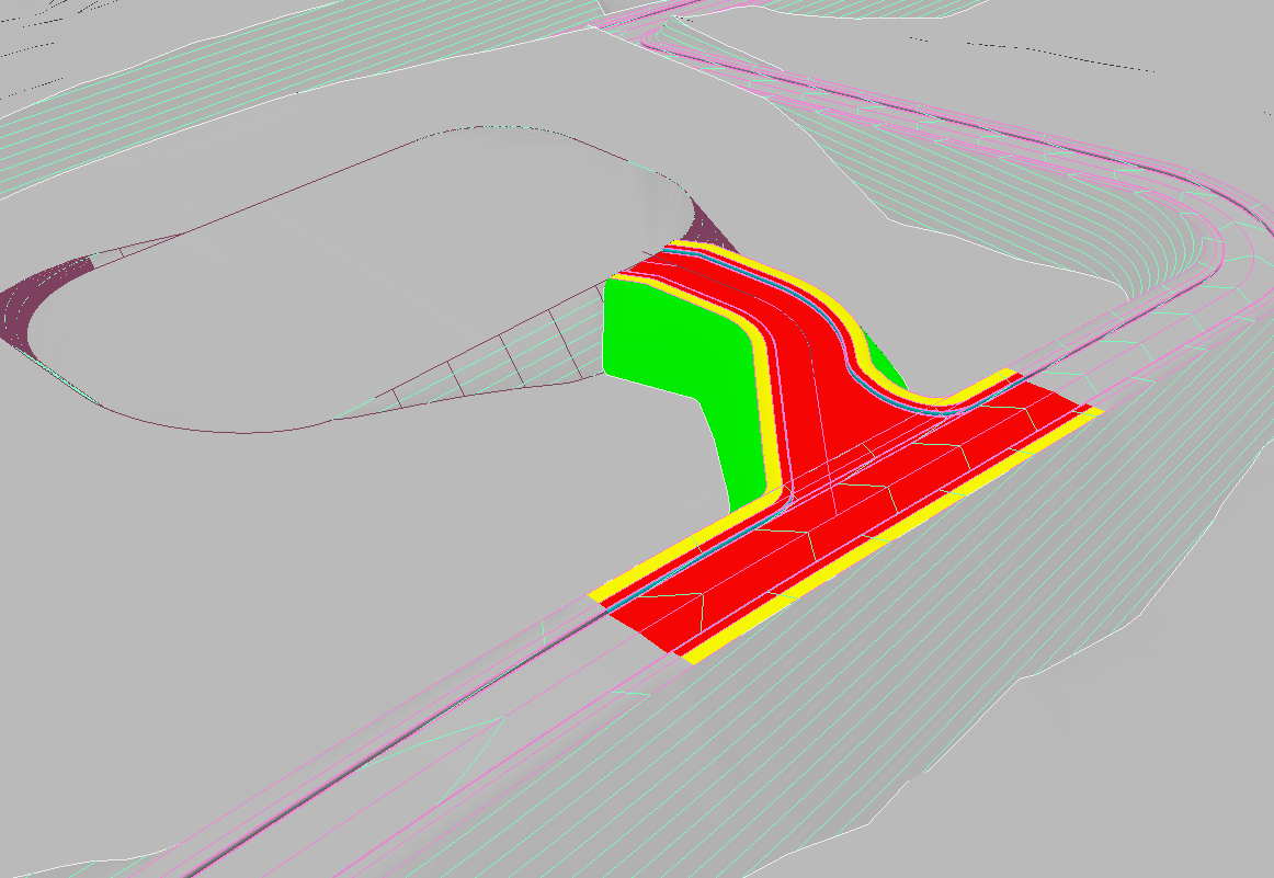
Carlson Civil gains several improvements to 3D design tools such as Polyline Elevation Editor, and an option for an Intersecting Edge in Road Network to connect to an existing roadway or pad:
Carlson Point Cloud received dozens of improvements and new features, including improved color edge identification with presets for grass and pavement and sidewalk,
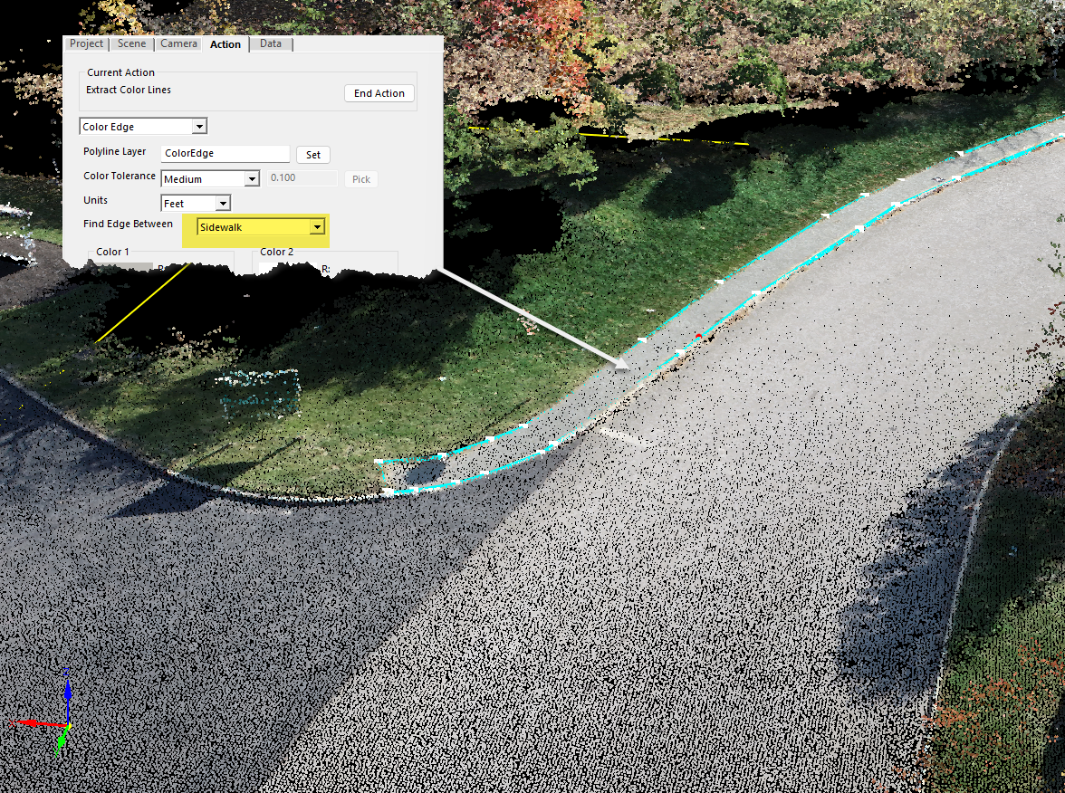
improved paint line and parking stripe detection, feature extraction for poles, hydrants, and trees, a new building extraction feature, and much more.
Carlson Hydrology sees the ability to draw laterals at station and offset, improvements to HydroNET including import/export to HydroCAD, and a pipe sleeve preview, while GIS features improved shape file functionality, Esri REST services, and GIS attribute import from CSV.
For more information about the many other enhancements in this new release, visit the Carlson 2023 webpage, www.carlsonsw.com/2023.
Carlson 2023 is now available for upgrade or new purchase. Take advantage of Carlson’s End-of-Year Specials through the end of 2022 for great pricing on these new releases.
About Carlson
Founded in 1983, Carlson Software Inc. specializes in CAD design software, field data collection, laser measurement and machine control products for the civil engineering, surveying, GIS, construction, and mining industries worldwide, providing one-source technology solutions for the entire project cycle. Carlson Software is headquartered in Maysville, Ky., U.S.A., with branch offices in Boston, Mass.; Almere, The Netherlands; Brisbane, Australia; Ottawa, Canada; and York, England.
