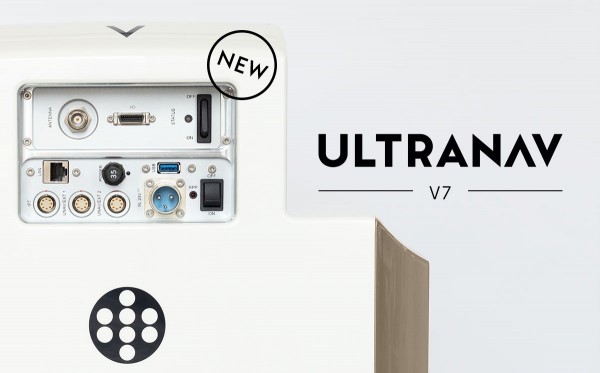
 Graz, Austria • October 18, 2022: From the Intergeo 2022 in Essen, Germany, Vexcel Imaging introduces the next version of UltraNav, its all-in-one Flight Management and direct georeferencing solution. UltraNav version 7 guides customers every step of the way from 3D Flight Planning to real-time navigation and quality control during flight to post-processing GNSS/INS data. To offer this integrated solution, Vexcel Imaging entered into a new partnership with TopoFlight for flight planning/management and continues its longstanding partnership with Applanix for the GNSS/INS modules & post-processing.
The fully integrated workflow ensures that customers can complete their projects more conveniently and quickly and thus reach their goals more efficiently. During 3D Flight Planning, UltraNav uses digital elevation models for fast, interactive and cost-effective flight plan designs. In the air, the software manages camera parameter settings, exposure triggering and automated mount stabilization for precise ground coverage and image overlap. Two displays for real-time navigation for the pilot and in-flight quality control for the operator support smooth and efficient data collection. Back on the ground, industry-leading GNSS/INS post-processing software achieves both maximum accuracy and maximum efficiency for direct georeferencing.
Customers can choose between 510 and 610 accuracy class performance levels based on the included Inertial Measurement Unit (IMU). All IMUs are ITAR free for maximum flexibility. For easy handling and space saving in often cramped aircrafts, the IMU and UltraNav module are fully embedded into the UltraCam sensor head. In 4th generation UltraCams, both can be comfortably accessed via a bay door on top of the camera and can be changed on-site. No additional boresight flight is necessary after the IMU is removed.
“At Vexcel, we offer customers a comprehensive solution from planning and data acquisition to processing and final data products”, says Alexander Wiechert, CEO of Vexcel Imaging. “I am very pleased that with this new version, we are offering our customers a state-of-the-art solution that can support them even better in the realization of their projects.”
To provide this integrated solution, Vexcel Imaging is partnering for the first time with TopoFlight Systems, a leading flight management system provider in the geospatial industry. “We are convinced that it is becoming increasingly important for customers in aerial surveying to be able to count on open systems. The ability to support a wide range of sensors has always been part of our strategy for further development of our software.”, Klaus Budmiger, CEO at TopoFlight Systems states. “We are very pleased that our new collaboration with Vexcel Imaging will allow us to continue to expand in service of the photogrammetry industry. This collaboration with another major sensor manufacturer honors us and we are very happy!”
About Vexcel Imaging
Vexcel Imaging, a global leader in aerial imaging, develops cutting-edge large-format aerial cameras and photogrammetric software with innovative approaches, and places an emphasis on continuing product upgrades and world-class support. The broad UltraCam aerial camera portfolio covers all applications in airborne photogrammetry — from nadir to oblique to wide-area data collection. UltraCam data is processed with the UltraMap photogrammetry software, providing an end-to-end processing workflow for highly automated, quality data products that include point clouds, digital surface and terrain models, orthophotos and 3D TINs. Learn more about Vexcel Imaging under www.vexcel-imaging.com.
About TopoFlight Systems
TopoFlight Systems specializes in the development of aerial mapping software. TopoFlight Mission Planner is the leading flight planning software for accurate 3D mapping missions. It provides different tools for quality and cost control of the flight plan during construction and for documentation. Thanks to the open architecture of the flight management system, TopoFlight Navigator is able to control a wide range of imaging and LiDAR sensors. The tight integration between Mission Planner and Navigator enables a smooth transition from planning to executing an airborne mapping mission. Learn more about TopoFlight Systems under www.topoflight.com.
