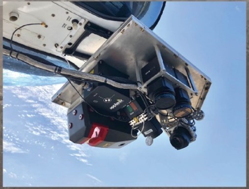
RIEGL VUX-240 for GEO1 Muir Woods project.
RIEGL is proud to announce that at the 15th Annual MAPPS Excellence Awards this year, three awards were given to projects utilizing RIEGL instruments such as the VQ-480 II, VUX-240 and the VUX-1LR. Long Term RIEGL clients NV5 Geospatial and GEO1 were selected for awards in the Data Acquisition and Processing, Small Projects & Membership Choice categories. The Data Acquisition and Processing & Membership Choice awards were given for their LiDAR and image acquisition of the active volcano Kilauea utilizing RIEGL Instruments. This project titled “The Fire and Water of PELE: Remote Sensing to Better Understand Kilauea”, detailed the capture of high-resolution LiDAR and imagery over Kilauea during the eruptions of 2018 and 2019 for the Hawaiian Volcano Observatory as part of the USGS’s GPSC contract.
“We documented groundbreaking changes (land shifts on the order of meters), and exciting discoveries like a growing lake of water in Halema`uma`u crater.” Said Ron Chapple, CEO of GEO1.
This project brought attention to the value of remote sensing in natural disaster response and monitoring and has become the model for the use of geospatial technology to study active volcanos and improve public safety.
“We engaged unique multi-sensor packages, flown by helicopter at low altitude, to collect ultra-high resolution and accuracies under challenging conditions.” said Mark Abatto, President/COO of NV5 Geospatial.
GEO1 was also awarded in the Small Projects category for their “Digitizing Ancient Muir Woods” entry featuring a RIEGL VUX-240 to acquire data. This data provided an accurate forest inventory and a lasting digital archive of Muir Woods National Monument. A publicly accessible digital replica of the forest grants anyone the ability to explore the forest and reveals the possibilities for access and education of our world. The project also demonstrates the feasibility of large-scale LiDAR acquisition and the value it presents in environmental research.
About RIEGL
RIEGL is an international leading provider of cutting-edge technology in airborne, mobile, terrestrial, industrial and unmanned laser scanning solutions for applications in surveying. RIEGL has been producing LiDAR systems commercially for over 40 years and focuses on pulsed time-of-flight laser radar technology in multiple wavelengths. RIEGL’s core Smart-Waveform technologies provide pure digital LiDAR signal processing, unique methodologies for resolving range ambiguities, multiple targets per laser shots, optimum distribution of measurements, calibrated amplitudes and reflectance estimates, as well as the seamless integration and calibration of systems. RIEGL’s Ultimate LiDAR™ 3D scanners offer a wide array of performance characteristics and serve as a platform for continuing Innovation in 3D for the LiDAR industry. From the first inquiry, to purchase and integration of the system, as well as training and support, RIEGL maintains an outstanding history of reliability and support to their customers. Worldwide sales, training, support and services are delivered from RIEGL’s headquarters in Austria and in the USA; main offices in, Japan, China, Australia, Canada and the UK; and a worldwide network of representatives.
About The Geospatial Excellence Awards
The Geospatial Excellence Awards are presented annually to member firms whose entries exemplify the professionalism, value, integrity, and achievement of the firm’s staff as demonstrated over the previous year. A distinguished and impartial panel of judges evaluated the 16 submitted projects from five categories and selected a winner from each: Data Acquisition & Processing, Surveying/Field Data Collection, GIS/IT/Remote Sensing Analysis, Small Projects, and Technology Innovation/Licensed Data Products. Two additional awards are presented for the Project of the Year and the Membership Choice Award, selected by the voting membership.
About MAPPS
MAPPS is the preeminent association of geospatial firms in the United States. MAPPS is dedicated to comprehensively supporting, advocating, and promoting the business needs, technical and professional education, geospatial policy, and legislation interests of its members. MAPPS’ member firms are thought leaders in mapping, surveying, photogrammetry, satellite and airborne remote sensing, aerial photography, hydrography, GPS and GIS data collection and processing services, technology development, and geospatial products.
About NV5 Geospatial
NV5 Geospatial is a provider of geospatial services, providing end-to-end solutions and insights to organizations that need geospatial intelligence to mitigate risk, plan for growth, better manage resources and advance scientific understanding. We combine the widest array of advanced remote sensing technologies with proprietary processes, analytics tools, algorithms, and analyses tailored to meet our clients’ needs. For more information visit nv5geospatial.com, join us on LinkedIn, or follow us on Twitter @nv5geospatial.
About GEO1
The award-winning GEO1 team enables creative vision through use of the newest lidar and imaging sensors. GEO1 works in extreme locations around the world to acquire high-resolution lidar and imaging data.
