GEO1 won awards in two categories at the 2021 MAPPS Geospatial Excellence awards for their lidar and imagery acquisition of Muir Woods National Monument in Northern California as part of the Earth Archive project.
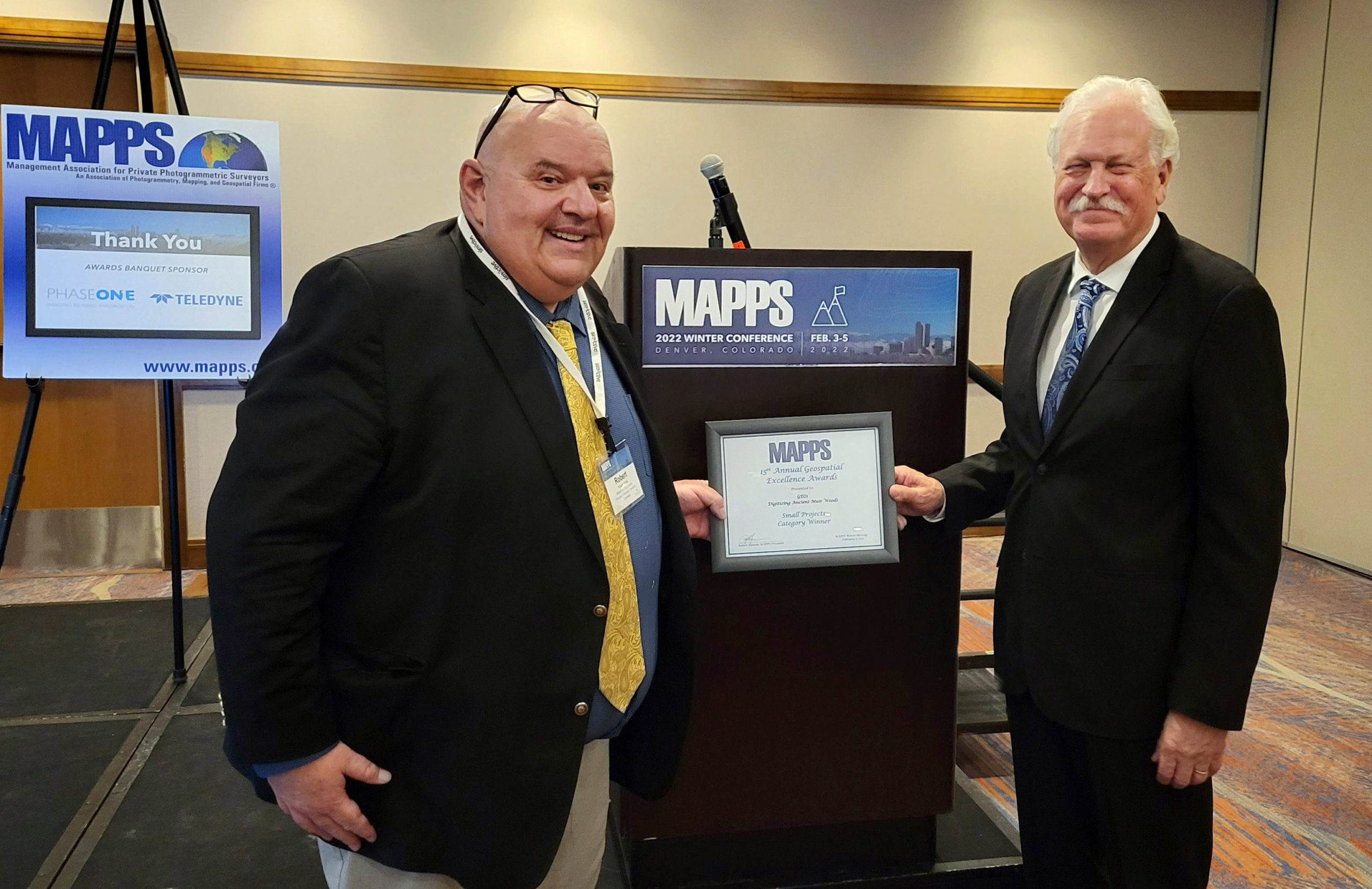 Hawthorne, CA – February 11, 2022 // On February 5, the MAPPS board announced GEO1 as the winner of this year’s Excellence Award for Small Projects, as well as the prestigious Members Choice Award. Both awards were presented to GEO1 in recognition of their acquisition of lidar and high-resolution imagery of Muir Woods National Monument.
The MAPPS Excellence Awards are presented each year to firms that demonstrate outstanding work in the industry. The awards recognize projects that are technologically innovative and reflect comprehensive solutions to enhance public health and scientific understanding of our world. GEO1 is honored to have received awards in two of the five categories in this year’s showcase.
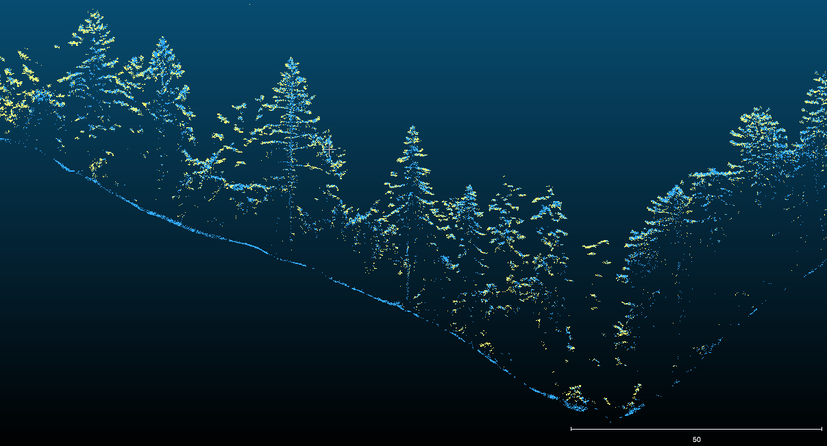 GEO1 acquired data that will be used to produce a permanent, open-sourced, digital archive of Muir Woods National Monument, through The Earth Archive. A publicly accessible digital twin provides research opportunities for a wide-range of scientists contributing to a fuller understanding of global earth system change. The high-resolution Muir Woods scan also demonstrates the feasibility of dense lidar acquisition and the value it presents for science and industry.
GEO1 collected the data for The Earth Archive, a non-profit group dedicated to digitally archiving the world’s most endangered areas for preservation and scientific study. The data will also be contributed to the USGS 3D Elevation Program (3DEP), as part of the organization’s effort to acquire and consolidate high resolution lidar data of the entire nation.
 “The entire GEO1 team was pleased to work on the Muir Woods project to document, preserve, and analyze one of the greatest treasures in the USA,” stated Ron Chapple, CEO and Founder of GEO1. “Our partners, including The Earth Archive, Voxelmaps, and BayesMap all contributed time and resources to creating this lidar data set that will serve current research and generations to come.”
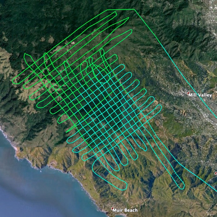
GEO1 used customized flight parameters, rapid deployment techniques, and extensive communication with partner organizations and federal agencies to successfully acquire data while mitigating environmental and social concerns of the project.
Lidar processing for this project was generously contributed by BayesMap using Wavex and StripAlign. The data will be visualized on an online platform powered by Voxelmaps, which offers the capability to perform AI-driven data analysis at an individual tree level, prior to being incorporated in the USGS 3DEP database.
As land historically inhabited by indigneous Coast Miwok peoples, the data collected by GEO1 has the potential to enhance knowledge of the social and environmental history of indigenous communities in the area . A wide range of analytical capabilities offered by Voxelmaps and independent researchers can be utilized with this dataset to improve forest management practices, calculate carbon and fuel loads, and deepen our existing scientific understanding of the ecosystem. This demonstrates the benefits of lidar scanning trees and terrain both for modern study and as a permanent legacy for future generations.
About The Geospatial Excellence Awards
The Geospatial Excellence Awards are presented annually to member firms whose entries exemplify the professionalism, value, integrity, and achievement of the firm’s staff. A distinguished and impartial panel of judges evaluated the 16 submitted projects from five categories and selected a winner from each: Data Acquisition & Processing, Surveying/Field Data Collection, GIS/IT/Remote Sensing Analysis, Small Projects, and Technology Innovation/Licensed Data Products. Two additional awards are presented for the Project of the Year and the Membership Choice Award, selected by the voting membership.
About MAPPS
MAPPS is the preeminent association of geospatial firms in the United States. MAPPS is dedicated to comprehensively supporting, advocating, and promoting the business needs, technical and professional education, geospatial policy, and legislation interests of its members. MAPPS’ member firms are thought leaders in mapping, surveying, photogrammetry, satellite and airborne remote sensing, aerial photography, hydrography, GPS and GIS data collection and processing services, technology development, and geospatial products. mapps.org
About The Earth Archive
The Earth Archive recognises the power and potential lidar offers in education, scientific studies, and conservation efforts, and plans to create an open source platform of worldwide lidar. Theeartharchive.com. The Earth Archive is excited to announce the open-source release of the Muir Woods dataset later this month.
About Voxelmaps
Voxelmaps is building the world’s most accurate 4D volumetric model of the earth by combining high-resolution scans using the latest lidar and HD imaging sensors, and fused with a wide variety of other rich content. The result is a new form of mapping which provides superior levels of accuracy, information, and insight. voxelmaps.com
About BayesMap
BayesMap Solutions, based in Mountain View, California, provides unique consulting and software development services for the lidar industry. BayesMap delivers data processing solutions, with efficient and accurate algorithms, to challenging problems through maximum extraction of information from large and complex data sets. bayesmap.com
About the National Park Service
The National Park Service preserves the natural and cultural resources and values of the National Park System for the enjoyment, education, and inspiration of this and future generations. The Park Service cooperates with partners to extend the benefits of natural and cultural resource conservation and outdoor recreation throughout this country and the world.
About USGS 3DEP
As the Nation’s largest water, earth, and biological science and civilian mapping agency, the USGS collects, monitors, analyzes, and provides science about natural resource conditions, issues, and problems. To respond to growing needs for high-quality elevation data, the goal of 3DEP is to complete acquisition of nationwide lidar (IfSAR in AK) to provide the first-ever national baseline of consistent high-resolution topographic elevation data – both bare earth and 3D point clouds.
