NV5 Geospatial and partner GEO1 win two awards at the 15th Annual MAPPS Awards for their lidar and image acquisition of erupting Kilauea Volcano
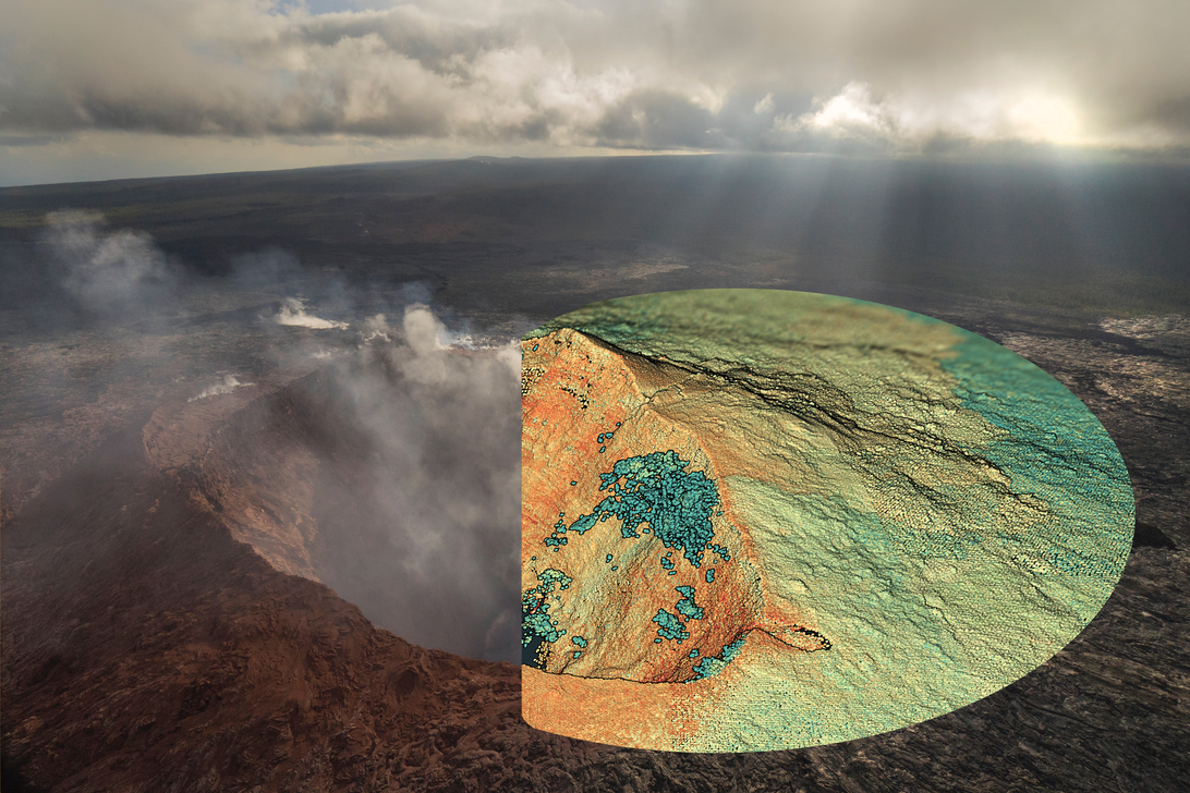
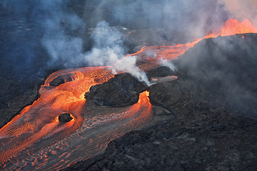
 Hollywood, Fla., February 7, 20212 – NV5 Geospatial, North America’s most comprehensive geospatial data firm, and their partner GEO1 today announced that they won in two categories, Data Acquisition and Processing and Membership Choice, in this year’s MAPPS Geospatial Excellence Awards. Both awards were for the capture of high-resolution lidar and imagery over Kilauea during the eruptions of 2018 and 2019 for the Hawaiian Volcano Observatory as part of the USGS’s GPSC contract. The purpose of the acquisition was to create a follow-up baseline survey to model and predict future activity for the enhanced safety of residents.
 The Geospatial Excellence Awards spotlight and honor the MAPPS members’ important and impactful work that addresses planning and design and construction needs with geospatial solutions. These members produce innovative technologies, software solutions, and ancillary services that aid global companies and government agencies.
“We are honored to be recognized among our colleagues and peers for these awards, ” said Mark Abatto, President/COO of NV5 Geospatial. “It was an exciting project that introduced a number of challenges for us and GEO1 requiring considerable innovation from the team. We engaged unique multi-sensor packages, flown by helicopter at low altitude, to collect ultra-high resolution and accuracies under challenging conditions.”
 “The entire project required extensive coordination and communication between our two firms,” said Ron Chapple, CEO of GEO1. “We documented groundbreaking changes (land shifts on the order of meters), and exciting discoveries like a growing lake of water in Halema`uma`u crater.”
The high-profile project brought attention to the value of remote sensing in natural disaster response and monitoring and has become the model for the use of geospatial technology to study active volcanos and improve public safety. The award also confirmed remote sensing data as a critical scientific resource for studying Kilauea’s present and future activity.
About The Geospatial Excellence Awards
The Geospatial Excellence Awards are presented annually to member firms whose entries exemplify the professionalism, value, integrity, and achievement of the firm’s staff as demonstrated over the previous year. A distinguished and impartial panel of judges evaluated the 16 submitted projects from five categories and selected a winner from each: Data Acquisition & Processing, Surveying/Field Data Collection, GIS/IT/Remote Sensing Analysis, Small Projects, and Technology Innovation/Licensed Data Products. Two additional awards are presented for the Project of the Year and the Membership Choice Award, selected by the voting membership.
About MAPPS
MAPPS is the preeminent association of geospatial firms in the United States. MAPPS is dedicated to comprehensively supporting, advocating, and promoting the business needs, technical and professional education, geospatial policy, and legislation interests of its members. MAPPS’ member firms are thought leaders in mapping, surveying, photogrammetry, satellite and airborne remote sensing, aerial photography, hydrography, GPS and GIS data collection and processing services, technology development, and geospatial products. mapps.org
About NV5 Geospatial
NV5 Geospatial is a provider of geospatial services, providing end-to-end solutions and insights to organizations that need geospatial intelligence to mitigate risk, plan for growth, better manage resources and advance scientific understanding. We combine the widest array of advanced remote sensing technologies with proprietary processes, analytics tools, algorithms, and analyses tailored to meet our clients’ needs. For more information visit nv5geospatial.com, join us on LinkedIn, or follow us on Twitter @nv5geospatial.
About GEO1
The award-winning GEO1 team enables creative vision through use of the newest lidar and imaging sensors. GEO1 works in extreme locations around the world to acquire high-resolution lidar and imaging data. For more information, visit geo1.com
