“ His tools were easy to use; they worked and scaled; and they drove standards and became the foundation of countless lidar processing workflows.1”
 Dr. Martin Isenburg, 49, of Rodgau, Germany, committed suicide at his vacation home in Sámara, Costa Rica about September 9, 2021, after a lifelong struggle with mental health which was exacerbated by the pandemic. Dr. Isenburg was the creator of the widely used LAStools, LASzip, and PulseWaves software packages, and he operated Rapidlasso GmbH while providing commercial and open-source software for lidar data processing, exploitation, compression, and organization.
Martin was born in Weiskirchen, Germany on July 6, 1972. After high school and a year of travel in Asia, he attended the Technical University of Darmstadt, where he studied computer science. An undergraduate visit to the University of British Columbia encouraged him to complete his MSc degree before following his mentor Jack Snoeyink from UBC to the University of North Carolina Chapel Hill. Working to complete his PhD at UNC, Martin continued research started at UBC into mesh compression techniques and, with funding from Hurricane Floyd efforts to develop new elevation models for North Carolina, he began to apply these techniques to processing lidar data.
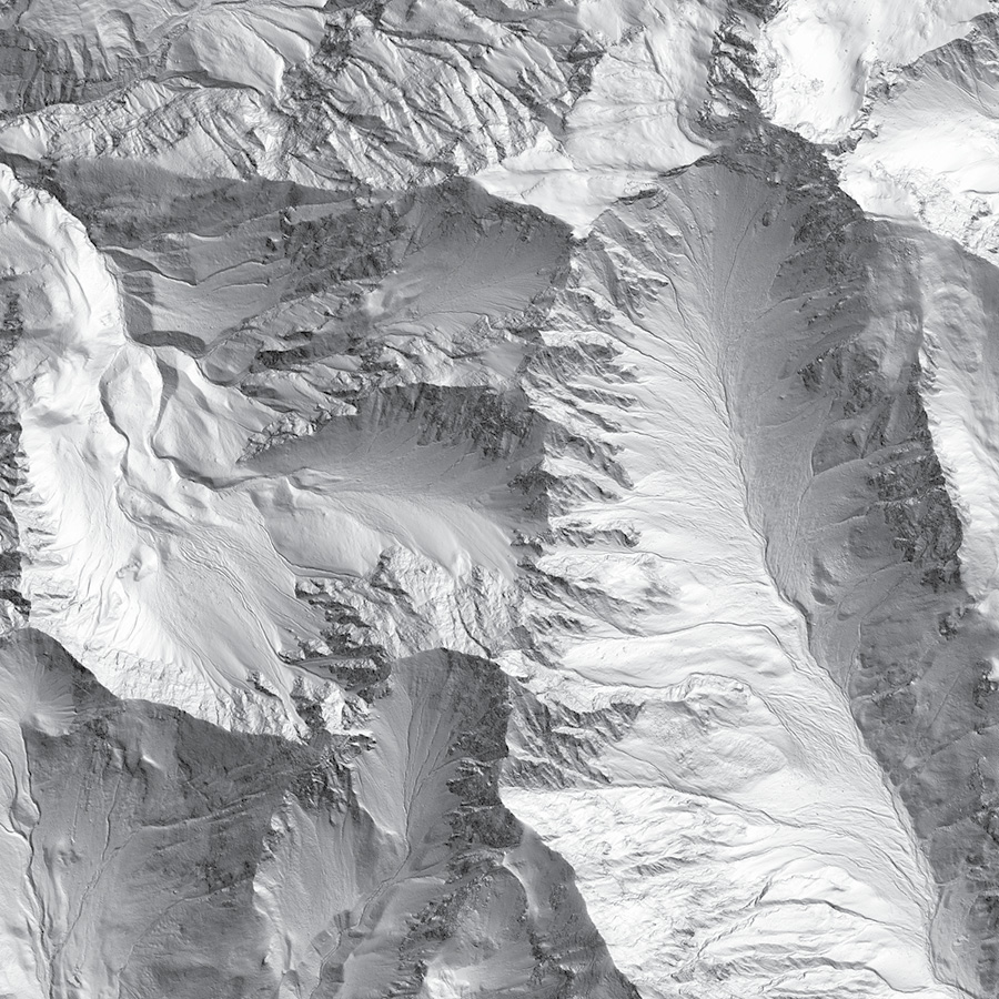 A frequent presenter at meetings such as SIGGRAPH, Martin published and presented frequently on mesh handling and compression techniques in the computational geometry field throughout the 2000s. After UNC, he undertook a postdoc with Jonathan Shewchuck of University of California Berkeley to implement the “streaming delaunay” capability, which became a foundational technique of commercial LAStools such as blast2dem. By constructing out-of-core techniques for processing large geometry data collections, Martin was able to demonstrate memory-efficient tools to chew through the oncoming rush of lidar data captures beginning to appear for natural science and morphological uses.
His advisor, Jonathan Shewchuck, notes in his memorial to Martin2:
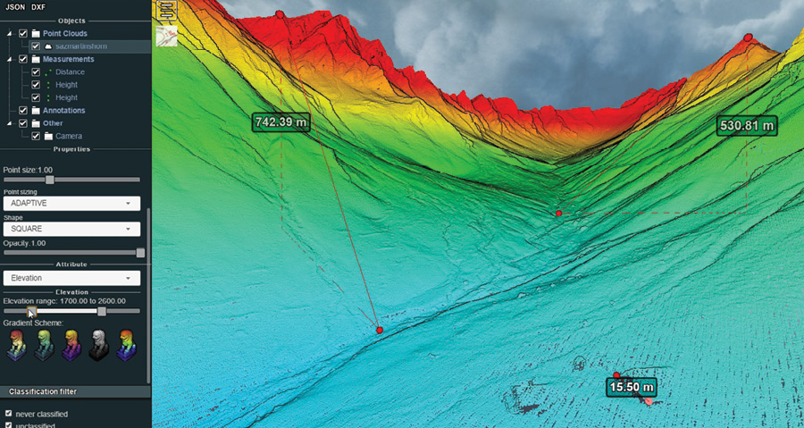
“I had the good fortune to work with Martin during what was probably the high point of his career and life. Martin was extremely energetic, productive, and creative throughout his two years at Berkeley. Before, during, and after that time, he pioneered ideas and software for streaming geometry processing, which have become standard methods for handling huge geometric data sets on commodity computers (like your laptop). ‘Huge’ meant hundreds of gigabytes in 2006, and means many terabytes today. His papers and software included algorithms for streaming mesh compression and decompression, mesh simplification, interpolation, isoline extraction (for mapmaking), visualization, and rasterization (to create high-resolution Digital Elevation Maps, aka DEMs). These operations are central to the field of Geographical Information Systems (GIS), which was and is a large industry. We detailed Martin’s amazing streaming GIS toolchain in a paper in GIScience 2006.”
 Martin began working for Lawrence Livermore National Laboratory after his postdoc and PhD, but a mental illness episode upset his life and employment shortly after starting there. The result was that he ended up back in Germany with few prospects beyond the software libraries and techniques he pioneered. After some fits and starts, these formed the foundation of the LAStools software packages, and the Rapidlasso company he built to distribute them.
In spring 2011, Martin worked with Hobu, Inc. to enhance his LASzip point-cloud compression encoder and more formally apply it to ASPRS LAS data. This included adding support for all the LAS content types, adding chunking support, and refactoring it to use a typical arithmetic encoding approach. It was then released as open-source software (at laszip.org), and clients were able to use it with libLAS and LAStools to compress heavy lidar data. LASzip and LAZ continue to have a lasting impact on the commercial software that picked them up and are incorporated throughout the industry.
In 2010 through 2012, Martin actively supported the ASPRS LAS committee developing its new LAS 1.4 format. Features Martin championed include portions of the specification that describe “extra bytes” variable length records, preservation of pre-1.4 content organization, simplification of data organization, and continued advocacy for fixed-precision coordinate content to make the LAS specification easier for software implementers. A few years later, Martin released a complementary LASzip encoding technique for LAS 1.4 content with support from NOAA and the USGS, which was widely used as the archive and transmission format for national-scale lidar holdings throughout the world.
Throughout the 2010s, Martin grew his software company, Rapidlasso GmbH, by adding new features to the software and frequently traveling to places such as Indonesia, Philippines, Central America, and Europe to give workshops showing users how to leverage LAStools. Martin loved international travel, experiencing many cultures, and riding his paddle board in their surf zones. Proud to have never owned a car, Martin sought ecologically sound solutions and lived frugally to do his best to limit his impact on the planet’s resources.
As others have noted in their memorials13 4, Martin was a vocal advocate for the release of public scan data. He frequently gifted his software tools to groups through the “LASMoons” program to allow students and organizations to use LAStools to achieve specific academic and ecological lidar data processing tasks5. Not only did this program show users how to use the software effectively, it demonstrated the worldwide thirst for lidar data acquisition, processing, and compression.
The open source part of LAStools will live on at github.com/LAStools/LAStools and lastools.osgeo.org. The commercial tools of Rapidlasso are planned to be licensed using the same mechanism. The new website is under construction and can be found at www.rapidlasso.de. Commercial customers with immediate license renewal inquiries are encouraged to email license@rapidlasso.de. Access to some operational material of the business is still disjointed, so please be patient as the work on reestablishing the licensing and service is still in progress.
The isolation, anxiety, and ambiguity of the pandemic has impacted nearly everyone. Unfortunately, for one of the lidar industry’s prolific gadflies, that pressure became too much. The industry will miss the playful lidar guy with the speedy and quirky software that has done and will continue to do a ton of heavy lifting for grateful industry. Godspeed, Martin.
Howard Butler is the founder and president of Hobu, Inc., an open-source software consultancy located in Iowa City, Iowa. Hobu focuses on point-cloud data management solutions. He is an active participant in the ASPRS LAS Committee, a Project Steering Committee member of both the PROJ and GDAL projects, a contributing author to the GeoJSON specification, and a past member of the OSGeo Board of Directors. With his firm, Howard leads the development of the PDAL and Entwine open-source point-cloud processing and organization software libraries.
1 opentopography.org/blog/remembering-martin-isenburg-friend-and-inspiration-opentopography
2 people.eecs.berkeley.edu/~jrs/martin/
3 blog.qgis.org/2021/09/14/in-memory-of-martin-isenburg/
4 geoweeknews.com/blogs/remembering-martin-isenburg-1972-2021