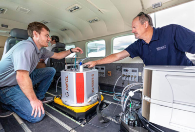
Fig. 1 RIEGL VQ-1560 II-S Dual Channel Waveform Processing Airborne LiDAR Scanning System for High Point Density Mapping and Ultra-Wide Area Mapping.
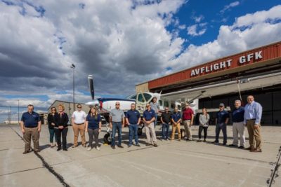
Winter Garden, Florida – December 2, 2021 – 95West Aerial Mapping formally KBM GeoSpatial, LLC. has completed integration and training finalizing the delivery of cutting-edge RIEGL VQ-1560 II-S airborne laser scanners.
The new VQ-1560 II-S system, with its doubled laser power and high pulse frequency, will allow 95West Aerial Mapping to more efficiently achieve a wide variety of projects; from wide area collections to ultra-density corridor collections.
95West Aerial Mapping’s name might be new, but their team has the geospatial experience that is ready to deliver on day one with the VQ-1560 II-S. Miles Strain, Aerial Services Manager Vice President, joins the team with over 35 years of acquisition experience in geospatial services. He looks forward to deploying the system and being able to turn around jobs faster than ever before, thanks to the new upgraded software and efficient workflow of RIEGL. They are among the first users to receive RIEGL’s new SNL (Serial number licenses) which allows for unlimited processing and ready to use for cloud or distributive processing setups.
The team not only chose the new VQ-1560 II-S for the sensor’s collection efficiency, but also for its ability to pair with their new Vexcel UltraCam Eagle Mark 3, which was added at the same time to provide their clients with a truly unique and unrivaled pairing. Not losing any momentum, they also completed the purchase of a brand new aircraft Cessna 208B Grand Caravan and made the custom modifications to allow for two camera ports to be added. This very ambitious triple acquisition is part of the company’s desire to provide their clients with the best imagery and LiDAR data available.
“With the new RIEGL VQ-1560 II-S, 95West now has the capacity to service larger projects of greater coverage areas with improved levels of detail and accuracy for federal, state, and local governments, utilities, and private entities, ” said Miles Strain, CP, RPP – 95West Aerial Mapping’s Aerial Services Manager VP.
RIEGL USA’s Division Manager Joshua France said, “The team is a great group to work with and the company’s vision to modernize its complete acquisition hardware from the sensor to the plane shows they are committed to success”.
RIEGL is committed to delivering proven innovations in 3D and dedicated to designing, developing, and producing the best possible laser sensors for the desired application in order to perfectly fulfill the given measurement task. RIEGL is thrilled to add 95 West Aerial Mapping as a customer. They chose the new and innovative RIEGL VQ-1560 II-S as soon as it was announced and they have been working hard at aligning all the stars for this to be a successful endeavor for their clients.
About RIEGL
RIEGL is an international leading provider of cutting-edge technology in airborne, mobile, terrestrial, industrial and unmanned laser scanning solutions for applications in surveying. RIEGL has been producing LiDAR systems commercially for over 40 years and focuses on pulsed time-of-flight laser radar technology in multiple wavelengths. RIEGL’s core Smart-Waveform technologies provide pure digital LiDAR signal processing, unique methodologies for resolving range ambiguities, multiple targets per laser shots, optimum distribution of measurements, calibrated amplitudes and reflectance estimates, as well as the seamless integration and calibration of systems. RIEGL’s Ultimate LiDAR™ 3D scanners offer a wide array of performance characteristics and serve as a platform for continuing Innovation in 3D for the LiDAR industry. From the first inquiry, to purchase and integration of the system, as well as training and support, RIEGL maintains an outstanding history of reliability and support to their customers. Worldwide sales, training, support and services are delivered from RIEGL’s headquarters in Austria and in the USA; main offices in, Japan, China, Australia, Canada and the UK; and a worldwide network of representatives.
About 95West Aerial Mapping LLC
95West Aerial Mapping LLC (formerly KBM GeoSpatial) provides aerial acquisition and geospatial services throughout the United States and Canada. Using the latest, leading edge technology to its full capabilities, 95West’s professionals provide efficient, accurate services for the firm’s varied clients. 95WestAerial.com

