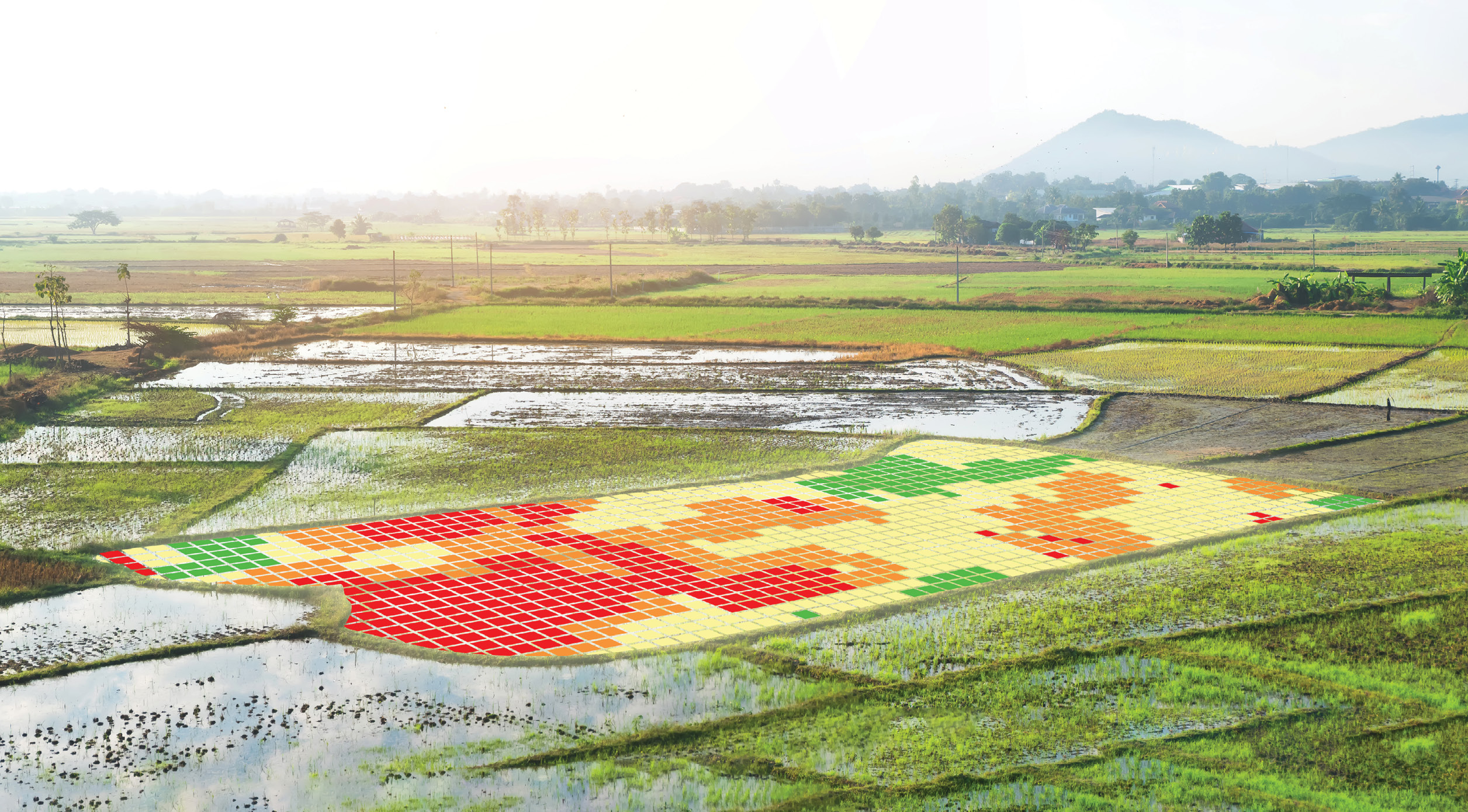
Near-infrared (NIR) images processed to create field maps using the normalized difference vegetation index in field rice.
Agriculture, one of humanity’s oldest industries, remained largely unchanged for tens of thousands of years, until a century ago. Then, it underwent a series of revolutions—from mechanization in the early 20th century, to the genetics-based Green Revolution of the 1960s, to the dawn of “precision agriculture” in the 1980s. As a result, the ancient practice of growing, harvesting, and delivering the food on which we depend has become among the most modern of occupations.
Pervasive instrumentation and networking are generating unprecedented volumes and varieties of data about soil, weather, topography, plant biology, fertilizer, and pests. Advanced medicine is teaching us about the human microbiome. We’re also hoovering up data on farm machinery, market demand, legislation, regulation, and environmental impact. It’s integrated and turned into insight through artificial intelligence.
This is the “precision” in precision agriculture—and it’s redefining the science of feeding the planet.
 We’re seeing new levels of efficiency, societal responsibility, and nutrition through the application of location intelligence and the emergence of a deep geospatial consciousness. It comes not a moment too soon. Not only do we face the prospect of feeding 9.5 billion people by 2050, but the world has awakened to the unforeseen impacts on our environment and our health of previous revolutions in agriculture—from “factory farms,” deforestation, and methane emissions from livestock, to ocean pollution, overfishing, and concerns about the genetic modification of both crops and animals.
Fortunately, we now have promising solutions to these and other agricultural and agribusiness challenges of the 21st century. They are playing out in three key dimensions—microlocation, smart supply chains, and environmental stewardship.
For instance, data-centric companies like farm equipment giant John Deere1 build sophisticated machines equipped with sensors that capture data on soil, water, and temperature conditions. The company uses satellite imagery to analyze land cover, sizing up how various grasslands, crop fields, or lawns correlate with consumer purchases. A map with 50 billion data points about field conditions and topography gathered from IoT-equipped machines gives Deere and its peers a kind of intelligent nervous system of America’s growing spaces.
Welcome to the era of sustainable sustenance.
Microlocation—the nanogeography of precision agriculture
The industrialization of agriculture vastly expanded the volume and productivity of the world’s farms by adopting the mindset and methods of mass production—standardizing processes and simplifying products. We got much more food, and much less variety. This impacted the health not only of those consuming the food, but also of the natural systems in which it grew.
Data-centric precision agriculture has made possible a far greater understanding of and attentiveness to the complexity, dynamism, and variety of both natural systems and their abundance.
On a precision-ag connected farm, advanced technology is everywhere2, and it is location-intelligent: mobile devices combined with smart maps; sensors embedded in both equipment and fields; and pickers equipped with trackable smart devices, so the farm manager can see where that picker was and when they picked that produce. These technologies can help isolate contamination issues so food isn’t unnecessarily destroyed, and it can help farmers identify their best produce so they can repeat that success.
Consider the business of berries, which are highly sensitive to their location and surroundings, requiring unique microclimates, air quality, and altitude, among many variables. At Driscoll’s, the world’s largest berry farmer, every time a new crop is planted, it is mapped and logged in a location-intelligent map. This data serves as a foundation for decision dashboards that fuse information from other departments. A dashboard may show the total acreage planted, a bar chart of forecast production for the coming week, and a map showing which berry varieties are growing where. That information also answers complicated questions about best farming practices and the timing of the supply chain.
Most major meteorological forecasts don’t have a high degree of confidence beyond 10 days, while Driscoll’s needs to anticipate supply 13 weeks out, tracking and analyzing growing conditions at specific locations across tens of thousands of acres. The company also uses location intelligence to predict when crops will be ready, and in what amounts.
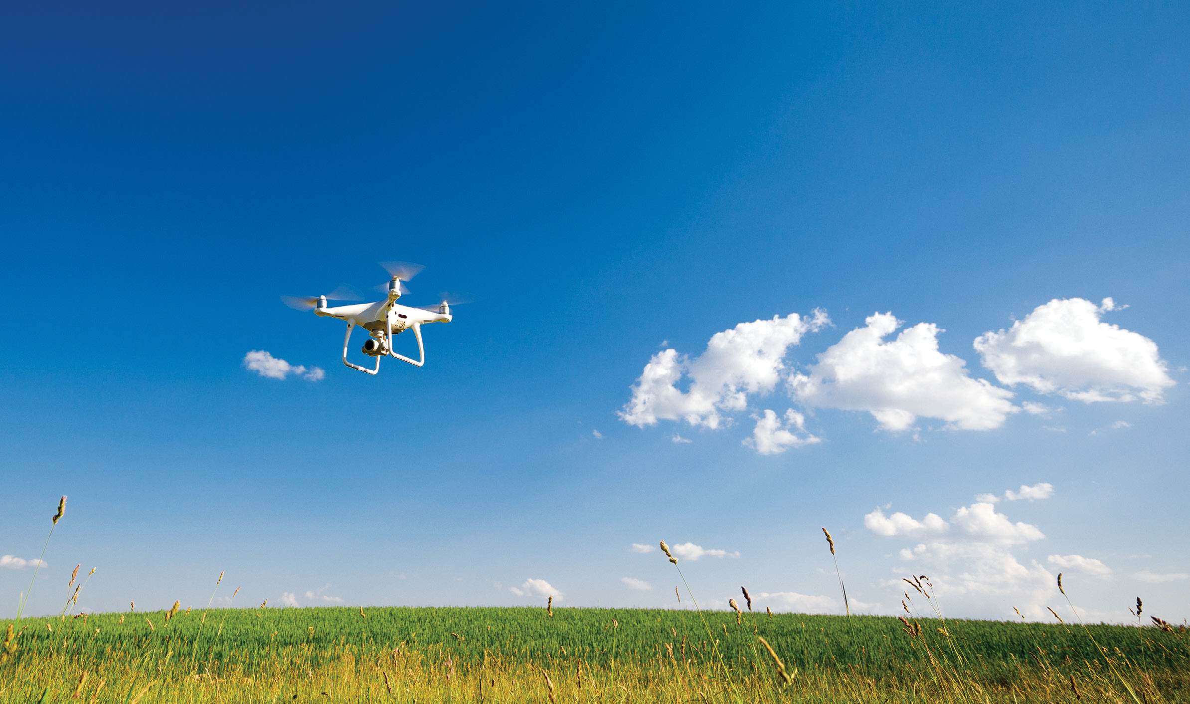
Soon AI-based robots that are spatially aware will navigate through a field to pick produce. Already, insurance companies are flying drones over fields after floods, fires, and tornados to do rapid damage assessment, so they can cut checks, and get farmers back on their feet. Some companies fly their fields with drones or aircraft toward the end of the growing season to analyze the vegetative index and estimate what the yield will be. That allows them to tell the grain elevator that they’re anticipating 5000 bushels of corn, for example. Then they can plan for how many combines and how many tractor trailers they’ll need to process it all.
From farm to fork—the new ag supply-and-demand chain
Modern agriculture is highly complex, and farmers today wear many hats. On any given day, they’re commodity brokers, bankers, chemists, agronomists, pickers, procurement managers, warehousers, machinists, meteorologists, and long-term gamblers. One thing all farmers must now be is technologists. And despite the Romantic trope of the solitary farmer in the field, all 21st century farmers are inherent members of multipart global supply chains.
“A lot of our work isn’t about the day-to-day operations of the business. It’s about long-term planning—how you build out your facilities and make investments in order to keep up with the continual changes in the agricultural market,” says Josie Taylor of Land O’Lakes’ Strategic Asset Management team. Land O’Lakes uses location intelligence and mapping to manage consolidation of facilities to avoid trade area overlaps, gaps, and redundancies. How much capacity does an operation have, and how much is needed to service existing and future customers?
Nespresso has used location intelligence3 to build a comprehensive view of farming operations and accessibility across regions, recording, mapping, and sharing data about farms, farmers, and coffee crops, including each farm’s objectives and performance. But it doesn’t stop there. The platform also reveals how farmers deliver coffee beans to central mills to be harvested, a key factor in supply chain productivity. The analysis uncovered areas where the terrain required long rides or walks through the mountains to reach certain farms, making frequent visits impractical. For a company that works with 100,000 farmers, a digital engine of that kind of intelligence is a difference-maker.
UMAP, the self-serve, geospatial digital platform of Agriculture and Agri-Food Canada (AAFC), provides visualization of crop density, field-level cropping patterns, soil moisture, farm locations and agri-environmental indicators across the Canadian landscape—all in one browser. UMAP also allows AAFC staff to mash up key organizational information layers—such as annual crop inventories and historic yield and production statistics—with data from other organizations and third parties. AAFC’s maps and apps are informing policy makers on a global scale, from grain brokers looking for new cereal sources to real-estate scouts seeking new investment opportunities.
Mapping the business ecosystem, as well as the natural ecosystem, is also important to the banks that provide farmers with the capital they need to run their businesses. Lenders need a system of record, so they know what’s in their portfolios, which clients have what assets and liabilities, and what geographic areas are doing better—creating an automated valuation model to assess agriculture real-estate values and determine which farmers are the best risks.
In the developing world, precision agriculture based on location intelligence offers billions of people the opportunity to leapfrog over millennia of learning, for improvement of productivity, nutrition, and sustainability. Ghana’s agricultural industry accounts for about 20% of its gross domestic product and employs more than half of its workforce, mostly on smallholder farms that average 1.2 hectares of arable land. To improve the livelihoods of these smallholder farmers by boosting the productivity of the country’s rice, maize, and soybean value chains, the Feed the Future initiative mapped the locations of the country’s agricultural value chain, including farms, warehouses, weather stations, tractor service providers, produce aggregators, and processors, and developed a demographic profile of those working at the facilities. The patterns revealed in the data showed that, contrary to expectations, it was not Ghana’s changing rainfall patterns but rather the introduction of advanced farming methods—better quality seed, improving water management and properly applying fertilizers and pesticides, for example—that determined the yield for farms.
Sustaining sustenance
We have learned over millennia that soil and the nutrients and biological ecosystems it supports are a finite resource. Once the soil is gone, there’s no more farming. So, applying precision agriculture is crucial to understand how much and what kinds of nutrients to input into the soil, how much water is required to maximize a crop, how much fertilizer, how much seed, and also how much tillage is going on at that exact location—all of which will help us understand how to protect our land for future generations.
Palm oil, the most widely used vegetable oil on the planet, serving as an ingredient in shampoo, lipstick, ice cream, biofuels, and other consumer staples, is big business. Its production accounts for nearly 10% of the world’s permanent cropland4—and prominent multinationals such as Mondelēz, Procter & Gamble, and Cargill are committed not to source products connected to deforestation. Turning to new forms of location intelligence5 and daily satellite imagery, they are detecting how many trees have disappeared from an area one week to the next. A new forest monitoring tool called Global Forest Watch Pro6 (GFW Pro), available through World Resources Institute (WRI), tracks forests cut or lost to fire.
The rise of organic and sustainable agriculture over the past two decades has spawned many new businesses, from Whole Foods to Indigo7. Agricultural companies are working on practices such as planting a cover crop, a hedgerow, or riparian plants along a waterway for carbon sequestration. And traditional retailers such as Walmart, along with many other Fortune 500 companies, are committing to a green future. In addition to its own decarbonization goals, Walmart has established sustainability requirements for its suppliers.
Across the Sahel region of Africa, the Great Green Wall8 reforestation initiative is fighting desertification. Launched in 2007 by the African Union Commission and the UN Convention to Combat Desertification, this initiative aims to restore Africa’s degraded landscapes and help improve the livelihoods of millions of people in one of the world’s poorest regions. The end-goal is to grow a 5000-mile-long line of trees and plants across the entire width of Africa, to help reverse a long history of desertification, boost food security and build stronger resilience and mitigation against climate change. The $8 billion project is expected to absorb 250 million tons of carbon dioxide from the atmosphere and create more than 350,000 new rural jobs for villagers.
In response to the world’s exploding demand for seafood, the aquaculture industry, which emerged in the 1980s, is today helping to provide healthy and environmentally sustainable animal-protein options. Location-intelligence systems such as those created by Innovasea9 help select prime locations for a responsible fish farm. Farmers can reduce overfishing, encourage aquatic ecosystem restoration, and help endangered species recover. According to the Food and Agriculture Organization of the United Nations, the global aquaculture industry can be pivotal to food security.
Conclusion
In agriculture, location intelligence provides information to both people and machines. When a machine is in a farmer’s field, it can know exactly what it’s going to see in that space at that time. The soil type is exactly what the equipment says it’s going to be. The soil moisture level or the soil health and soil properties are going to be exactly what the equipment says they’re going to be at that precise location. Some zones of the field may have better yields historically than other areas that may need more attention, so the application of fertilizer or nitrogen and phosphorus later and after harvest is exactly where it’s supposed to be.
It’s how precision works hand-in-hand with sustainability.
Charlie Magruder is Esri’s Senior Account Executive on the Agriculture Team. He has spent over 25 years working in the field of geographic information systems (GIS) at Esri. He helps organizations adopt and implement spatial technology for their ag-based businesses.
Matthew Harman is Esri’s Commercial Agriculture Practice Lead for the Professional Services Division. His work includes supporting agriculture users in the application of GIS technology, including promoting best practices and sharing information across the industry. His career at Esri has spanned over 15 years, most recently working on solution design, integrating Esri and Partner technology, for a variety of agriculture users.
1 esri.com/about/newsroom/publications/wherenext/john-deere-market-development-with-location-intelligence/.
2 storymaps.arcgis.com/stories/795fa0328cb2497a8f960b5f3e8d2c7a
3 esri.com/about/newsroom/publications/wherenext/sustainability-and-location-intelligence/
4 apps.worldagroforestry.org/downloads/Publications/PDFS/OP16401.pdf
5 esri.com/en-us/location-intelligence
6 pro.globalforestwatch.org
7 esri.com/about/newsroom/publications/wherenext/indigo-ag-pursues-innovation-in-the-dirt-and-from-outer-space/
8 greatgreenwall.org/about-great-green-wall
9 esri.com/about/newsroom/blog/innovasea-optimizes-aquaculture/