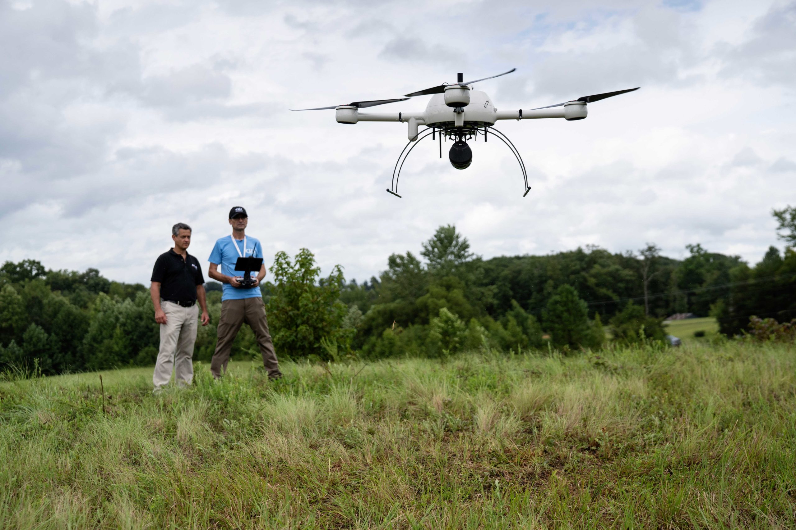
Robert Chrismon, PLS, pilots the mdLiDAR1000LR as Jeff Allen, President of Allen Geomatics, observes.
Rome, NY- Down to Earth, a surveying reality series, heads into the woods of North Carolina to compare traditional and drone surveying methods on a 15 acre design survey for a development project. In these 4 informative episodes, Allen Geomatics, a land surveying and consulting firm located in Advance, NC, utilizes a 3 man crew to collect their ground shots and survey the site while Robert Chrismon, PLS, takes a different approach high in the sky with Drone LiDAR.
To see the results and learn about the differences between the two surveying methods CLICK HERE to watch NOW On-Demand.
“Down to Earth” is a reality series that shows how real surveyors collect data and turn it into real deliverables, despite challenging terrain, rough weather, and hidden dangers.
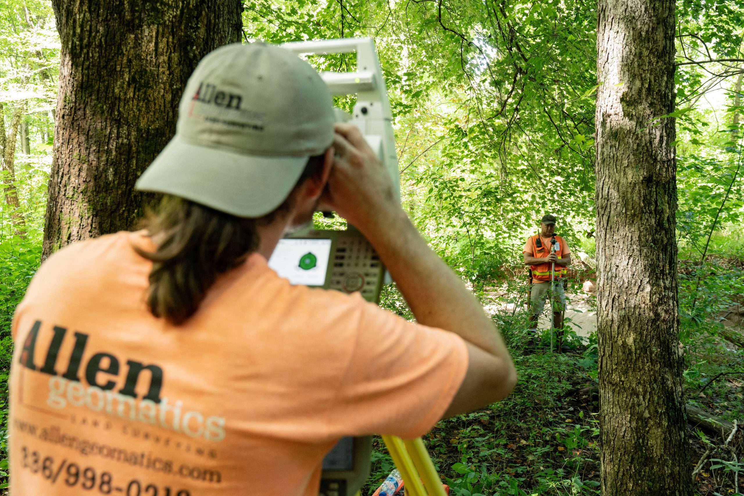
The Allen Geomatics crew collects survey data in the woods.
These days, many surveying professionals are considering adding drone surveying equipment to their toolbox. In these episodes of Down to Earth, we meet Jeff Allen, owner of Allen Geomatics P.C., a land surveying and consulting firm located in Advance, NC, who is also curious to see if drone surveying methods can enhance his practice.
That’s why he invited Robert Chrismon, PLS, a former surveying co-worker and early adopter of drone surveying equipment, to one of Allen Geomatic’s design surveys for a development project. Together they’ll compare the traditional methods of using a 3 man crew on the ground and Robert’s drone LiDAR system to create a digital map with 1 foot contours as a deliverable.

Data collected over 5 days by a Total Station, is highlighted on top of the LiDAR data from the 20 minute drone flight.
In episode 1, Robert meets up with Jeff and his crew at the survey site to assess the project, plan the mission and demonstrate the capabilities of using drone Lidar. “Jeff’s an old buddy of mine from my early days of surveying,” said Chrismon. “He’s interested in how drones can apply to surveying and I’m at a place where I can help Jeff out with understanding the LiDAR technology and how it may actually benefit Allen Geomatics in the future.”
Episode 2 sees the duo step into the woods to join the Allen Geomatics 3-man crew as they use a Total Station to collect their shots on the ground. Each surveying method faces challenges in the form of thick vegetation, changes in elevation, river embankments and more. “Looking at the distances between the shots taken by the Total Station, it leaves a lot of little undulations and information left to be located,” Chrismon noted in the field. “That’s what we pick up with the LiDAR.”
The Allen Geomatics office is where Episode 3 begins, as Robert and Jeff compare the results and assess the differences between the traditional and drone surveying data. Both the conventional and drone data are able to provide the final deliverables. “It’s easy to pick out the features that we surveyed in the point cloud,” said Allen. “You can see a clear definition of the road and the crown that we talked about from my data. This has really helped me realize how close my small company is to using Lidar to help us with our topos.”
The series concludes with the fourth episode set in a local restaurant, where Jeff and Robert review the project, workflow, and discuss the changing landscape of surveying technology, all while enjoying a cold beverage.
About Allen Geomatics
Allen Geomatics, P.C. is a land surveying services and consulting firm located in Advance, NC. Honesty and Integrity seem to have become cliché terms, but they sincerely are at the root of every action taken at this company. Allen Geomatics specializes in construction staking (commercial & residential); but is willing to provide most Land Surveying needs including: Boundary/Title Surveys, Topographic Surveys, Easement Mapping, Subdivision Platting, As-Built Surveys, Elevation Certificates, Sport Fields, etc. Allen Geomatics strives to provide the best service for their clients by never cutting corners and ensuring a commitment to a job done right the first time. Whether you are a general contractor in need of construction staking services or a residential client in need of an elevation certificate, we offer the services you require backed by honesty and integrity.
About Microdrones
Microdrones grew out of the collaboration between the German inventor of the world’s first commercial quadcopter and a determined surveying payload and software developer in North America. The result is a global aerial mapping technology company that delivers complete and reliable mapping systems specifically developed for the surveying, mining, construction, oil & gas and precision agriculture industries. Microdrones Integrated Systems are industrial tools addressing specific complex mapping challenges for professional customers, relying on a fully integrated geospatial workflow that enables cutting-edge software technology from Microdrones to transform raw data collected in the field by Microdrones survey equipment into valuable high-quality survey-grade data. Microdrones is widely recognized for its LiDAR technology leadership. Microdrones has engineering centers and manufacturing facilities in Germany, Canada, France, China and the United States, as well as a sales, support and distribution network spanning six continents. Microdrones serves markets around the globe. To learn more about Microdrones, visit www.microdrones.com or follow @Microdrones on Facebook, LinkedIn, or Twitter.
