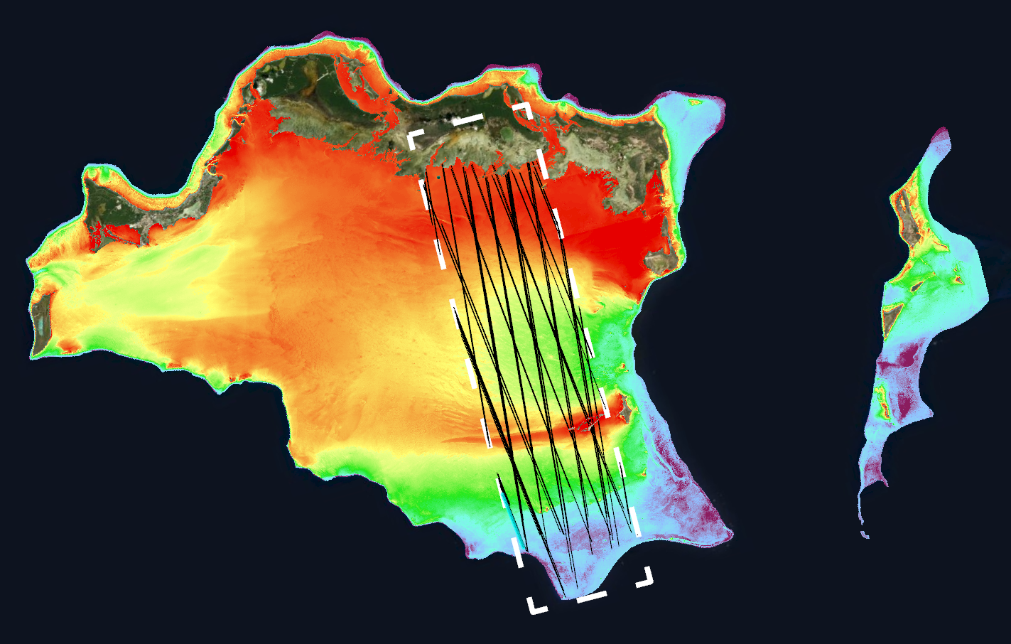
10m satellite-derived bathymetry map of Turks & Caicos with ICESat-2 tracks overlaid.
Denver, Colorado, 27 September 2021 – TCarta Marine, a global provider of hydrospatial products, will introduce geospatial industry veteran Michael Smallwood as Director of Sales at the GEOINT 2021 Symposium. In addition, TCarta will demonstrate the new Trident Satellite Derived Bathymetry (SDB) Toolbox, now available as a software-as-a-service product.
Smallwood, along with TCarta President Kyle Goodrich and Technical Program Manager Ross Smith, will be conducting live demonstrations of the Toolbox and other TCarta products in Booth 1319 at GEOINT 2021, which is being held Oct. 5-8 in the America’s Center Convention Complex in St. Louis, Missouri.
“TCarta is excited to welcome Michael Smallwood onboard, and we encourage his many friends and colleagues from the Federal Civilian and Defense/Intelligence communities to greet him at GEOINT 2021,” said Goodrich.
Smallwood brings more than 30 years of executive-level geospatial industry experience to his role as TCarta Sales Director. His most recent positions include President/CEO at Parallel Inc., Senior Sales/Business Development Manager at Intrepid Geomatics, and Director of Strategic Accounts at SPOT Image Corp. He is based in Aiken, S.C., and may be reached at ms@tcarta.com.
TCarta demonstrations at GEOINT will focus on the new Trident SDB Toolbox, which is a series of software applications that operate within Esri ArcPro and allow organizations to perform their own extraction of bathymetric measurements from satellite, aerial, and UAV imagery. The Toolbox currently contains these applications:
- Pre-processing tool to calibrate and validate in situ source data, such as SONAR or LiDAR, for use with satellite or other imagery.
- Two algorithm workflows to derive water depth measurements, one using Machine Learning and the other using more traditional Band Ratios.
- Post-processing tool to perform quality assurance and validate the SDB measurements.
“The Trident SDB Toolbox will be popular among GEOINT agencies and other organizations that have access to their own imagery sources and prefer to perform their own processing,” said Goodrich.
Also at GEOINT, TCarta will be demonstrating its ICESat-2 LiDAR data sets, which can be used in SDB validation, and the TCarta Global Satellite Derived Bathymetry (G-SDB) unveiled earlier this year. G-SDB is generated with Machine Learning and ICESat-2 laser data at 10m resolution to depths of 30m depending on water clarity.
“The Trident SDB Toolbox, G-SDB product, and ICESat-2 data set were developed through a Small Business Innovation Research Grant from the National Science Foundation (NSF),” said Goodrich.
About TCarta (www.tcarta.com)
The TCarta product lines include high-resolution satellite-derived water depth and seafloor map products as well as 90- and 30-meter GIS-ready bathymetric data aggregated from numerous information sources.
