 3D TARGET srl, in its continuing pursuit of innovation in the field of mobile mapping, is excited to present the new addition to the Scanfly series: the Scanfly ULTRA X.
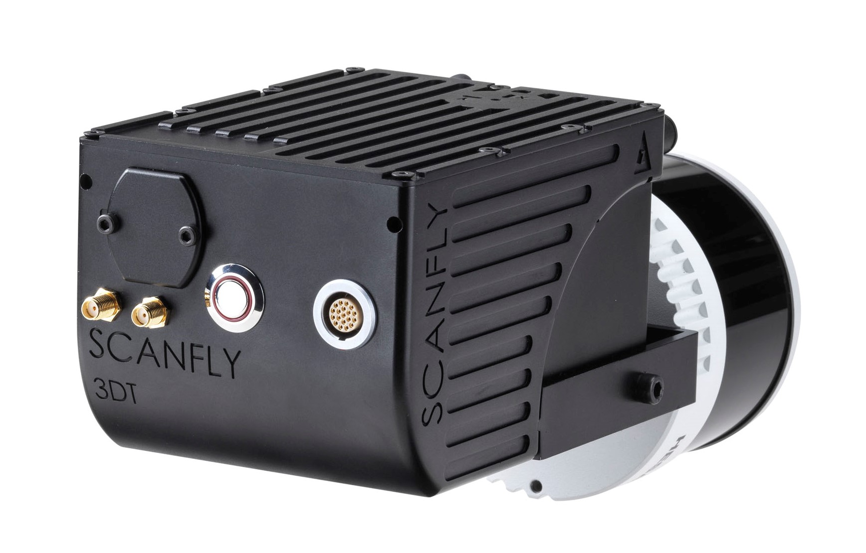
Scanfly ULTRA X is the first mapping system featuring triple returns and a range of up to 300 m on a 32 channels LiDAR head, with the exclusive integration of the state-of-the-art Hesai XT32M2X.
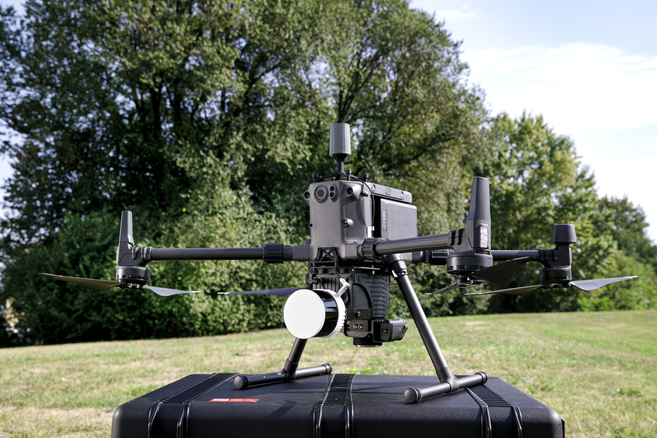
Scanfly ULTRA X is compatible with the range of accessories and mounting kits of the Scanfly ecosystem, allowing for an easy installation in any land or aerial vehicle. With a weight contained at 1.49 kg, Scanfly ULTRA X is the perfect choice to increase productivity when mapping with a drone.
Applanix Option on All Scanfly Series
3D TARGET srl is proud to announce the full integration of the Applanix control interface in the Scanfly core. The integrated Web App can easily configure and control all the parameters of an Applanix based Inertial Navigation System through the usual interface. This innovation allows for the implementation of the robust and accurate Applanix position and orientation technology in the Scanfly ecosystem. Effective immediately, each Scanfly model can be delivered with the single antenna, single receiver Applanix APX-15L as an option.
 SmartProcessing Lidar: New Interface and Ground Control Points Tool
A keystone of the easy-to-use philosophy of the Scanfly series, SmartProcessing Lidar features the 3D Target’s proprietary direct geo-referencing engine to empower the extraction of accurate point clouds from the best estimate of the trajectory and the synchronized Lidar data. From the definition of the lines to be extracted to the export settings, the procedure requires just a few clicks.
The new version is based on a brand new graphic interface, which keeps the peculiar features that have always made the user experience so intuitive and well recognized and introduces the full preview of the point clouds, quickly responding to any change on the output settings. What you see is now definitely what you get!
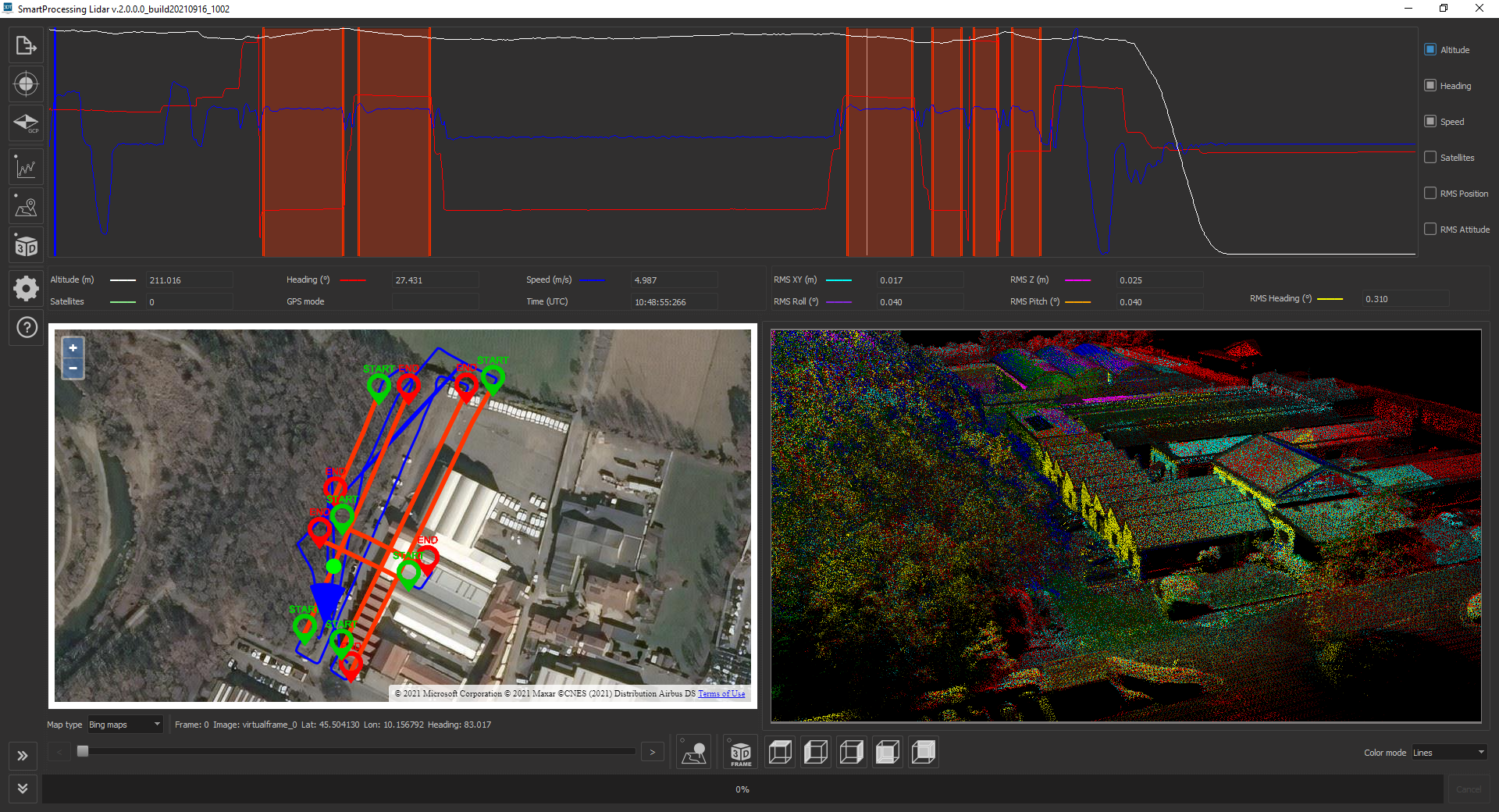 Furthermore, the new optional Ground Control Point and Strip Alignment tool allows improving the quality and the accuracy of the point clouds. A streamlined procedure allows for the adjustment of the point clouds extracted blending the features of the adjacent strips and the accurate estimation of the trajectory. Then, Ground Control Points align the output to the ground truth measured with different methods.
“We have taken the state-of-the-art performances of the Hesai XT32M2X to establish a new leap forward of the Scanfly ecosystem. The increased range, the triple returns and the compactness opened yet a new world of possibilities with the range of accessories introduced this year to increase the multi-platform philosophy of Scanfly.”, said Mauro Contrafatto, Product Manager of 3D TARGET srl.
He added that “Implementing the dedicated hardware and software interfaces of Applanix, allowed empowering the Scanfly series with the recognized reliability of the trajectory processing and the increased flexibility of the Applanix INS solutions. Also, 3D TARGET srl has a solid track record of delivering innovative solutions to solve the business needs of its customer. The new graphic interface of SmartProcessing Lidar is one of them: the operator can now see in real-time the effects of the advanced algorithms of the newly introduced strip alignment and ground control points plugin.”
About 3D TARGET
3D TARGET was founded in 2008 to distribute non-destructive measuring instruments on the Italian market. The department dedicated to the distribution of measuring instruments (3D LiDAR, high-resolution, thermal, multispectral and hyperspectral cameras) is supported by an internal R&D team, engaged in the integration of systems, image analysis and artificial intelligence projects. With customers all over the world, 3D TARGET is present in several sectors.
About APPLANIX Technology
Applanix, a Trimble Company (NASDAQ: TRMB), develops, manufactures, sells and supports products and solutions for mobile mapping and positioning. Applanix’ products and solutions are used in a variety of applications, including road profiling, GIS data acquisition, aerial surveying and mapping, railroad track maintenance and seafloor mapping. Established in 1991, Applanix supports its growing global customer base with exceptional service.
