
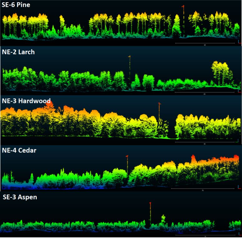
Visualization of dominant tree structures in Northern Wisconsin around the flux towers.
20th July 2021 – UAV LiDAR to inform carbon emission reduction policy making
A specialist team at the University of Wiconscin-Madison (UW-Madison) used the Routescene UAV LiDAR system to detect and visualize forests in Northern Wisconsin, USA as part of the CHEESEHEAD project. The objective of this wider project is to improve weather forecasting by understanding further how vegetation and forests influence the atmosphere. This information will be used by decision makers to develop policies which more effectively enable carbon emission reductions.
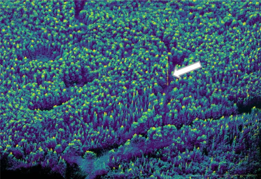
UAV LiDAR point cloud of area around one of the flux towers.
CHEESEHEAD project overview
The aim of the CHEESEHEAD project (The Chequamegon Heterogeneous Ecosystem Energy-balance Study Enabled by a High density Extensive Array of Detectors) is to study interactions and feedbacks between the land surface and atmosphere and how these results can be used to improve weather and climate models. Ultimately the results will enable better carbon emission reduction policy making.
The UW-Madison team collected high density 3D point cloud data of the prominent tree species in the Chequamegon-Nicolet National Forest, USA. Routescene’s LiDAR system mounted on a drone can capture the full tree structure from the tree canopy to the vegetation at ground level. This survey was part of a wider project to understand how water, heat and carbon interact across a variety of landscapes like forests.

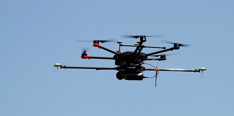
The team setting up the UAV LiDAR system.
The UAV LiDAR surveys
UAV LiDAR is ideal to quickly and efficiently survey and represent the type, shape and composition of the forest canopy. Surveys were carried out around eleven 100ft flux towers within areas that ranged from 0.25 to 1km². Six forest types were identified which included Aspen, Pine, Poplar, Larch, Cedar and Hardwood.
Christian Andresen from the University of Wisconsin-Madison commented, “The tall canopy of 20-30m height created difficult flying conditions. It was difficult to keep a visual line of sight, so we decided to fly smaller 500 x 500m flights to keep sight of the drone.”
The Routescene LiDAR system includes a 32-laser LiDAR sensor providing a scan rate of up to 1.4 million points per second. Point cloud density averaged 600 points per meter squared with a vertical accuracy of 2-5cm.
Christian added, “The Routescene system worked flawlessly we achieved all we had planned. Over the 3 days our crew of two covered a total of 4.2 km². We were particularly impressed with the density of overlapping flight lines and the mapping of the forest structure.”
Summary
This study was the first to use a UAV LiDAR system to characterize the forest structure by tree type in Northern Wisconsin. The project contributed to the wider CHEESEHEAD experiment to generate knowledge that advances the science of surface flux measurement and modelling, relevant to many scientific applications such as numerical weather prediction, climate change, energy resources and computational fluid dynamics. For more information please visit www.routescene.com more information about this case study can be found here
About Routescene
The Routescene® UAV and vehicle LiDAR turnkey solutions have been developed to save time, improve efficiencies and productivity. It enables faster surveys and higher resolution outputs with Quality Assurance as standard. All the complex integration is complete. The result is an operational system ready for immediate use. Comprising workflow methodologies, quality assurance software, post-processing software, hardware and firmware. The UAV based system is perfect for applications where accurate mapping is essential but difficult to achieve such as hard to reach areas, hazardous environments and situations where you need to penetrate vegetation to reach the ground beneath. Routescene® is a global operation. We offer authoritative insight across all aspects of data management and have industry recognition as data visualisation experts. We understand the problems the survey industry needs to solve and have combined intelligent thinking with experience to design a reliable and practical solution to deliver fast geospatial data capture, analysis and visualisation to improve commercial decisions and performance.