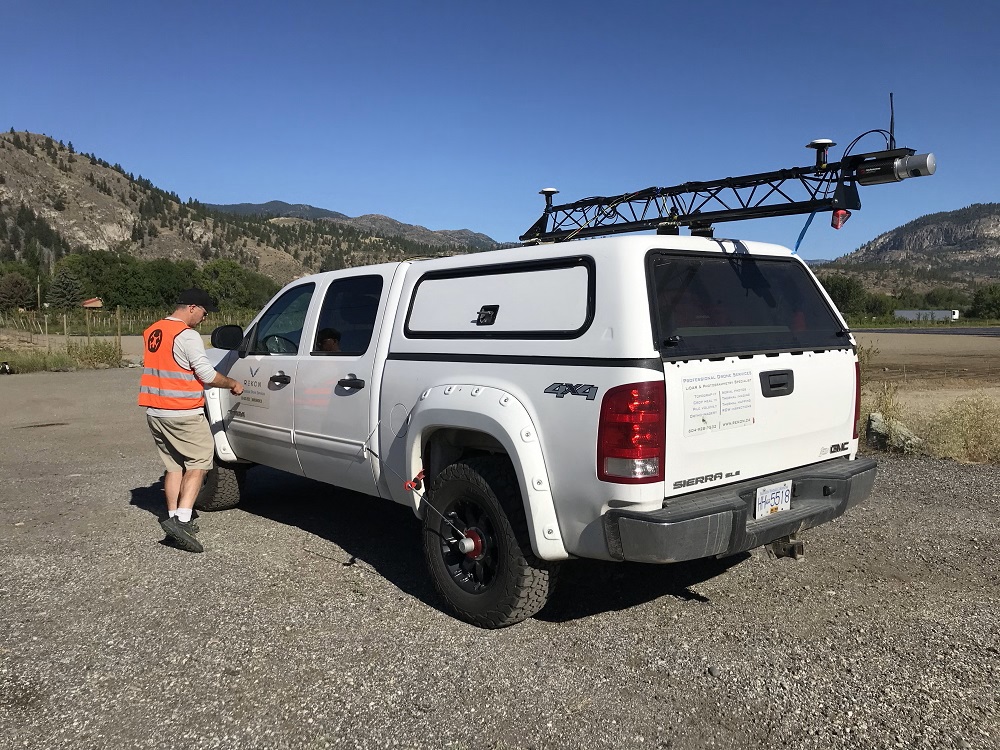
Routescene LiDAR mobile mapping system deployed in the truck.
25th June 2021 – Electricity distribution company Fortis did not have an up-to-date view of their ageing power lines in the rural, small town of Oliver in British Columbia, Canada. To prepare for the replacement of these power lines Fortis contracted professional LiDAR service provider, Rekon Solutions Inc, to conduct a survey. Rekon used both the Routescene vehicle and UAV based LiDAR system to undertake this. The data captured was used to create a 3 dimensional view of the roads in Oliver to assist the detailed planning of works and materials required.
Vehicle and drone based survey
Vashaun Henderson, Operations Manager at Rekon, had planned to conduct the survey using drone based LiDAR. However, once the team assessed the neighborhood they decided they could collect 95% of the data using mobile mapping from a truck. The Routescene LiDAR system offers the flexibility of being either vehicle or UAV mounted. With mobile mapping the LiDAR system is closer to the road and street assets, such as telegraph poles and power lines, which allows more accurate data to be collected. The drone was used to fly over an area including a river which it was not possible to access using the truck.
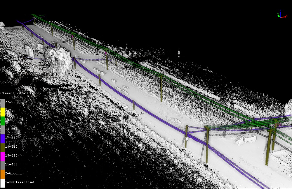
Transmission line LiDAR data.
Vashaun commented, “We have learned from this experience. If there is a possibility that we can use the vehicle system for a project, we now always fix the roof rack system to the truck. It never hurts to take it along, just in case. We protect all the sensors from grime from the road during transport to and from the site. With the vehicle mobile mapping system you can collect a huge amount of data. We collected all the truck based data for this project in just one hour. With the drone we are limited by battery life to 15-20 minute individual flights.”
Ensuring data quality
Routescene’s vehicle LiDAR kit includes a roof rack which has a specially developed shock absorption system to reduce vibrations from an uneven road surface. This allows the best possible results to be obtained.

Resulting point cloud data used to plan the power line upgrade.
Quality control is important to ensure the right data is collected and that it is of good quality. During the survey the LiDAR scanner, INS and GNSS within the system were constantly monitored from inside the truck using Routescene’s QA Monitor software. This ensures the system is set up properly and is collecting high quality data throughout the survey. This prevents repeat visits to sites and delays to projects. As a result of this quality control only one pass through the neighborhood was required with the truck.
Efficient and detailed LiDAR data collection
In this case the mobile mapping system was quicker and more efficient than using the drone. The area to be surveyed covered about 4.9km, which took about an hour. A total of over 950 million points were collected and processed. This meant the average number of points per meter squared was over 1,400, to provide an incredibly detailed view. The point cloud showed fine details such as road kerbs, manhole covers, electricity poles, guy ropes, trees, the sag of electricity lines, electricity entry points into houses and many other useful features.

Classified power line LiDAR data.
Processing the data
The LiDAR data was processed back at the office with Routescene’s LidarViewer Pro software. The data was matched with the location, orientation and ground control points to establish absolute accuracy. The data was then cleaned and analysed. Using specialist software it was also possible to classify the data. This meant that the client was provided with separate LAS files for a DEM, DTM, distribution lines, neutral lines, fibre optic overhead lines, anchor and guy lines, structure and poles, vegetation and roads lines. The client also received the data in .x, y, z format, which is used in special power line analysis packages.
In summary, using the Routescene mobile mapping system accelerated the collection of data for the survey team and LidarViewer Pro software enabled the huge amount of data collected to be processed and analysed in detail.
Vashaun added, “Using the vehicle based LiDAR system and the UAV where required allowed the client to save money and time planning the update of electricity lines to the community. We were able to provide highly detailed 3D geo-referenced information quickly and efficiently. It would have taken a considerable amount of time and cost to gather this data any other way.”
For more information please visit www.routescene.com or www.rekon.ca
