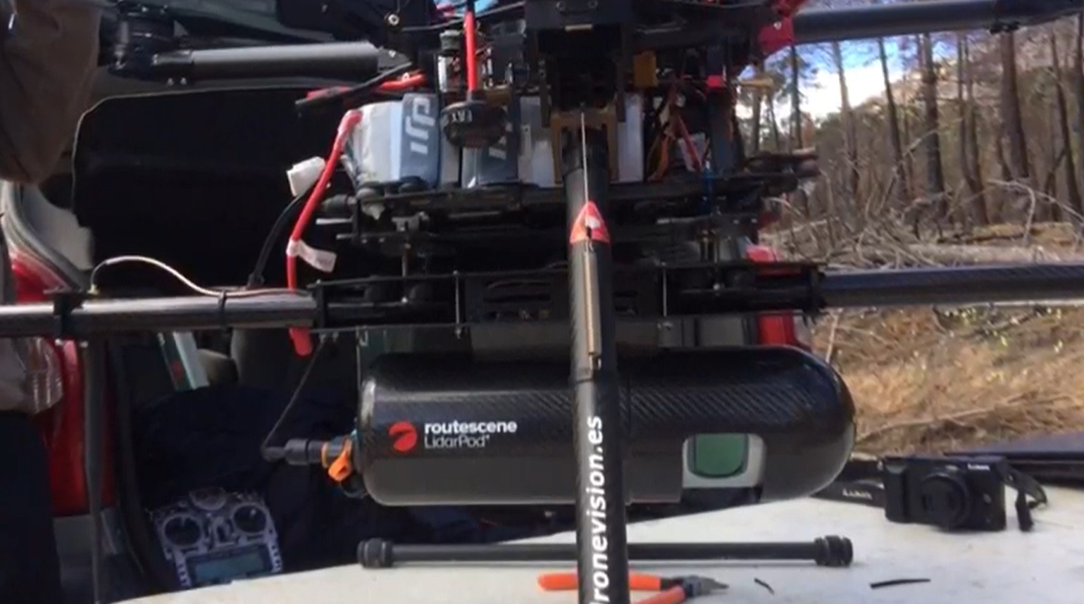
Routescene UAV LidarPod
25th May 2021 – With climate change forest fires are becoming more common, causing ecological and economic loss. A forest fire site was assessed using both high-resolution LiDAR (Light Detection and Ranging), captured from a drone, and satellite optical imagery to appraise the potential of this approach for the future. The findings showed that UAV LiDAR data provided ecologically meaningful metrics which can be used to predict fire risk, develop more precise, site-specific fire impact studies and create post-fire management plans.
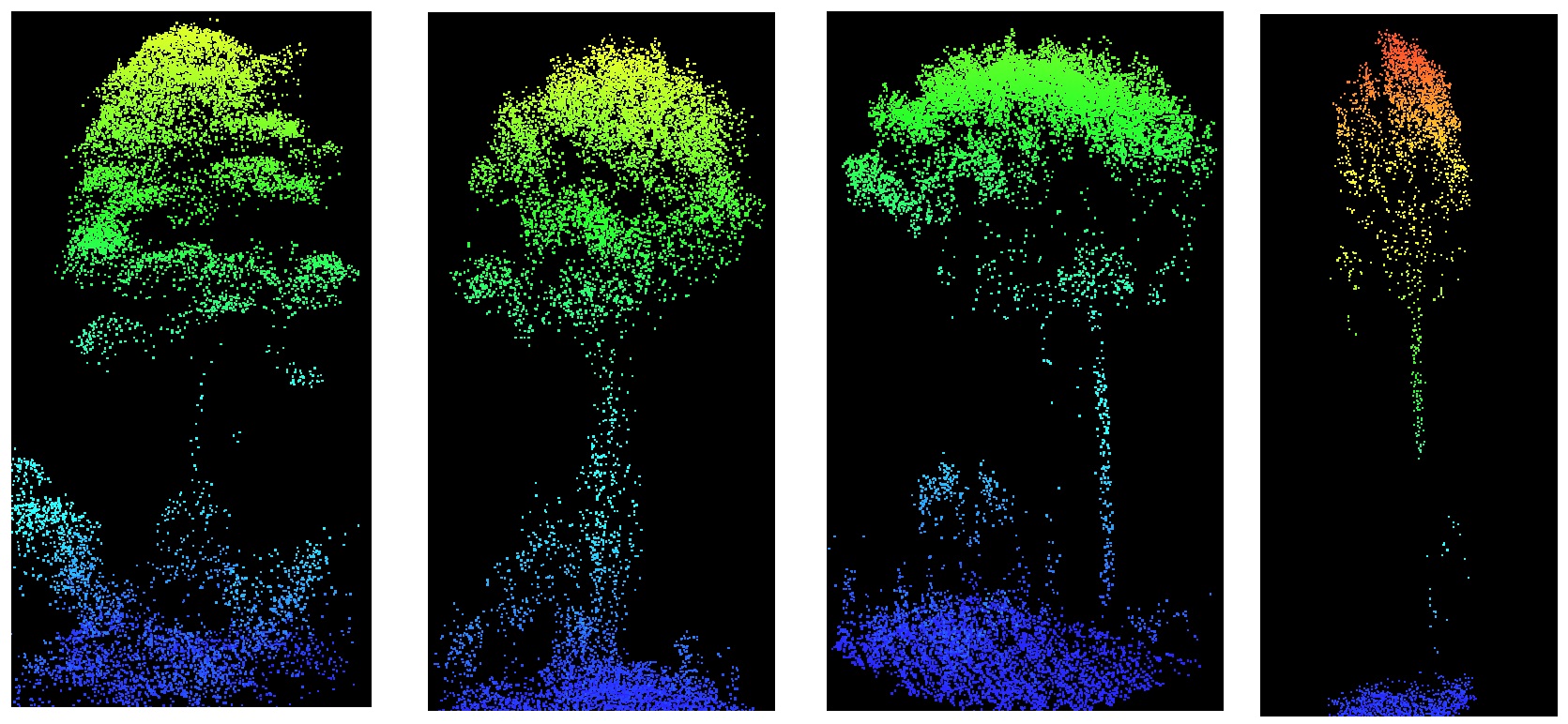
Different tree profiles from UAV LiDAR within the forest fire area
Establishing forest fire severity with UAV LiDAR
Wildfires don’t burn evenly through forests, some areas may be barely touched, whilst in other areas, most of the trees and foliage will be severely damaged. Understanding the severity and distribution of a fire within a forest can assist with estimating and modeling future forest fires to aid both prevention and containment.
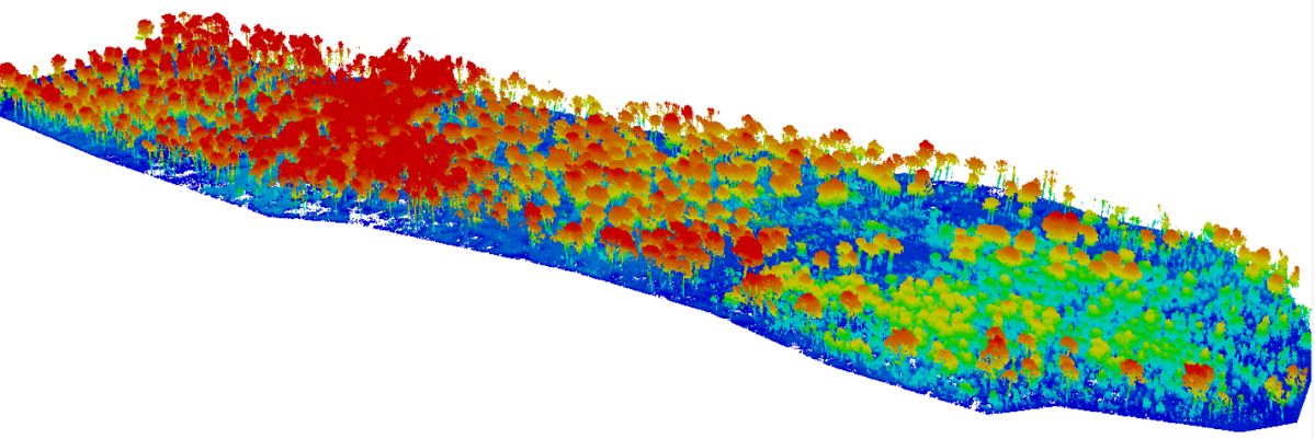
Areas of moderate severity damage from forest fire shown in LidarViewer Pro software
Satellite optical imagery is not able to penetrate through the canopy down to the low level vegetation and the ground below. Low altitude UAV LiDAR overcomes this constraint. Lasers can penetrate through the gaps in the foliage and the resulting 3 dimensional point cloud displays the canopy, the lower vegetation and the ground beneath. Individual trees can be detected and the vertical profile of the canopy and vegetation can be viewed.
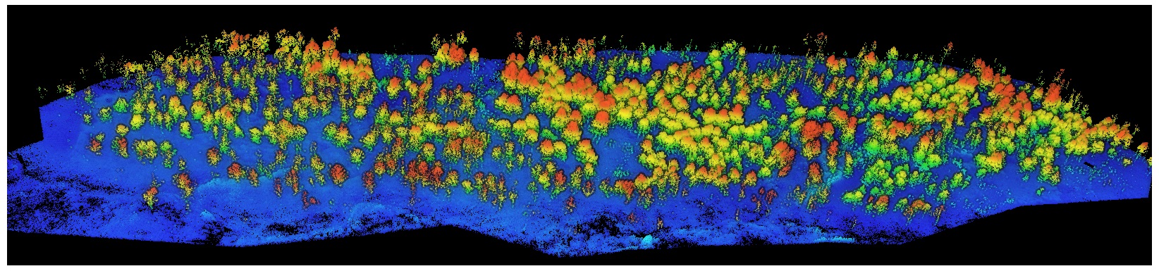
Forest fire survey area shown in LidarViewer Pro software
UAV LiDAR enables a fine-grain assessment of fire severity
In this study, the research team at Toledo University surveyed the 2017 Yeste forest fire site in the province of Albacete, SE Spain. The survey was undertaken using the Routescene UAV LiDAR system and data analysis in Routescene’s LidarViewer Pro software to establish ground from non-ground points to then create Digital Terrain Models (DTMs) and Canopy Height Models.
Relatively few studies have used LiDAR drone data to characterise crown damage after fires at the individual tree level. The team could distinguish crown fire from surface fire through changes in the understory Leaf Area Index and understory and midstory vegetation. They found that unburned and low-severity burned areas were more diverse in tree structures than moderate and high severity burned ones.
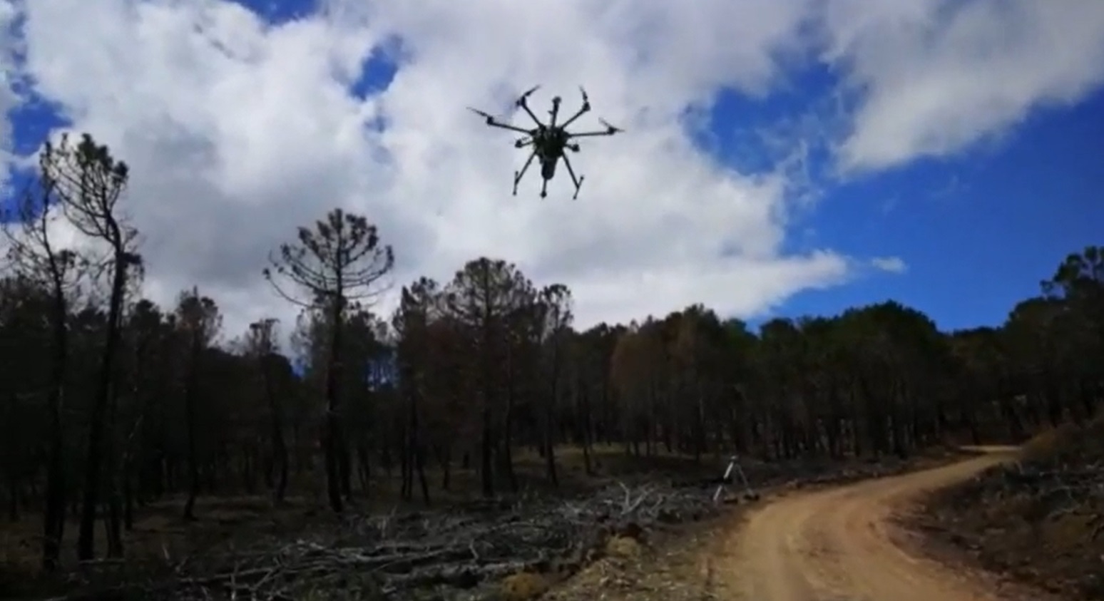
Routescene UAV LidarPod surveying forest fire damage
Olga Viedma from the Department of Environmental Sciences, University of Castilla-La Mancha, Spain, commented, “UAV LiDAR surveying, with its level of detail, was the obvious next choice of technology and a natural evolution to further examine the levels of damage to individual trees. I am delighted to say the Routescene UAV LiDAR system worked well and proved to be very useful. We have since carried out further studies on forest fires using the system in central Spain and the Canary Islands.”
The project demonstrated the potential to distinguish post-fire plant structures in detail using UAV LiDAR data. When crossed with satellite-based fire severity metrics, the high resolution results allow researchers to estimate the impact of fire on single trees not just whole forested areas, using metrics that are ecologically meaningful down to an individual tree level.
For more information on this case study of the Routescene UAV LiDAR system being used for investigating the effects of forest fires please visit https://www.routescene.com/case-studies/assessing-vegetation-structure-lidar-uav-forest-fire-severity/
About Routescene
The Routescene® UAV LiDAR turnkey solution is designed specifically for use on Unmanned Aerial Vehicles (UAVs or drones). Developed to save time, improve efficiencies and productivity, it enables faster surveys and higher resolution outputs with Quality Assurance as standard. Perfect for applications where accurate mapping is essential but difficult to achieve such as hard to reach areas, hazardous environments and situations where you need to penetrate vegetation to reach the ground beneath. All the complex integration is complete. The result is an operational system ready for immediate use. Comprising workflow methodologies, quality assurance software, post-processing software, hardware and firmware. Routescene® is a global operation. We offer authoritative insight across all aspects of data management and have industry recognition as data visualisation experts. We understand the problems the survey industry needs to solve and have combined intelligent thinking with experience to design a reliable and practical solution to deliver fast geospatial data capture, analysis and visualisation to improve commercial decisions and performance. www.routescene.com
