Figure 1: Leica Aibotix X6.
It’s 2021 and we are many years into the evolution of using drones with high accuracy sensors for surveying and mapping applications. In fact, I think I would say we are at Generation 3 (at least), where the line-up is:
- Generation 1 – everyone is focused on the drone and not so much the sensor
- Generation 2 – it will all be done via web portals, requiring no skill on the part of the practitioner
- Generation 3 – oh, it is actually just another survey tool!
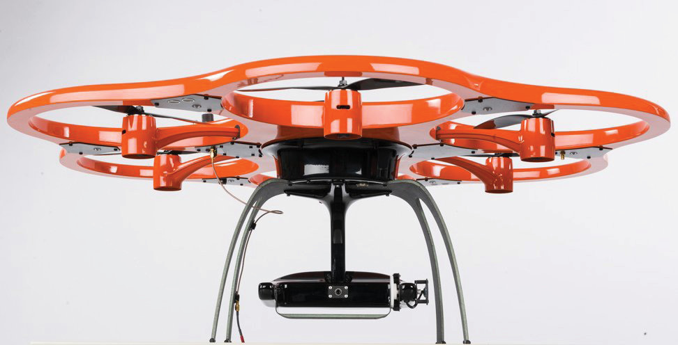
Generation 1 saw a total focus on the drone and very little on the sensor itself. We saw both Trimble and Hexagon acquire companies which were making drones but not sensors. This seemed odd to me at the time. It would be comparable to a purveyor of mobile laser scanning systems ignoring the scanner and acquiring a truck company! Thus we saw exotic drone designs (consider the Leica Aibotix of Figure 1) with no focus (pun intended) on the sensor – it was usually just a prosumer camera. I cannot help but wonder how different our drone mapping world would be today if Leica Geosystems had chosen to work on the sensor side of this emerging market.
Both acquirers soon realized the error of their ways and divested or emasculated their drone companies. But they did not move into their core competence of sensors, choosing instead to move to the sidelines, occasionally selling someone else’s kit.
Generation 2 included the rise of companies which were very focused on “scaling” the operation of drone-collected data. These schemes usually involved the end user flying the sensor, uploading data to the “cloud” service and receiving pristine results. The first of these offerings were “mechanical Turks”, where, behind the cloud curtain, were humans processing the data. This scaling was not all that attractive to the VCs funding these activities, however, so the follow-on schemes tried to fully automate the process or trained the end user to employ web-deployed tools in a self-service scheme. Fully automated failed too often to be useful (automatically detecting stockpiles in a crowded mine site is not as easy as initially thought). This led to a surge in “do it yourself” data processing, similar to taking all your ingredients to a communal kitchen except you did not get to have conversations with the other chefs! Serious surveyors who were out on this bleeding edge soon realized that what these models were really providing was monthly access to their wallets!
Thus we are entering Generation 3. We now realize that it is all about the sensor and that a professional needs to be intimately involved in both the data collection and data processing loops. In hindsight we could have easily skipped the previous generations – it’s not as if surveying is a new thing!
Unfortunately, some of those burned by dabbling in Generation 1 and Generation 2 seem to have a bad taste in their mouths they just cannot wash away. Even though it might have been the drone itself that caused all the grief, the entire premise of surveying by UAS is sometimes dismissed. I find this to be especially true amongst those who used web portals to process data. For some of the cloud solution providers, spatial reference systems and network accuracy checks seemed a foreign concept. There was an assumption (always a bad idea, of course) on the part of the customers submitting data that the cloud software was smart, imbued with lots of newfangled AI. As it turns out, often it wasn’t and a lot of bad data was delivered by some embarrassed service providers.
Now we have scaled back our expectations and realized that surveying with a drone is just a small-scale version of the lidar and photogrammetry surveying from manned aircraft that we have been (very successfully) accomplishing for years. This scaling applies not only to project size, where it now makes sense to use airborne resources on 20-acre projects, but also to the cost to play. We have users of our 3D Imaging Sensors who are claiming recovery of total system cost in four months or less. That’s an ROI worth writing home about!
If you are one of the unfortunate ones who was burned by missteps in Generations 1 and 2, you should come back for an updated look. The technology does work and it works very well. The missing ingredient, I think, was the expertise needed by the folks who deploy this technology. In the hands of someone who has been competently performing topographic surveys using ground-based gear, UAS-deployed sensors are a (positive) game changer. Go forth and fly!