
Coast of Jamaica as captured by Kucera’s flight crew from the Piper Navajo Chieftain aircraft.
Some of most interesting yet logistically difficult work for US suppliers of aerial lidar data are flyovers beyond the continental United States. In 2020, Kucera International, an experienced international lidar provider based in Ohio, tackled multi-country flight logistics and customs to deliver lidar data and aerial imagery to CEAC Solutions, a Jamaican civil and environmental engineering company.
CEAC was contracted by the Airport Authority of Jamaica (AAJ) to perform various environmental, zoning, and other baseline studies for the Norman Manley International Airport (NMIA/KIN) in Kingston, Jamaica. This work included creation of high-accuracy topography covering the immediate Airport Property and defining the obstacle limitation surface (OLS) of the airport to ensure obstacle clearance for airport approaches and departures and to define the extent of development allowable in the highly-populated surrounding area (designated “Area 2C”). Aerial lidar was recognized as a primary support technology for this work. Following internet research and contact referral of aerial lidar providers, Kucera was chosen for its understanding, experience, and confidence of a successful outcome, according to Kris Freeman, CEAC civil engineer.
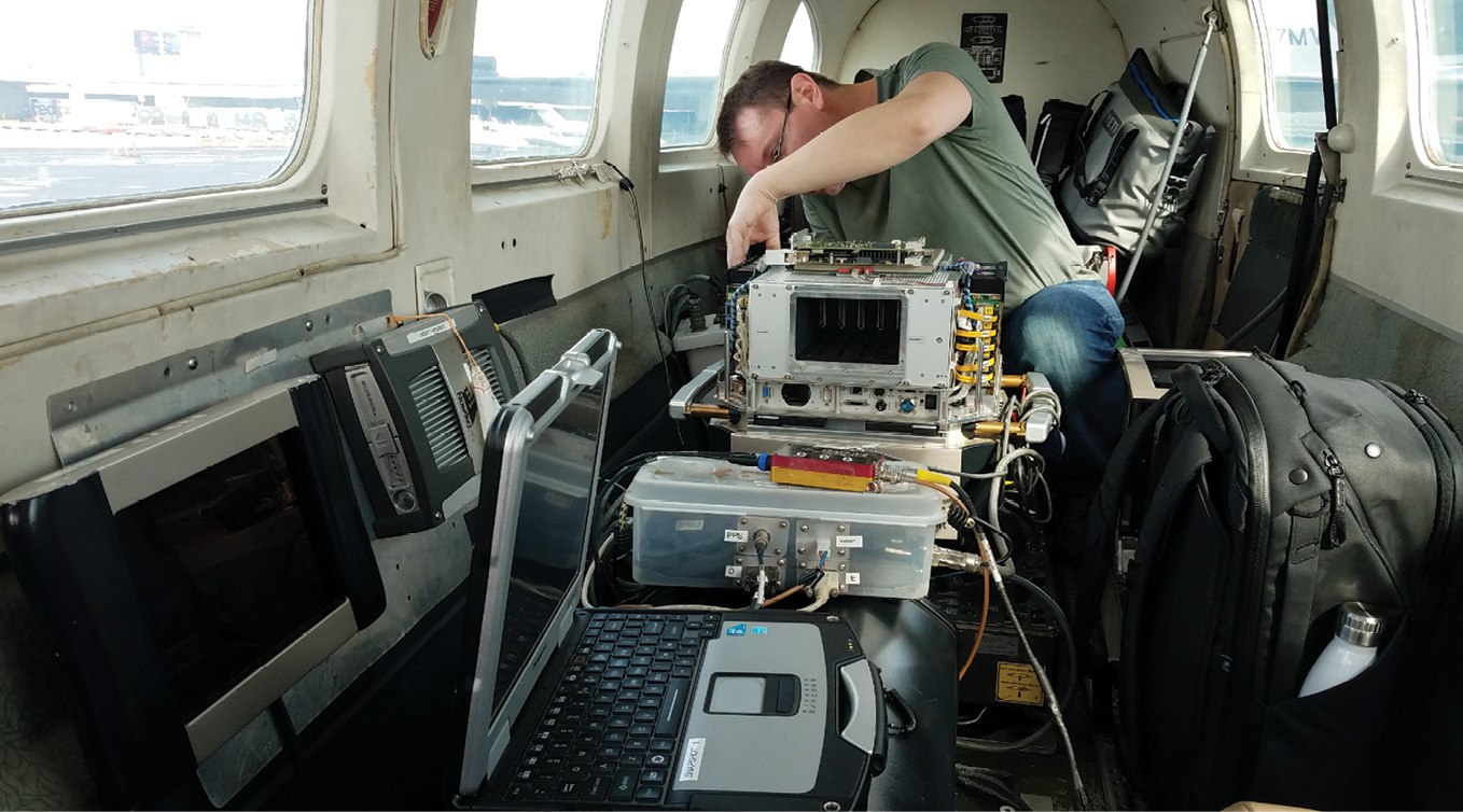
Sensor operator Pocs servicing the Vexcel Eagle UltraCam sensor at Fort Lauderdale before departure to Jamaica.
Since starting into aerial lidar surveying as a primary in-house service in 2003, Kucera has successfully performed lidar surveys covering hundreds of thousands of square miles throughout the US and abroad, including major projects in Poland and in Haiti following the 2011 earthquake. Kucera currently has seven twin- and single-engine fixed-wing aircraft outfitted for large-area and corridor lidar capture with latest-generation lidar sensors and is one of the few companies that has flown aircraft across the Atlantic Ocean and throughout the Caribbean region to perform aerial lidar surveying.
Pre-flight preparation
In the months leading up to the flight, CEAC prepared for Kucera’s flyover by making hosting arrangements with the local air authority and conducting the ground control survey work. Kucera carefully selected a flight crew of Drew Walker, a pilot with international and open-water flight experience, and Joe Pocs, a highly skilled sensor operator.
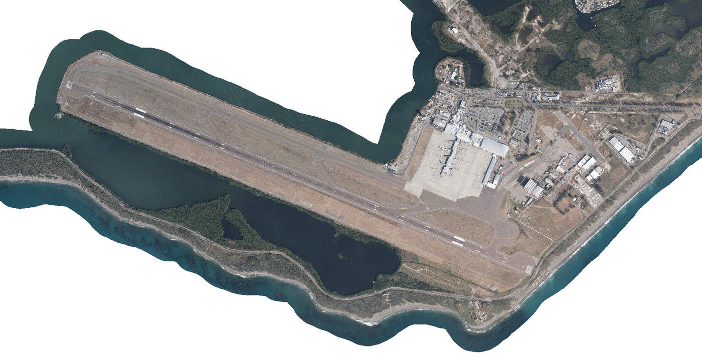
Orthoimage of the NMIA/KIN area at image pixel resolution of 7.5 cm/3 inches.
Walker used his knowledge of flying to the Bahamas to prepare for the project. He filed much of the preliminary paperwork and arranged for the rental of lifeboats and personal floatation devices at the airport of exit, Fort Lauderdale-Hollywood International Airport (FLL). His research informed Kucera’s decision to hire an international handler, based in Canada, to provide fueling services, preparation of customs paperwork, approval of crew lists, and coordination of in-bound and out-bound flyovers, including permits to enter Cuban airspace.
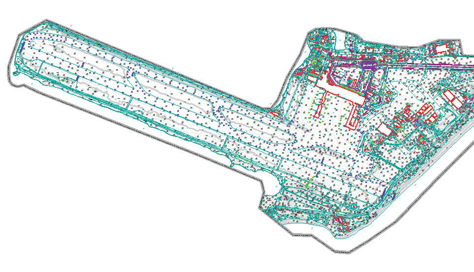
Planimetry and topography of the NMIA/KIN area.
Immediately before scheduled departure to Jamaica, the twin-engine Piper Navajo Chieftain aircraft used for the project was flown to Kucera’s hangar facility in Willoughby, Ohio for a major inspection. Every effort was made to minimize in-country maintenance needs as local repair stations in Jamaica were unavailable. In the case of an issue, Kucera’s senior aircraft mechanic would have flown to Jamaica to conduct the repairs himself using the common spare parts included in the initial cargo. Extensive documentation of these extra parts, as well as the sensors and peripheral equipment, including drives, download stations, and computers, was gathered to present to customs. Any items with no immediately clear purpose (drives external to the sensors, for example) had the potential to be flagged in international customs.
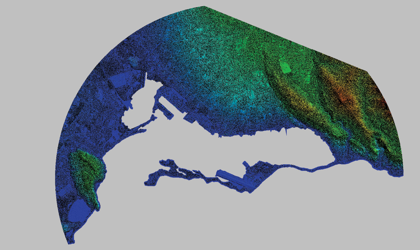
Project-wide DSM derived from the lidar data.
The initial plan for the project was for the aircraft to be based out of NMIA/KIN, with the flight crew staying in Kingston. Due to on-site ground surveying and other work being performed directly at NMIA/KIN, however, along with increased air traffic congestion, AAJ requested Kucera to base from Ian Fleming International Airport (OCJ) at the north end of the island. This had the advantage of hotels in closer proximity to the airport base (OCJ being located in a popular tourist area), but ultimately created a tighter constraint on the aerial capture window due to the increased flying time need to reach NMIA/KIN (approximately 20 minutes) combined with restrictions on flying during non-daylight hours. It became almost impossible to perform the lidar capture at night as was planned. Kucera’s crew was able to adjust and to work within the reduced capture window, nevertheless, by making sure to be “wheels-up” at daybreak on each flight day.
On-site work
Walker and Pocs travelled from Willoughby, Ohio to Fort Lauderdale, Florida, from which they exited the country. The flight to Jamaica included Cuban airspace, which required a permit, as well as stretches of open ocean without radio contact. “There were periods when we were not being watched, tracked, or communicated with,” said Walker. Loss of contact with local air traffic control was an atypical experience for the crew, as they usually fly over contiguous land with constant contact. Kucera Flight Operations also had an unusual experience during the water crossing when the flight’s satellite tracking path was interrupted with data gaps. Still, the crew arrived safely in Jamaica after a four-hour flight.
Upon arrival, Jamaican customs inspected the extra gear and aircraft parts thoroughly. Walker and Pocs picked up their rental car that night and planned the rest of the week.
For each day, the flight crew had to submit a flight plan to the air traffic controllers. Typically, Kucera flies its surveying work under spontaneous visual flight rules (VFR). VFR is conducive to aerial surveying as it allows the pilot to maneuver freely in the sky, given clear conditions and a position outside restricted airspace. Instead, Jamaican air traffic control requested daily flight plans with specific, orderly routing from point A to point B for every flight, similar to instrument flight rules (IFR) flight plans.
The expectation of destination-focused flight plans, as is typical with IFR, caused difficulties for the flight crew to relay flight manifests to Jamaican air traffic control, especially in the first days of flying. The flight plans submitted by Kucera, to take off, fly in repetitious lines over and around Kingston, and then return to the point of origin at an unspecified time, were novel. Walker and the OCJ airport manager filled out the forms together, by hand, and submitted them by fax. Multiple flight plans were submitted and rejected, then submitted and rejected again. The flight plans that were ultimately accepted required the crew to navigate across the island through a series of predetermined waypoints and bore most of the characteristics of an IFR flight plan. Once the aircraft was in the air, however, the controllers were informed and understanding of the atypical flight plans.
While in the air, Pocs flagged lines of imagery affected by clouds in-real-time to perform same-day re-flights where possible. After each day’s flying, the hard drives of lidar data and imagery were collected from the flight crew in northern Jamaica and driven back to Kingston for shipment to Kucera headquarters. Amazingly, the data arrived in Willoughby for quality control (QC) within 24 hours each day.
Window of acquisition
Jamaica has only a six- to eight-week window of clear weather conditions that are suitable for aerial survey because of persistent, heavy clouds. Due to concerns about the availability of clear weather, the original plan was to capture the imagery and a portion of the lidar during the day and to return at night, after the clouds dissipated, to complete lidar collection. Instead, lidar acquisition was captured in concert with the imagery because of OCJ’s limited hours of operation. Despite being handicapped by lighting restrictions, Kucera’s well-planned approach using advanced sensor technology and some luck with the weather allowed for timely data acquisition.
The mountains surrounding Kingston create a microclimate, resulting in fewer clouds obstructing the city and airport area compared to the rest of the island. The clouds gather in the mountains and roll toward the coast throughout the day, so acquisition on and near the mountainous northeastern portion of the AOI was given first priority each morning. Even so, only one or two lines could be acquired at higher elevations before clouds began to appear. An average of two to four hours of on-line flying (along the plotted flight lines) was possible each day.
The aircraft used for the project, a Piper Navajo Chieftain, has a large cabin and dual fuselage holes, which can accommodate two sensors for simultaneous capture. Kucera’s Chieftain was outfitted with a Leica ALS80 lidar sensor and a Vexcel UltraCam Eagle camera for the project. While simultaneous capture of lidar and imagery was possible and is regular practice, two separate flight plans were used and the crew collected on only one plan at a time, using the corresponding sensor.
The flexibility of being able to switch between sensors allowed Pocs to take advantage of changing conditions. Imagery, flown at a greater altitude and with collection specifications more affected by cloud cover, was given priority over lidar. When cloud cover increased, Pocs switched sensors, Walker decreased aircraft altitude, and lidar acquisition began. The prioritization of data capture and the ability to switch from imagery to lidar quickly with the appearance of more clouds maximized efficiency and increased cost-effectiveness.
Product outcome
The data products Kucera created from the acquisition with the Leica ALS80 and Vexcel UltraCam Eagle sensor systems were georeferenced orthoimagery, lidar surface representations of Area 2C, and a topographic base map of the immediate airport property. The 43-square-mile Area 2C encompassed a wide range of environments, including coastal mountains with terrain variations of over 800 meters, dense vegetation, and complex urban development. A lidar capture resolution of 10 ppsm was determined as optimal for project work in terms of allowing the flyover to be completed within the short time frame needed while providing sufficient data density for the OLS and topographic survey work in the varied project terrain. A narrow field of view (<20°) was chosen to better penetrate the vegetation and the flight altitude was limited to keep under the daily occurring clouds as much as possible.
Since the Leica ALS80 captures lidar data at near vertical or nadir, the lidar was captured and processed with high (~50%) overlap, to make sure that all obstructions were captured in the data, including small and vertical features. Optimizing the laser footprint and flying the sensor with double coverage and high density ensured that all the features of interest that the client tasked to be located by the lidar as potential obstructions were identified in the lidar data. The result was confirmed, as the data was paired with “ground truthing,” and orthoimagery comparison for feature verification.
The lidar data was carefully processed and checked to separate ground and non-ground features/surfaces, with particular attention to obstruction features. The fully classified lidar dataset was further processed and furnished to CEAC as a GeoTIFF raster along with a digital surface model (DSM) and point-cloud lidar products.
After receiving the data, CEAC sent a team of local surveyors to verify the obstructions indicated in Kucera’s data and to identify any missed features. “This blended approach [between aerial and ground surveying] worked well,” said Marc Henry of CEAC. “The lidar did capture what it should—poles and antennae—and it was shown in the DSM as well as in the point clouds.” In some areas of limited ground access, Kucera’s lidar data alone was used for the obstruction identification.
By means of the finalized lidar, AAJ’s existing database of obstacles was verified and updated to create the Area 2C OLS. For the Airport Property, Kucera merged the lidar bare-earth return with stereo-compiled break lines to create a design-grade digital terrain model (DTM) and 0.3 m contour topography. The lidar data is also being used for planning purposes by the local development regulatory agency to create building height codes in Kingston and for drainage mapping and flooding analysis.
Another international success
The success of the NMIA/KIN project has encouraged CEAC and Kucera to jointly pursue other engineering projects with lidar support services in the Caribbean region and build Kucera’s résumé of international aerial acquisition experience. “With our staff’s can-do attitude and knowledge of international aerial flight requirements, open-water flying, and island/country hopping, there are many more places outside of the US we can reach for aerial survey work,” commented John Antalovich, Jr., Kucera’s President.
Barbora Ubar is Kucera South-Tampa office manager. She joined Kucera in 2010 after serving as photogrammetrist for Hillsborough County, Florida. As a project manager, she oversees numerous aerial mapping projects. Barbora holds an M.Sc. in civil engineering—geodesy and cartography from Slovak Technical University and has been an ASPRS Certified Photogrammetrist since January 2017.