 1 April 2021 – KlauPPK has been the go-to product for survey accuracy on drones since 2015. Now, as the industry starts to move away from the DJI monopoly to a more open architecture, the KlauPPK hardware and software solutions are an even more powerful component to bringing best-of-breed technologies together.
The UAV sector has fallen into this love/hate relationship with DJI. Yes, we love the technology, the features, how they are shiny and powerful out of the box. This is shown by their 80% market capture, an almost-monopoly that seemed destined to consume the world. Like Apple, who closed their system, using only their own hardware, software and services, DJI have guided a passionate following to come into their world where they have everything you need; the drone, the sensors, the data platform for analytics. Why go anywhere else?
Not everyone is looking for this contained prescribed product. US Agencies have banned the use of Chinese drones in the current trade war. Corporates don’t typically like having their data sent back to the drone manufacture, regardless of if they chose to use their analytics platform or not. Professionals, such as surveyors, require hands on control of their data and processes, not necessarily committing their professional licence and reputation to a black box solution.
We are seeing a more democratised open architecture model emerge that allows the best of breed to come together to produce extremely high spec-technology customised for specific requirements. ArduPilot has been working in this space since 2007, with software to control drones before we even knew words like drone, UAV, UAS and RPAS. Hardware such as the open source Pixhawk PX4 are the basis of many non-DJI drones. With the Mavlink standard, external hardware devices can be integrated, such as a wide variety of quality cameras and sensors.
The opportunity has never been greater for ‘open’ systems to shine.
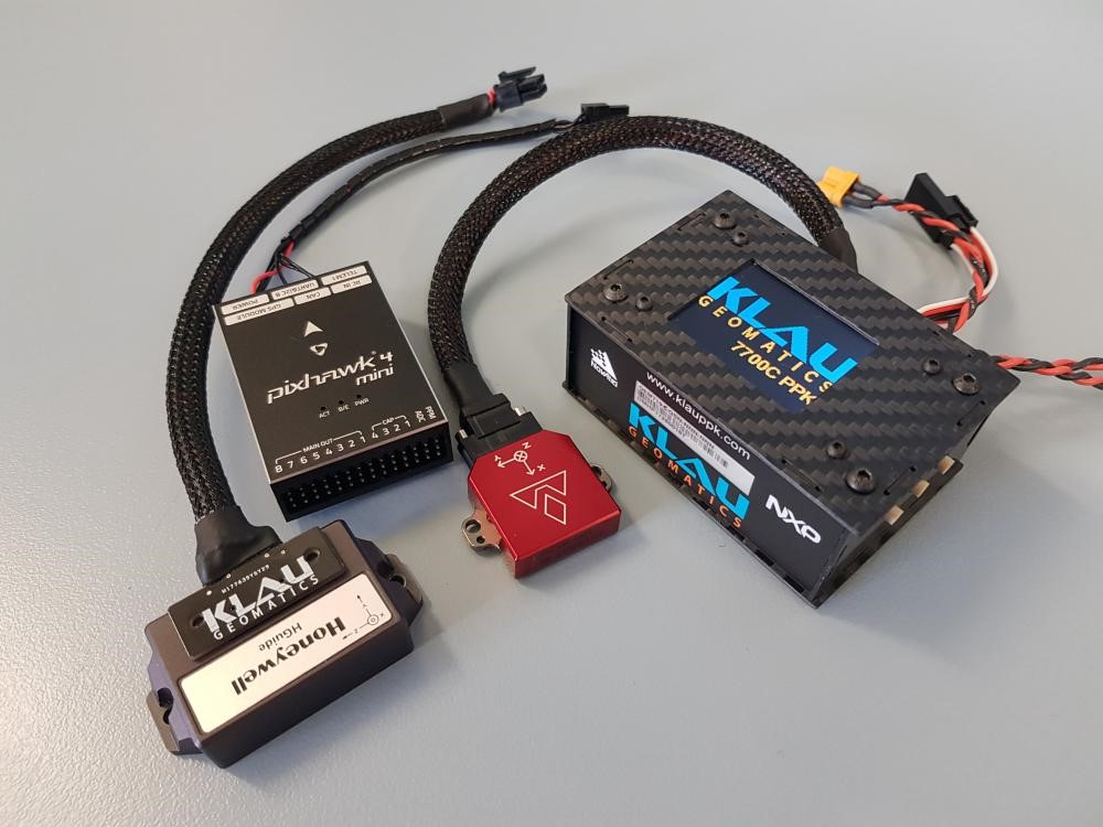
For survey grade accuracy on UAVs and manned aircraft, Klau Geomatics is established as the quality product, high spec hardware and sophisticated software designed and built by surveying professionals and academics.
About KlauPPK
Klau Geomatics PPK hardware and post-processing software has been in development for over 6 years and is regarded as the most sophisticated, accurate and reliable solution in the industry. The modular hardware is drone and camera agnostic and can be moved between platforms, enabling the greatest cost effectiveness for fleets of various aircraft. Compatible with manned aircraft, drones from DJI, Yuneec, Intel and other custom drones, handheld and terrestrial camera systems. KlauPPK Software is the most sophisticated PPK processing software on the market. See full details of the KlauPPK Positioning system at www.KlauPPK.com
