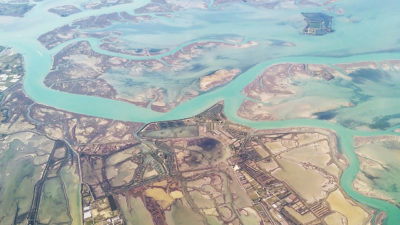
 Portland, Ore., March 17, 2021 – Extensis®, a leading provider of digital asset management solutions, today announced its GeoViewer Pro for Desktop application will now be offered at no charge. GeoViewer Pro is a standalone GIS image viewer for compressed MrSID files, raster imagery, LiDAR point clouds, and vector layers.
“GeoViewer Pro enables anyone – whether a GIS professional or map consumer – to view and interact with geospatial data sets without a full GIS software package,” said Terry Ryan, Federal Government Sales Manager at Extensis.
GeoViewer Pro was developed by LizardTech, now Extensis, as a paid multi-feature upgrade to the free GeoViewer application. It allows end users to view satellite, aerial and drone image files, as well as LiDAR data and GIS vectors. Moreover, it is a free way to view MrSID, JPEG 2000, NITF, LAS, and LAZ files created with the popular GeoExpress software.
“The GeoViewer application has been embraced by thousands of users worldwide, especially by GIS managers who want to fully leverage the value of their geospatial information by providing a no-cost way for users and the general public to view and interact with their image and LiDAR files,” said Ryan.
In addition to supporting a variety of raster image formats, GIS shapefiles, and even KML files, the core functionality of GeoViewer includes customizable display settings, support for OGC map services, exporting files, and displaying maps in their native projections. Users can make and save measurements and annotate geospatial files create new images or maps from the larger data sets for exporting and sharing with another user.
GeoViewer Pro offers advanced capabilities for greater precision and enhanced analysis:
- Change map projections to additional supported projections
- Print images or portions of images that you specify
- Display area of shapes that you draw on the map
- Create image tiles when you export images
- Search for a location using address information
Current GeoViewer users will be able to upgrade to the now-free Pro version without a new download. First-time GeoViewer Pro users are invited to download the upgraded application to their desktop computers at extensis.com/geoviewer-pro.
Owned by the same parent company, Extensis and LizardTech united under the Extensis brand in September 2018, combining the industry-leading geospatial image management and compression expertise of LizardTech with the Digital Asset Management (DAM) capabilities of Extensis. These data management solutions enable clients to easily organize, access and share geospatial datasets along with associated documents.
About Extensis (www.extensis.com)
Extensis broke ground in 1993 in Portland, Ore., with the express goal of removing the barriers that impede creativity. Since it began its mission in earnest 27 years ago, Extensis has worked with hundreds of thousands of creative professionals and organizations around the globe to accelerate their workflows through powerful digital asset and font management solutions. In reflecting on its work with customers, Extensis has arrived at one simple truth: When you remove the appropriate barriers, people are freed to invent amazing. To learn more about the company, visit our website or follow Extensis on Twitter @extensis
