This data and imagery will be used to update nautical charting and benthic mapping in support of several NOAA mission areas and 2022 NOAA Ship Rainier operations in the same area.
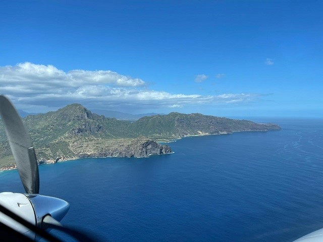 Kaua’i, Hawaii (Feb. 12, 2021) — Woolpert has been awarded a task order under the National Oceanic and Atmospheric Administration’s Shoreline Mapping Services Contract to provide topographic and bathymetric lidar data and imagery for islands in the Northwest Hawaiian Islands chain, mostly within the Papahānaumokuākea Marine National Monument. This contract is administered by NOAA’s National Geodetic Survey Remote Sensing Division and will support several mission areas within NOAA.
Under this task order, Woolpert will deploy its King Air 300 Turboprop aircraft with Leica Chiroptera 4X and Leica HawkEye 4X lidar sensors out of Kaua’i to collect Quality Level 1 topographic and QL2b bathymetric lidar data. The project will cover 1,687 square miles on and around Necker Island, Nihoa Island and the French Frigate Shoals.
Woolpert will process and deliver the lidar and imagery data, along with normalized reflectance imagery, for use in nautical charting and benthic mapping. The data will be used in support of operations by NOAA Ship Rainier, a hydrographic survey vessel, updating the nation’s nautical charts in the Pacific Ocean and supporting numerous other programs within NOAA, including the Office of National Marine Sanctuaries, Coral Reef Program and NOAA Fisheries.
“This data will enhance the safety and efficiency of the NOAA Ship Rainier operations planned for 2022 by reducing or eliminating the need for them to survey inshore of 50 meters, which is the depth we expect to achieve with this technology,” Woolpert Geospatial Project Manager Megan Blaskovich said. “Because the area is so remote and uninhabited, it comes with unique acquisition challenges like not being able to be based in the project AOI (area of interest).”
The topo-bathy lidar will be provided in a classified point cloud format and delivered as a seamless digital elevation model, including all necessary metadata. The imagery will be fully processed through an orthomosaic, using direct georeferencing.
The lidar and imagery collected under this NOAA NGS task order complements the topographic lidar Woolpert is currently collecting in Hawaii for the U.S. Geological Survey and for NOAA’s Office for Coastal Management. The Natural Resources Conservation Service, the Federal Emergency Management Agency and the State of Hawaii, Office of Planning, all contributed to the topographic lidar project.
Woolpert Vice President and Maritime Market Director John Gerhard said these agencies collaborate on the collection and utilization of lidar data and imagery, which benefit multiple end users.
“This is an outstanding example of how these federal agencies are working together to ensure vital mapping data are procured and available for multiple applications—while saving time and money,” Gerhard said. “We’re honored to support these agencies and this team however and whenever we can.”
This acquisition is scheduled to start this spring, with data and imagery set to be delivered in late 2021 or early 2022.
About Woolpert
Woolpert is committed to a vision to become the premier architecture, engineering, geospatial (AEG) and strategic consulting firm, and one of the best companies in the world. It’s a vision we’ve been fine-tuning for decades. It guides our decisions and investments, provides our clients with optimal solutions and offers our employees unrivaled opportunities. Woolpert is recognized as a Great Place to Work by its employees and is America’s fastest-growing AEG firm. With more than a century of experience, over 1,100 employees and 42 offices, Woolpert supports public, private, federal, and U.S. military clients nationally and around the globe. For more information, visit woolpert.com and connect with us on LinkedIn, Twitter, Facebook and Instagram.
