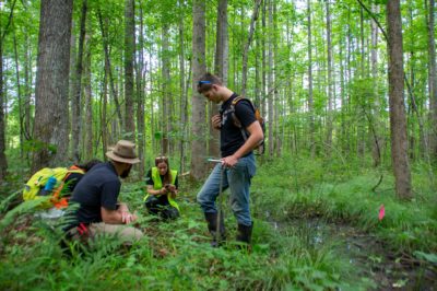
Trimble GNSS Integrates with Ecobot’s Natural Resources Platform to Enable Fast Sub-Meter Accurate Wetland Delineation

Built using industry standards around the existing wetland delineation workflow, the Ecobot app works without an internet data connection, includes reference guides and automatically performs calculations and quality assurance/quality control. Ecobot, which integrates with Esri® ArcGIS® mapping software, enables organizations to speed regulatory reporting, save money, keep projects on time, protect natural resources and enable responsible economic progress.
“By combining Ecobot’s workflow with Trimble’s high-accuracy GNSS positioning capabilities, we’ve created a solution environmental scientists can use to more quickly and efficiently support their work in the field,” said Stephanie Michaud, strategic marketing manager, Trimble Surveying & Mapping Field Solutions. “The combination enables users to collect data and support field work on projects both large and small.”
“Complexities introduced as a result of changes in the National Environmental Policy Act and the COVID-19 pandemic’s impact on the way the architecture, engineering and construction and environmental industries work make the need to digitize workflows more important than ever,” said Jeremy Schewe, professional wetland scientist, cofounder and chief scientific officer of Ecobot. “We’re excited to partner with Trimble as part of our broader push to facilitate the connections needed to reduce the time and costs of regulatory wetland reporting and monitoring, while improving scientific accuracy.”
Availability
Trimble R Series GNSS receivers are available through Trimble Geospatial Distribution Partners. For more information, visit: geospatial.trimble.com/products-and-solutions/gnss-systems. The Ecobot wetland delineation application is available through Ecobot and Trimble Geospatial Distribution Partners. For more information, visit: ecobotapp.com.
About Ecobot
Ecobot empowers the architecture, engineering and construction (AEC) and environmental consulting industry to better serve their clients by reducing the time and expenses required to complete environmental regulatory reporting. The field scientists in these industries make critical decisions that inform land use and Ecobot’s wetland management platform provides accuracy and efficiency for thousands of wetland delineation reports submitted to the USACE each month. Learn more at: ecobotapp.com.
About Trimble Geospatial
Trimble Geospatial provides solutions that facilitate high-quality, productive workflows and information exchange, driving value for a global and diverse customer base of surveyors, engineering and GIS service companies, governments, utilities and transportation authorities. Trimble’s innovative technologies include integrated sensors, field applications, real-time communications and office software for processing, modeling and data analytics. Using Trimble solutions, organizations can capture the most accurate spatial data and transform it into intelligence to deliver increased productivity and improved decision-making. Whether enabling more efficient use of natural resources or enhancing the performance and lifecycle of civil infrastructure, timely and reliable geospatial information is at the core of Trimble’s solutions to transform the way work is done. For more information, visit: geospatial.trimble.com.
About Trimble
Trimble is transforming the way the world works by delivering products and services that connect the physical and digital worlds. Core technologies in positioning, modeling, connectivity and data analytics enable customers to improve productivity, quality, safety and sustainability. From purpose built products to enterprise lifecycle solutions, Trimble software, hardware and services are transforming industries such as agriculture, construction, geospatial and transportation. For more information about Trimble (NASDAQ:TRMB), visit: www.trimble.com.