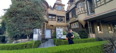
The team at geospatial 3D mapping specialist GeoSLAM has produced a digital twin of one of the world’s most haunted mansions, The Winchester Mystery House, using the newly-launched ZEB Go.
It may be hard to believe the feat of scanning this vast architectural landmark, built in 1886. The site, located in the City of San José, spans 4.5 acres and the four-story mansion covers 24,000 square feet, featuring some 160 rooms, as well as 40 staircases, basements and a myriad of passages, corridors and alcoves.
An exterior scan, containing 172.3 million points and 820 high resolution images, was captured in just 20 minutes using the ZEB Discovery, and the 160 interior rooms were scanned in under 3 hours with the ZEB Go. The result? A comprehensive digital model, including detailed 2D and 3D floorplans of the enormous mansion, produced significantly quicker than traditional survey equipment.
Brian said: “The Winchester Mystery House is one of the most complex buildings I have ever had the privilege to survey. However, with our mobile scanners it took only a few hours, when it would have taken weeks using terrestrial survey tools. Everything is so quick and easy with the ZEB Go.”
For more information on GeoSLAM, visit www.geoslam.com.
