 Leicestershire, UK, 12 October 2020 – Bluesky International is partnering with the UK’s University of Leicester to co-fund an advanced postgraduate degree study into the use of LiDAR, machine learning and artificial intelligence to create citywide maps of trees enriched with new levels of information.
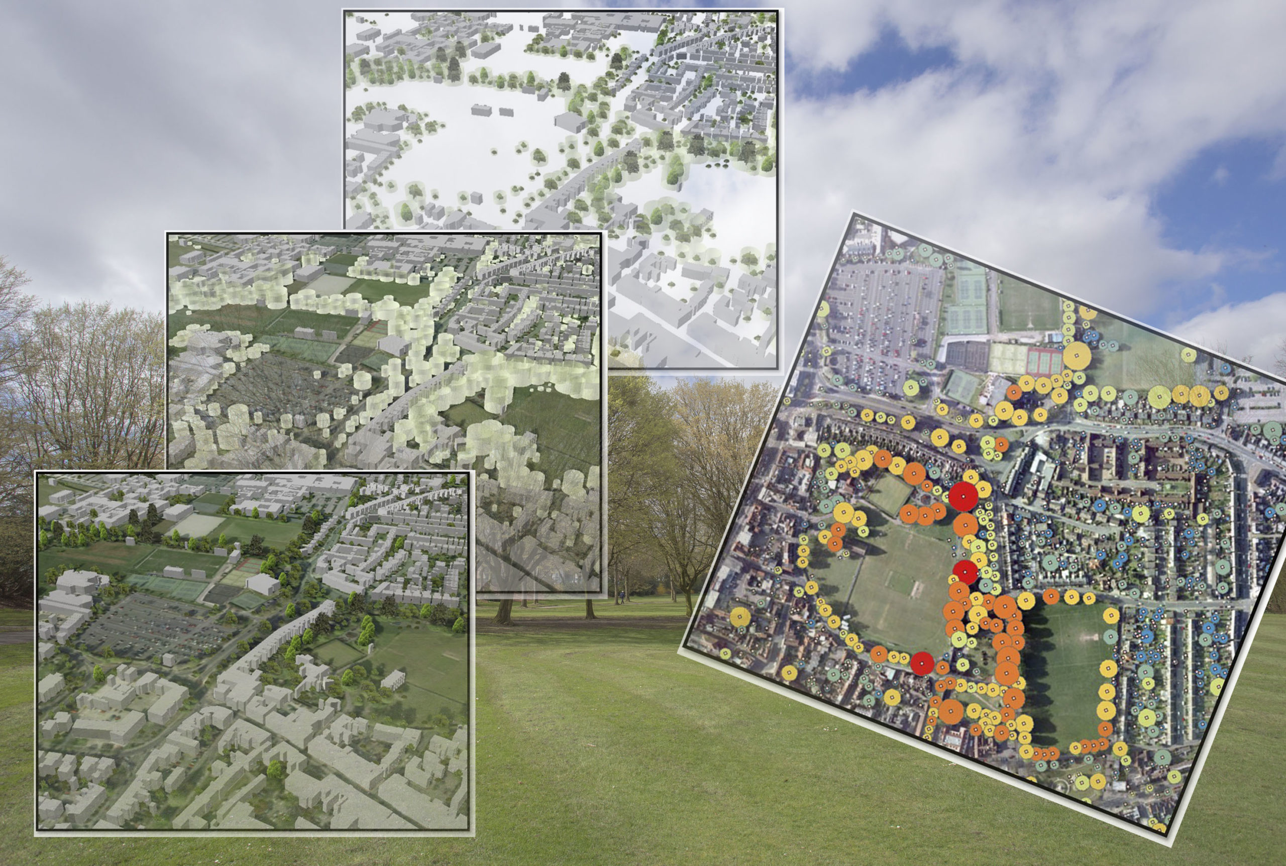
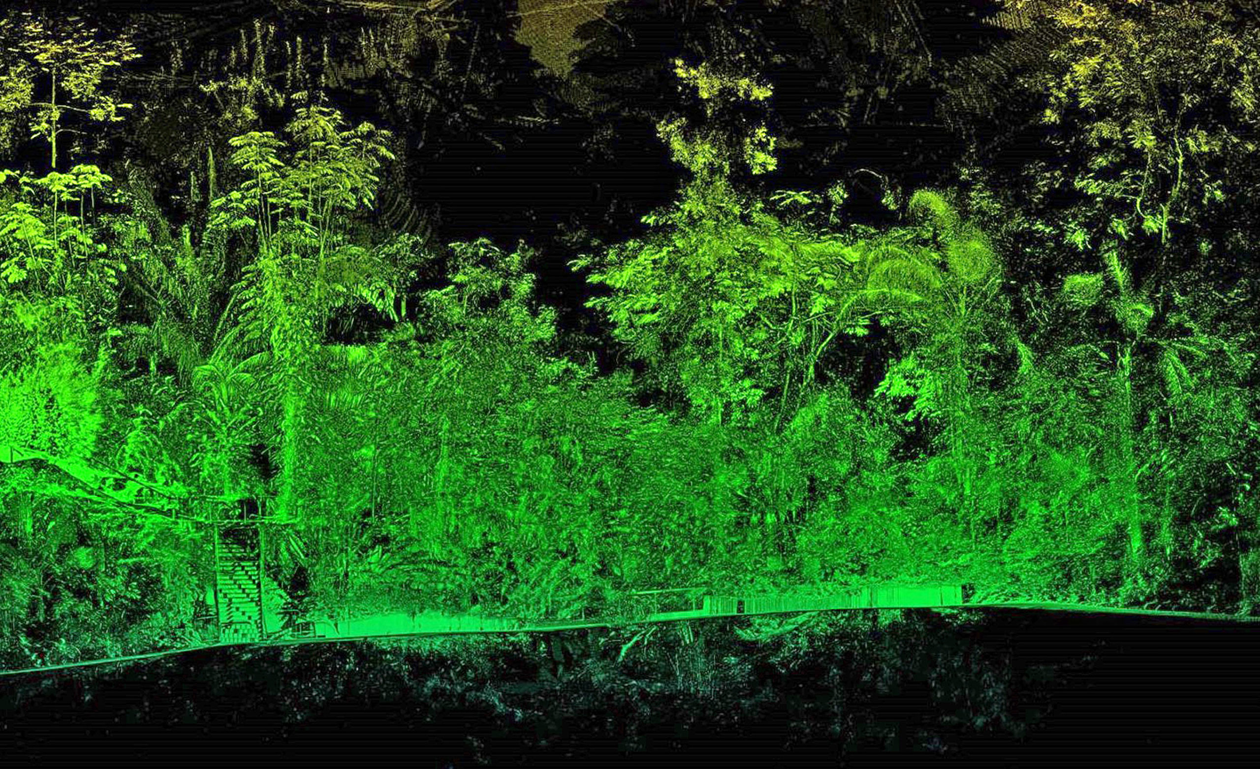
A specialist in aerial mapping, Bluesky use aircraft mounted lasers (LiDAR) to capture millions of highly accurate measurements called point clouds that detail the earth’s surface and features. Bluesky has already pioneered nationwide maps detailing the location, height and canopy cover of trees and this R&D project is expected to result in an automated workflow for the extraction of tree structural features and the classification of tree species.
“We have recently upgraded the sensor used to capture LiDAR point clouds so we have more detailed and accurate measurements than ever before. We are therefore exploring how artificial intelligence and machine learning can be applied to extract additional intelligence from this data in the most efficient, accurate and cost effective way,” commented James Eddy, Technical Director at Leicestershire based Bluesky.
 “By partnering with the University of Leicester we hope to exploit its expertise across natural science and data science to develop automated algorithms for processing this data to identify specific tree structures and classify species to augment our National Tree Map datasets.”
“The characterisation of tree structural features is important for ecological, climate change with respect to changes in above-ground biomass and environmental studies,” added Prof. Kevin Tansey, University of Leicester School of Geography, Geology and the Environment. “We therefore have an interest in using advanced observational technologies to understand how we can extract meaningful information about the properties of trees.”
Prof. Ivan Tyukin, University of Leicester School of Mathematics and Actuarial Science commented, “Artificial Intelligence approaches are proving versatile enough to be used in a wider variety of application domains. By partnering with Bluesky to offer this opportunity we can ensure the study benefits from the most accurate and up to date source material available and the experience and expertise used to create the National Tree Map.”
The Bluesky proposed study, titled ‘High density point cloud processing for tree structural features extraction and species classification’, will result in a Master of Philosophy (MPhil) qualification. Offered by Leicester Innovation Hub, part-funded by the European Regional Development Fund, and delivered by the School of Mathematics and Actuarial Science and the School of Geography, Geology and the Environment at the University of Leicester, it is hoped the outputs of the project will include an annotated software code for tree identification, feature extraction and species classification, and a synthetic technical documentation on its algorithmic.
Prof. Ian Gillespie, University of Leicester Pro-Vice-Chancellor, Research and Enterprise, concluded, “The Leicester Innovation Hub is working with SMEs and the academic departments to facilitate the translation of cutting-edge research results into products and services, foster innovation and enable economic growth. Bluesky is an excellent partner, and we are proud to add another layer of collaboration.”
Bluesky International is the leading aerial survey and geographic data company in the UK producing and maintaining seamless digital aerial photography and height data on a national scale in both Great Britain and the Republic of Ireland. Bluesky also undertakes bespoke surveys, including LiDAR, for a range of public and private sector clients. Bluesky International operates a range of aircraft and sensors including three Ultracam Eagle Mark 3s, a CityMapper which allows the simultaneous collection of vertical and oblique imagery as well as LiDAR data, and a Galaxy LiDAR which is mounted with a thermal sensor and survey grade camera. These systems put Bluesky International in the enviable position of being able to provide customers with unique and cost-effective geospatial solutions. As well as being an established and respected aerial survey company Bluesky International is also highly innovative and continually strives to develop new products and services by embracing new technology and methods. This has resulted in the development of some unique products such as the National Tree Map (NTM). These datasets underpin long term contracts with local and central governments and many major blue-chip companies from a range of market sectors including financial services, utilities, telecoms, web portals, construction and environment. Bluesky International has offices in the UK, US, Republic of Ireland and a dedicated production centre in India. https://www.bluesky-world.com/
The University of Leicester is led by discovery and innovation – an international centre for excellence renowned for research, teaching and broadening access to higher education. It is among the top 25 universities in the Times Higher Education REF Research Power rankings with 75% of research adjudged to be internationally excellent with wide-ranging impacts on society, health, culture, and the environment. The University is home to just over 20,000 students and approximately 3,000 staff. https://le.ac.uk/about
