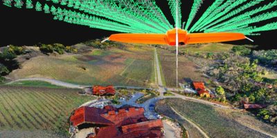
Wingtra’s recent WingtraHub 1.0 release has launched to fully support a lean workflow between the WingtraOne drone and Pix4Dmatic, a fresh Pix4D product for reliable speedy processing of large datasets. This integration is especially key since Wingtra’s VTOL drone is designed to map large sites fast and safely while providing the best possible data quality. The high-quality datasets that result can now be processed into point clouds and orthomosaics at twice the speed on average with Pix4Dmatic.

“With the new WingtraHub release, you can now output geotagged images, which include all required information in the image metadata (EXIF & XMP tags) like image locations, orientations, accuracies, coordinate system and vertical reference. This improves compatibility with all major photogrammetry engines and is especially well integrated with Pix4Dmatic, which now enables up to two times faster large dataset processing,” explained Julian Surber, Product Manager at Wingtra.
As Surber mentioned, the ability to use the EXIF and XMP tags supports the use of other photogrammetry engines. Specifically, WingtraHub 1.0 better integrates with DroneDeploy and Trimble Business Center by improving processing of post process kinematics (PPK) data on each of the platforms.
“Compatibility with all major photogrammetry tools ensures that you can embed WingtraOne data into your workflow no matter which software you are using,” said Surber. “Previously it might have taken specific expertise to work around, but from now on, the process is lean and fast. With the image orientation, the accuracy, and other specifics being included in the image metadata, you only have to drag and drop your images into the photogrammetry tool of your choice.”
WingtraHub 1.0 is a release comprising a number of improvements to Wingtra’s data processing workflow and is available for users as of September 4, 2020. Learn more about Wingtra here.