Geo-data acquired by Fugro’s new uncrewed surface vessel, the Fugro Autonomous Surveyor (FAS-900), will be used to safely and more efficiently update Australia’s nautical charts.
Adelaide, Australia, 17 August 2020 – Fugro has been selected to chart the waters of South Australia’s Gulf St Vincent and Investigator Strait as part of the Australian Government’s HydroScheme Industry Partnership Program (HIPP). The 998 km2 survey will be conducted on behalf of the Australian Hydrographic Office (AHO), who will use the data to update nautical charts for safer navigation. Data will also be shared with scientific agencies, including Geoscience Australia and the national AusSeabed community.
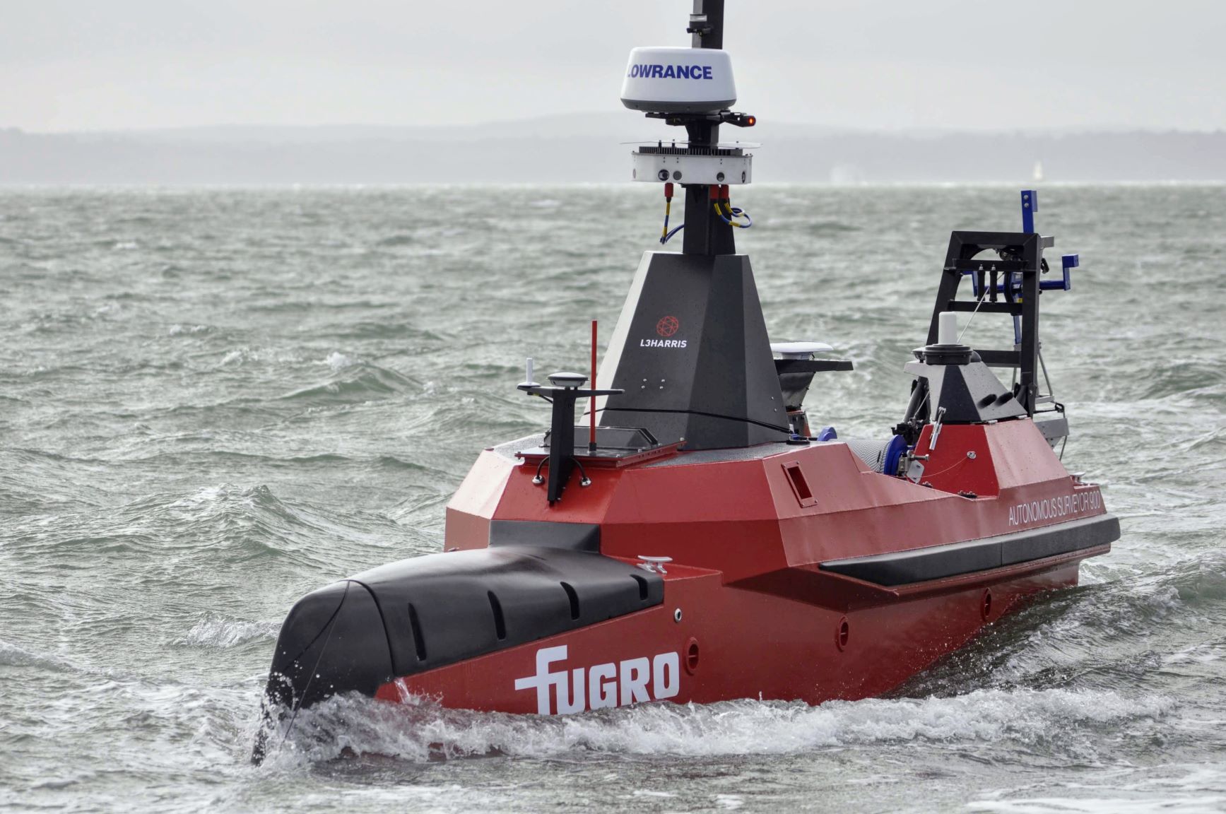
This area within Gulf St Vincent and Investigator Strait is the major waterway for the approach to Port Adelaide and features adjacent marine parks and habitat protection zones of national significance. Fugro will deploy a new uncrewed surface vessel (USV), Fugro’s Autonomous Surveyor-900 (FAS-900), to expedite data collection, the first time this technology has been deployed in Australia for the AHO and a demonstration of the innovations being developed to improve the safety and efficiency of data collection in the marine estate. Fugro will also utilise other technologies developed in Australia, including remote operations centres (ROCs) and Back2Base™ data transfers, to achieve significant environmental, safety and efficiency gains.
“Fugro is proud to be supporting the AHO as part of the HIPP,” said Mark Sinclair, Director of Hydrography for Fugro in Asia-Pacific. “Long-term strategic partnerships help support innovation, such as our USV for faster data acquisition, and contribute to developing an enduring national hydrographic industry.”
The nautical charts of Gulf St Vincent and Investigator Strait that support marine traffic, fishing, tourism, recreational boating and environmental management currently consist of historical data of varying reliability, some going as far back as Matthew Flinders and Nicolas Baudin in the early 1800s. As part of the hydrographic survey, Fugro will also deploy a number of tide gauges and current meters to improve understanding of the gulf’s oceanography and support the development of an accurate tide model for future vessel traffic and to resolve known tide datum anomalies in this complex region.
About Fugro
Fugro is the world’s leading Geo-data specialist, collecting and analysing comprehensive information about the Earth and the structures built upon it. Adopting an integrated approach that incorporates acquisition and analysis of Geo-data and related advice, Fugro provides solutions. With expertise in site characterisation and asset integrity, clients are supported in the safe, sustainable and efficient design, construction and operation of their assets throughout the full lifecycle. Employing approximately 9,500 talented people in 61 countries, Fugro serves clients around the globe, predominantly in the energy and infrastructure industries, both offshore and onshore. In 2019, revenue amounted to EUR 1.6 billion. The company is listed on Euronext Amsterdam.
