 June 17, 2020 – Huntsville, AL – GeoCue Group announces the release of their new True View® 615 and True View 620 UAS LIDAR/Imagery 3D imaging systems (3DIS). GeoCue’s True View 615 & 620 are equipped with RIEGL’s miniVUX-2UAV laser scanner integrated with dual photogrammetric cameras. Position and Orientation is provided by an Applanix APX-15 (True View 615) or extreme accuracy APX-20 (True View 620). All True View 3D Imaging Systems are bundled with Applanix POSPac, True View EVO post-processing software and True View Reckon data management solution.
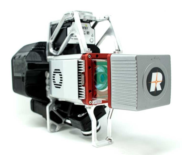
The True View 615/620 systems are compact, survey grade 3D Imaging Sensors designed for small Unmanned Aerial Systems. The RIEGL laser scanner and dual photogrammetric cameras have been carefully configured to provide a fused LIDAR/imagery field of view of up to 120°. The system includes full post-processing software that generates a stunning ray-traced 3D colorized point cloud and geocoded images. An upgrade path will be available to promote a True View 615 to a True View 620 by adding the Applanix APX-20 external inertial measurement unit.
The True View product line gives mappers and surveyors the ability to deliver high quality analytic data with exacting accuracies. These deliverables are generated using workflows and tools within GeoCue’s post-processing software, True View EVO. Examples of derived products include bare earth models, profiles, cross sections, topographic contours, volumetric analysis and more.
GeoCue’s President, Lewis Graham, stated, “Our Quanergy®-based True View 410 has rapidly become the standard for general purpose drone 3D Imaging, where moderate vegetation penetration and accuracies of 5 cm RMSE are adequate. The True View 615/620 provides a solution for situations where deeper vegetation penetration, wire extraction and extreme accuracy are required. These are great new additions to the True View product line.”
GeoCue is excited to expand their True View product line of 3D imaging systems. The True View 615/620 will be available for shipment late June 2020.
About GeoCue
GeoCue is the largest supplier of kinematic LIDAR processing tools in North America and LP360 is one of the world’s most widely used tool for exploiting point cloud data. In 2014, GeoCue Group started a division focused on using small Unmanned Aerial Systems for high accuracy mapping. Leveraging our expertise in production, risk reduction, and point cloud processing tools, we are continuing to bring new services and products to market to provide surveyors and other geomatics professionals exciting tools for geospatial data extraction using low cost drones including Loki, our plug-and-play PPK direct positioning system, and now our new True View® drone camera systems product line. To learn more, visit www.geocue.com.
