 Montreal, Canada, April 28th, 2020 – SimActive Inc., a world-leading developer of photogrammetry software, announces that its Correlator3D™ product is used to map the UNESCO World Heritage Site of Halin in Myanmar. The archaeological project involved the deployment of drones to gather data necessary to prepare orthophoto maps and digital elevation models.
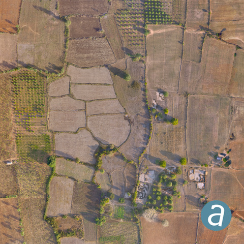
The goal is to find new features as well as to assess the state of the known ones. These include monumental walls, dams and digging canals many of which are still visible in the landscape. The resulting geospatial data also allow to check if modern constructions or farming are not causing any damage.
“Our collaboration with SimActive is allowing us to produce highly accurate maps of an historic site that is more than 2,000 years old” said Kasper Hanus, research fellow at The Institute of Mediterranean and Oriental Cultures of the Polish Academy of Sciences. “The datasets help us understand the past civilizations and safeguard the common heritage of mankind.”
About SimActive
SimActive is the developer of Correlator3D™ software, a patented end-to-end photogrammetry solution for the generation of high-quality geospatial data from satellite and aerial imagery, including UAVs. Correlator3D™ performs aerial triangulation (AT) and produces dense digital surface models (DSM), digital terrain models (DTM), point clouds, orthomosaics, 3D models and vectorized 3D features. Powered by GPU technology and multi-core CPUs, Correlator3D™ ensures matchless processing speed to support rapid production of large datasets. SimActive has been selling Correlator3D™ to leading mapping firms and government organizations around the world, offering cutting-edge photogrammetry software backed by exceptional customer support. For more information, visit www.simactive.com.
