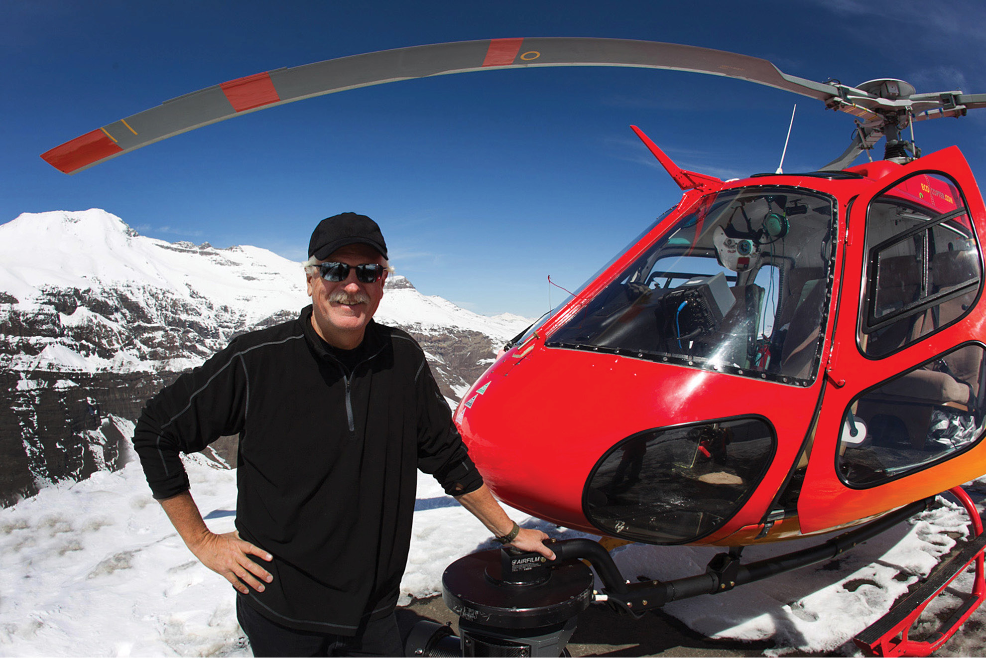
Founder and CEO, Ron Chapple.
In 2009, a client request for high-resolution video of an electrical transmission circuit drove this group of aerial cinematography experts to consider and eventually adopt lidar for 3D visualization. Having honed their craft within the high-stakes world of entertainment and visual effects, GEO1 applies world-class technique and special forces style deployment capabilities to exotic surveying and mapping projects.
Editor’s note: A 3.8Mb PDF of this article as it appeared in the magazine—complete with images—is available HERE.
Southern California-based GEO1 is an intelligent aerial sensing firm that uses high-density lidar, high-resolution imagery, and video with augmented reality technology, to execute challenging land surveying and mapping projects. GEO1 is often called upon to assess complex landscapes, from the world’s tallest mountains to remote volcanoes; from busy airport runways to structures hidden beneath dense jungle canopy.
Headed by aerial film industry veteran Ron Chapple, GEO1 was founded in 2015 as the survey and mapping division of Aerial Filmworks. Aerial Filmworks, the parent company, provides gyro-stabilized Cineflex and Shotover camera systems for entertainment, advertising and corporate clients worldwide. Extensive helicopter filming experience, full-time camera operators, tech support and more than 25 years of location work positioned Aerial Filmworks as a leader in aerial cinematography.
GEO1 provides the newest Riegl lidar and Phase One high-resolution imaging technology for utility corridor, archeology, and visual effects (VFX) projects.
“We first got involved with survey work through a client request,” stated Ron Chapple, founder, and CEO, GEO1. “We had a client that asked for a high-resolution video of an electrical transmission circuit. I was intrigued by the new business opportunity as we delivered what was likely the first ‘feature film’ quality video of electrical infrastructure. We all laughed that we were going to win an Oscar for the best electric utility inspection film! From there, we built the first commercially available device to overlay date/time and positional information.
“The idea of creating 3D visualization was always intriguing and finding new ways, such as lidar, to explore and document landscapes that we were already documenting with gyro-stabilized video seemed like a natural extension.”
As part of its decision-making process when looking to add new technology, the GEO1 team tries to adopt a fresh perspective.
“In our first meeting with a lidar manufacturer, we told the tech rep that we wanted to find a way minimize the use of GPS base stations, and they said ‘No way, not possible,’ Chapple said. “ Nevertheless, in the past three years, the GEO1 team has been able to dramatically increase their efficiency thanks to the Trimble AV39 antenna and Trimble’s PP-RTX subscription.”
The Trimble AV39 GNSS Antenna has been designed to support centimeter-level accuracy for airborne applications by using Applanix POS AV software to process the airborne sensor data. The antenna is fully certified by the FAA for aircraft installations.
The Trimble PP-RTX is a point-to-point communications protocol designed to provide real-time, centimeter-level positions through its satellite-delivered global positioning service. The subscription service provides the geographic reach needed for capturing the data.
With its roots and experience in the aerial cinema industry, GEO1 has needed to produce quality work quickly in challenging environments.
According to Chapple, the cinema industry is the definition of urgency. “You don’t tell a film director that the shoot needs to be delayed because of logistics or equipment issues. On a feature film set, there could literally be hundreds of extras, expensive props and multiple camera crews waiting on the helicopter to be in position.
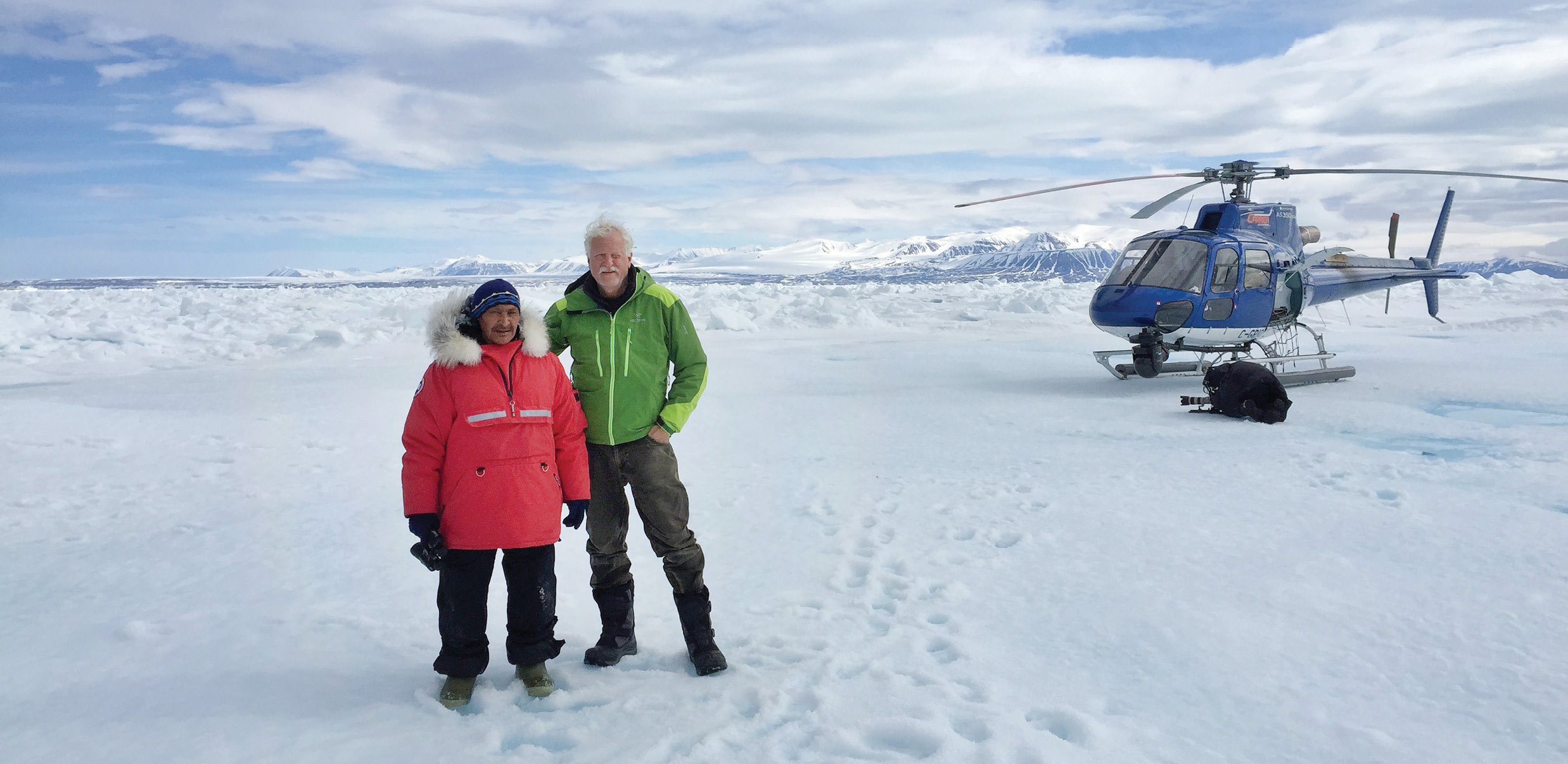
Ron Chapple working in the Arctic Circle on a nature documentary for National Geographic.
“In aerial filming, the aerial director creates the optimal shot, not unlike making the optimal flight path for an electrical corridor scan. The resulting data is then edited by another team, music added, and the final story (or deliverable) is shared with the audience. I view lidar data in much the same way… there’s a crew that pulls together all the technical details and acquires the information. Once the data files are processed, analyzed, and prepared, they become our deliverable to the desired audience. Understanding the workflow and making sure the film director or processing team has excellent information with lots of options is our standard operating procedure.”
Ron Chapple’s business roots helped shape the current processes found in the company.
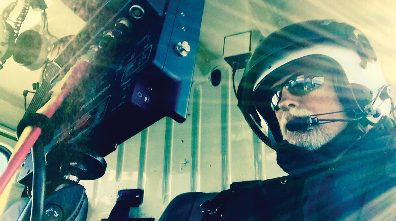
Chapple, working on a helicopter-based aerial filming project.
“I started my business career as a commercial and advertising photographer and then transitioned into aerial cinematography about 15 years ago,” Chapple said. “My company, Aerial Filmworks, worked on numerous nature documentary projects for National Geographic, BBC, and the National Park Service along with a few feature films and commercial projects.”
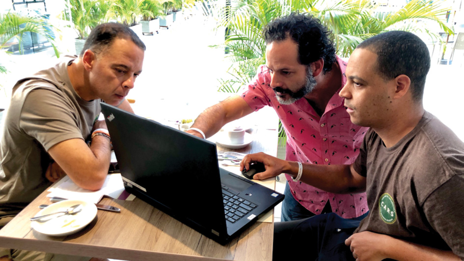
According to Chapple, the GEO1 team is the reason for continual success. Phil Carter, aerial systems director, joined the company six years ago prior to the transition period from Aerial Filmworks to GEO1.
The nature documentary and environmental projects were easy to relate to for new prospective clients, which helped Aerial Filmworks’ business growth.
“Managing complex logistics, travel, and shipping is in our DNA,” stated Carter. “In our time working in aerial cinema, we worked in every US state and 30+ countries, so we knew we needed to build lightweight and durable sensor integrations. All of our equipment cases weigh under 70 pounds in order to be checked as excess baggage for international projects. We’ve also become well versed in exporting gear internationally using ATA carnets, and purchased hardware that does not require special regulatory compliance, which would potentially cause delays in rapid response situations. From our aerial cinema days, we were just about on a first name basis with Customs and Border Protection (CBP) officers at a few airports!”

In building the GEO1 team, Chapple sought out remote sensing operators who are technicians first, and all his operators have worked first in the cinema industry.
“We look for the rare person that has helicopter, technical trouble-shooting, and creative experience along with a diligent work ethic,” Chapple said. “The ability to deploy quickly also runs deep in our organization. When I started in business many years ago, I once waited 20 minutes to call back a potential client and when I returned the call, they said ‘too late, we already gave the project to someone else.’ I vowed to never let that happen again.”
Carter added, “When our gear comes back from an acquisition, we do a clean-up and re-pack to be ready for the next project. In the past few weeks, we traveled from Los Angeles to Bogotá with less than 48-hours notice. The Colombia project was complex, as the client added a late request for 4-band imagery after our arrival in-country. So, within 10 hours, we orchestrated the logistics to have one of our team members jump on a flight and hand-deliver a Phase One iXU-RS1000 4-Band camera system to our crew in Colombia, which we were then able to integrate on-site the next day. We have learned to keep our passports current and a bag packed!”
GEO1 works both as an acquisition partner and a prime contractor for a range of survey/mapping and data clients, both small and large. Three years ago, the company developed the industry’s first dual-sensor pod with two Riegl VUX1LR lidar units and Phase One cameras which created a new lidar standard for the electric utility industry. Last year, demand enabled GEO1 to bring on a dedicated team of geospatial professionals for data processing and analytics. GEO1 now provides a range of services for smaller clients that need a full-service approach.
“Our team is amazing,” states Chapple, “our ability to generate new ideas and new perspectives has expanded exponentially.”
Phil Carter, Aerial Systems Director (right), and Francisco Forero, Business development Director of GEO1 (left) at the moment of discovery of lost civilizations with Santiago Pelaez, Director of the Global Heritage Fund.
GEO1 has also extended its lidar capabilities to provide UAS-based data collection with the Riegl miniVUX1. The company’s current business is 50% electrical corridor work and 50% “small” wide area up to around 100,000 acres. Almost all of the work is helicopter based and the wide-area projects are in challenging locations, where clouds, weather, and terrain can be significant factors. Their lidar data is used for archeological discovery, vegetation management, electric conductor engineering analysis, highway corridor mapping, urban planning, and terrain modeling.
As Chapple said: “We are always working on interesting projects with inspirational clients! We enjoy the challenge of creating solutions for unique projects!”
Here are several interesting GEO1 projects:
National Geographic: Lost Cities
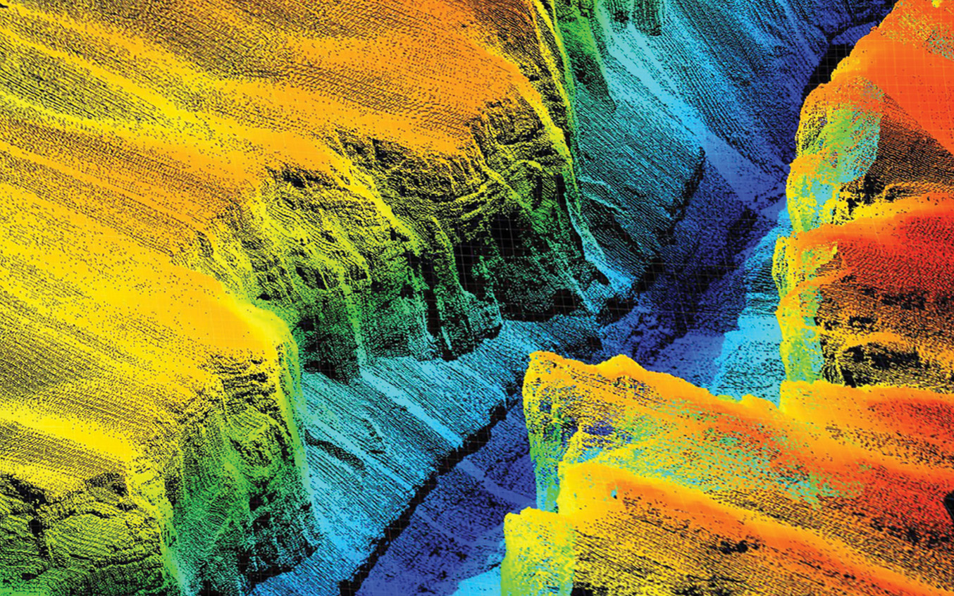
GEO1 ventured into the depths of the Colombian rainforest to both map an existing archeological site and explore for undiscovered settlements. The work centered on “Ciudad Perdida,” a Tairona settlement, which was built around 600 A.D. in the northern regions of Colombia at the base of the world’s largest coastal mountain. The company arranged the helicopter and planned the flight lines in conjunction with local archeologists. The flights followed difficult-to-traverse footpaths that climbed steeply into the jungles surrounding the native settlement. In addition, the in-house team processed the lidar data, built the digital terrain model, and delivered slope shade analytics. GEO1’s reward was the discovery of six previously unknown settlements!
The lidar findings became the basis for the National Geographic explorer Albert Lin hosted television program, “Lost Cities with Albert Lin.”
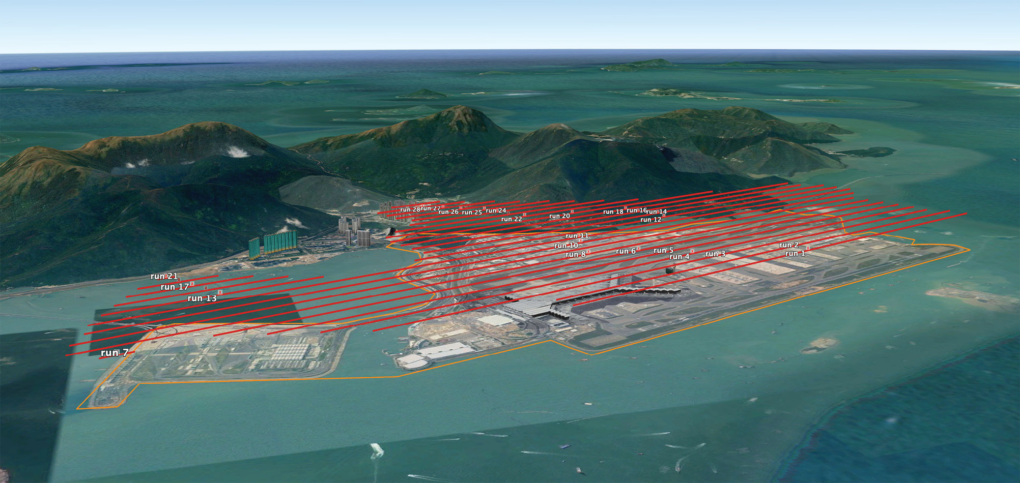
Flight lines and a DEM of the Hong Kong International Airport project where GEO1 collected lidar and imaging data to build a Digital Twin.
Hong Kong International Airport
The Hong Kong International Airport (HKIA) contracted GEO1 to deliver high-density lidar data and imagery to build a full “Digital Twin” 3D visualization. Considering an international airport is a massive dynamic facility that needs clockwork-like functionality to serve the traveling customer, a “Digital Twin” allows airport managers to view the eighth-busiest airport in the world as an interactive environment from any angle at any time. HKIA has two runways with a third runway under construction.
The digital model can be used to simulate an emergency event, or as a cost-effective simulator to train new employees on where to safely drive airport service roads, or for better visualization of new construction.
The lidar data and images acquired by GEO1 were shipped directly to GeoSim, based in Vancouver, BC, Canada, to build a full high resolution “Digital Twin.” In addition, GEO1 delivered calibrated LAS files and a colorized point cloud with 1-3cm accuracy directly to the Hong King Airport Authority for use with their new holographic viewing table.
To capture the data, GEO1 team worked closely with the helicopter company and the Hong Kong Aviation Authority to develop a flight plan covering 4,000 acres of airport property that would meet air traffic control safety protocol while delivering the best possible results. Air Traffic Control granted permission for the lidar and imaging flights to be flown from the hours of 6:30am – 7:30am Monday through Friday.

HKG International, the world’s 8th busiest airport.
“Being granted permission to fly just one hour per day was a unique challenge,” stated Carter, the aerial director for the project. “Logistically that meant leaving the hotel at 4 am to prep the helicopter, and then de-rigging after each mission so the helicopter was available for other flights during the day. We then needed to re-rig the aircraft late in the afternoon for our next day’s flight.”
Lidar data was acquired with the Riegl VQ480II and Applanix AV610 IMU with imagery from the Phase One 4-Band iXU-RS1000 system during the first set of flight sessions. A follow-up mission with GEO1’s new MultiCAM system was subsequently flown to acquire 150-megapixel oblique and nadir imagery. The MultiCAM is another first for the GEO1 team with a successful integration of six Phase One cameras at nadir and oblique angles. All cameras trigger simultaneously to acquire 800 megabytes of combined data with every shutter activation.
In addition, both of GEO1’s sensor pods needed to be approved for use on the helicopter by the Hong Kong Civil Aviation Department (HKCAD). Mechanical drawings and manufacturer certifications were submitted to a third-party engineering firm, and on-site radio frequency interference tests were successfully conducted. At this time, GEO1 believes that their sensors are the only approved lidar and imaging pods in Hong Kong.
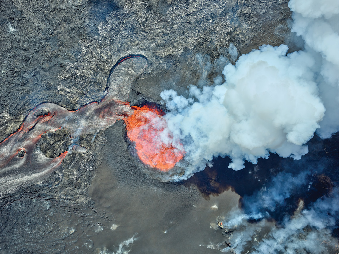
GEO1 collected high density lidar data and imagery for Quantum Spatial during the active volcanic eruption of Kilauea.
Kilauea Volcano, Hawaii
Lidar and imaging data for the Kilauea Volcano was captured for Quantum Spatial (an NV5 Company) while the volcano was active in 2018, and a follow-up baseline survey was conducted a year later in 2019. The data was collected on behalf of the United States Geological Survey (USGS), the Hawaiian Volcanic Observatory, and as a test project for the new USGS Rapid Imagery Response program.
The initial acquisition took place during the active volcano eruption, with lava devastating neighborhoods on a daily basis. Five distinct locations, covering an area of 57 square miles, were targeted. The project required 11 missions over the course of six days, operating, at times, as low as 500 feet above the ground and above active flows and nearby erupting calderas. With a need for a quick turnaround, a Quantum Spatial analyst accompanied the GEO1 flight crew on location.
One of the unique requirements was the delivery of LAS format files within 10 hours after each mission. LAS file format is an open, binary format designed for the interchange and archiving of lidar point cloud data. Quantum Spatial’s team used high-performance workstations for the immediate processing of the data. The processed data was then sent via FTP to Cold Regions Research and Engineering Laboratory (CRREL) for cloud processing of a digital elevation model to be uploaded within another 10 hours.
In 2019, GEO1 with Quantum Spatial acquired a much larger and higher density data set as a baseline for the new landscapes created during the 2018 eruption. On the last flight of the 2019 project, the GEO1 crew alerted the science team to the discovery of a small 10-foot pond at the bottom of the Halemaumau Crater. The pond has since expanded to a lake that is 600 feet long and over 60 feet deep and is the first time in recorded history that a lake has been observed in the crater.
Airborne lidar data and imagery analysis will help first responders, scientists, and government agencies monitor conditions, predict future lava flows and protect Hawaiian residents from the Kilauea volcano, which has been erupting since May 3, 2018, and has changed the topography as fissures emerge and lava flows extend to the ocean.
GEO1 flew the entire USA/Mexico border for USA Today with HD video, lidar, and imaging sensors. The team shared a Pulitzer Prize for the documentary work.
Southern United States Border Wall
The GEO1 shared a Pulitzer for Explanatory Reporting with the USA Today team for their work on an innovative documentary project. GEO1 delivered almost 2,000 miles of geo-referenced video, lidar data, and high-resolution imaging for “The Wall” project. The interdisciplinary endeavor used virtual reality, aerial video, 360-degree video, documentary video, photos, podcasts and interactive maps—as well as more than a dozen stories—to examine and document the border between the USA and Mexico.
“The border between the USA and Mexico is truly amazing, from the meandering deltas at the Gulf of Mexico through rugged canyon lands in Texas, and through dense urban neighborhoods into the Pacific Ocean,” states Ron Chapple, CEO of GEO1. In addition to navigating the complex border, Chapple and the GEO1 team filed daily reports with the US Customs and Border Patrol and military agencies to alert law enforcement to their presence at any given time.


• • •
Since its first day, GEO1 accepted the necessary risks to build a business based on providing the newest lidar and high-resolution imaging technology to clients.
“We have had no funding from a private equity firm, venture firm, or angel investor,” stated Chapple. “Our first lidar scanner was purchased with a 2nd mortgage on my house and a personal guarantee. After that purchase, we were successful in booking absolutely $0—zero dollars—in our first year of business. Definitely an eye-opener into the challenges of starting a new business, but we were confident that we were moving in the right direction!”
Within 18 months of that first investment, GEO1 began receiving projects and experienced double-digit year over year growth. The company now owns three Riegl scanners, three Applanix IMUs, and nine Phase One cameras plus meteorological sensors, field support vehicles, and multiple workstations.
GEO1 has successfully used its years of aerial cinematography experience to create what they consider the geo-spatial business of the future.
According to Chapple, “What drives our team is being innovative in how we use lidar and imaging data to contribute to a sustainable future. Still, the usual challenges of developing a business, learning new software, and incorporating new workflows are always part of the mix.”
Nevertheless, it appears that with a history of growth and a promising future ahead, these challenges are ones that Chapple and GEO1 gladly embrace.