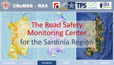
 20 January, 2020, Bologna Italy – SITECO Infomatica SRL announces the start of the new Monitoring Center for the Road Safety in the Region of Sardinia, the so-called CReMSS-RAS.
The temporary association of companies led by SITECO Informatica and Sina, IT and Engineering companies respectively of the Gavio Group, has successfully started the 2M€ Contract awarded by the Sardinia Region in 2018, with the participation of TPS, Go-Mobility, and Era Informatica.
The CReMSS-RAS center is an ambitious multidisciplinary project that integrates several activities in a single framework:
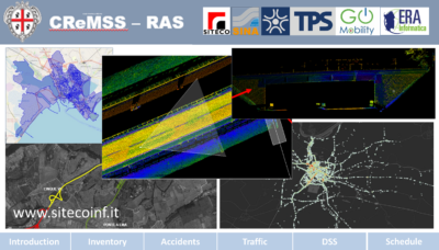
- Survey of the Road Inventory with Laser Mapping System
- Road Accident Management Information System
- Traffic Model on a regional scale
- Decision Support System (DSS)
- Support for the Regional Road Safety Plan (PRSS-RAS).
 The project main objective is the sharp reduction in the number of road accidents in compliance with the National Road Safety Plan Horizon2020 perspective of “No more victims on the road”, a target to be achieved through actions, programs and interventions, monitoring the consequences and applying suitable corrective actions.
The activities already carried out in 2019 were the following:
- Definition and approval of the General Project of the CReMSS-RAS Information System.
- Definition of the reference graph on a regional scale, based on the institutional graph provided by the Region, including the main extra-urban roads and urban connections (in collaboration with the Research Center of the University of Cagliari (CIREM).
- Configuration of the Road Inventory System, including Survey with the Laser Mapping System and post-processing of the first 900-km stretch.
- Search and recovery of existing cadastral data provided by the Road Management National Body (ANAS) and the Provincial Administrations.
- Configuration of the Traffic Model, including summer and winter surveys of traffic flows, source-target analysis and integration with ANAS data.
- Implementation of the Road Accident Management Information System based on the open-source Inci-WEB application already adopted by a number of Italian Regions and available to all Monitoring Centers and Municipal Police headquarters of the Region, according to the Agreement with ISTAT.
The contract will extend in 2020-2021 with the adoption of the Guideline of DGLS 35/2011 for the road infrastructure safety management, with the execution of the planned set of activities:
- Road subdivision into homogeneous stretches, and calculation of the corresponding reduction in the accident potential;
- Identification of the critical points on which inspections will be carried out.
- Development of the Decision Support System, to carry out optimized intervention scenarios based on a multi-criteria analysis.
Finally, the institutional portal of CReMSS-RAS will be created to share all the information collected in the System to the users of the various Monitoring Centers and the Public Administrations of the Region, with different access levels.
The portal will be used as a public tool for spreading information and to stimulate social sensitivity within the framework of the National Road Safety Plan (e.g. information on traffic, works in progress, and so on).
The General Director of Siteco Informatica, Ing. Augusto Burchi, stressed the huge multidisciplinary scope of the project that requires specific skills, a great commitment, and large resources but also confirmed the ability of the company association to manage this new challenge.
About Siteco Informatica s.rl
A unit of the Gavio Group, one of Italy’s top industrial groups. Siteco was established in 1995 as a civil engineering infrastructure, software and technical consulting firm. In 2005 they developed the first scalable, high performance fully integrated mobile mapping system and have since been delivering the most flexible roadway management mobile mappers in price, performance and software flexibility on the market. Siteco’s Road Scanner hardware and software products are fully compatible with Faro, Z+F, Leica, Riegl, Teledyne Optech, Topcon, Teledyne and other mobile mapping systems and sensors.
