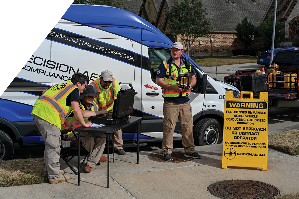
Precision Aerial has an experienced UAV crew and well developed procedures, so a variety of projects can be executed rapidly and efficiently.
The aftermath of Harvey
Harvey began as a small, slow moving tropical storm in mid-August 2017. It was categorized as a tropical wave as it grew in strength off Western Africa. It brought brief storm conditions to the Windward Islands a few days later then diminished back to tropical wave status. As the tropical wave moved east, it fed off the increased humidity produced from the warm sea conditions and Tropical Depression Harvey progressed into Hurricane Harvey by the third week of August 2017. Continually feeding off the warm ocean conditions, Hurricane Harvey reached Category 1 by August 24th and Category 4 by August 25th. By this time it was heading directly toward the Texas coastline just south of Houston. Hurricane Harvey made landfall at Rockport, Texas late on August 25th as a Category 4 Hurricane with sustained winds of 130 mph and torrential rains. Stalling on the coast for most of August 26th, it degraded to Tropical Storm Harvey from a wind perspective, but as it moved north into the Greater Houston area, it brought unforeseen torrential rains that caused catastrophic flooding the likes of which had never been seen in Texas. 500-year flood zones were exceeded and two flood control reservoirs in the Houston area were breached, flooding their respective communities. Levees throughout greater Houston were brimming and the collective breath of all Houstonians was held in unison, hoping that the rain would stop and the levees would hold.
 Hurricane Harvey would become the first major hurricane to strike southeast Texas in over four decades. In its wake would follow over 125 billion dollars in damage and it would rank second only to Katrina as the most costly hurricane in US history. Hurricane Harvey would be responsible for 135,000 destroyed homes, 13 million residents adversely effected and close to a million automobiles, trucks and other vehicles destroyed. The death toll stands at 88.
 The unifying slogan of “Houston Strong” would be the mantra of the survivors of this disaster and a nascent, somewhat reviled industry would finally gain acceptance as a mainstream provider of life-saving intelligence, disaster response and quick, accurate damage assessment. The UAV had finally made it into the mainstream conscience of America and would continue to provide a technological wave of valuable data to post-Harvey Texas and then, within weeks, to Florida and Puerto Rico.
The situation
As the city of Houston and the greater Houston area began to recover from the devastation and flooding damage in Harvey’s wake, it became essential to begin the postmortem on the levee system and ancillary flood controls. Did the levees perform to their projected capacity? How much degradation to the levees had happened as a result of the flood waters’ effect on their substrate? How could such a large, logistically challenging and data-intensive survey be done affordably, accurately and efficiently?
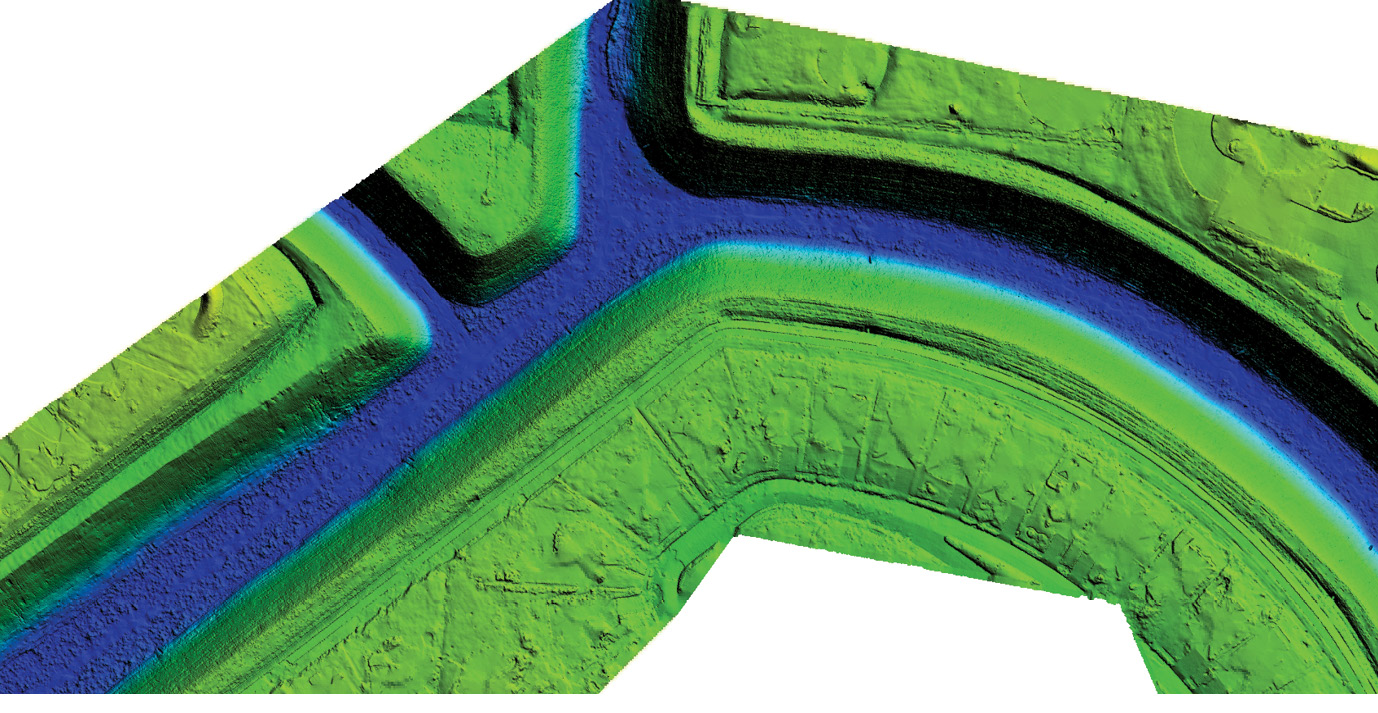
Example of digital elevation model of levee area, color-coded by elevation.
Levee systems are constructed and maintained to restrict the movement of flood waters from reaching communities and structures in the proximity of areas known to be flood-prone. In the case of greater Houston, the levee system is used to control the flooding of the Brazos River in Fort Bend County, Texas. This levee system was initially constructed in 19131, enabling the surrounding area to be developed with numerous homes, shopping centers, sports facilities and education buildings. For example, the rapid expansion in the later 20th and early 21st centuries of the city of Sugarland, Texas has been directly related to the expansion of levees and increased flood control projects. This area has been a booming financial and residential district with a bright future, but heavily reliant on the integrity of its levee system.
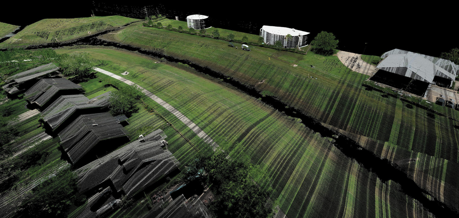
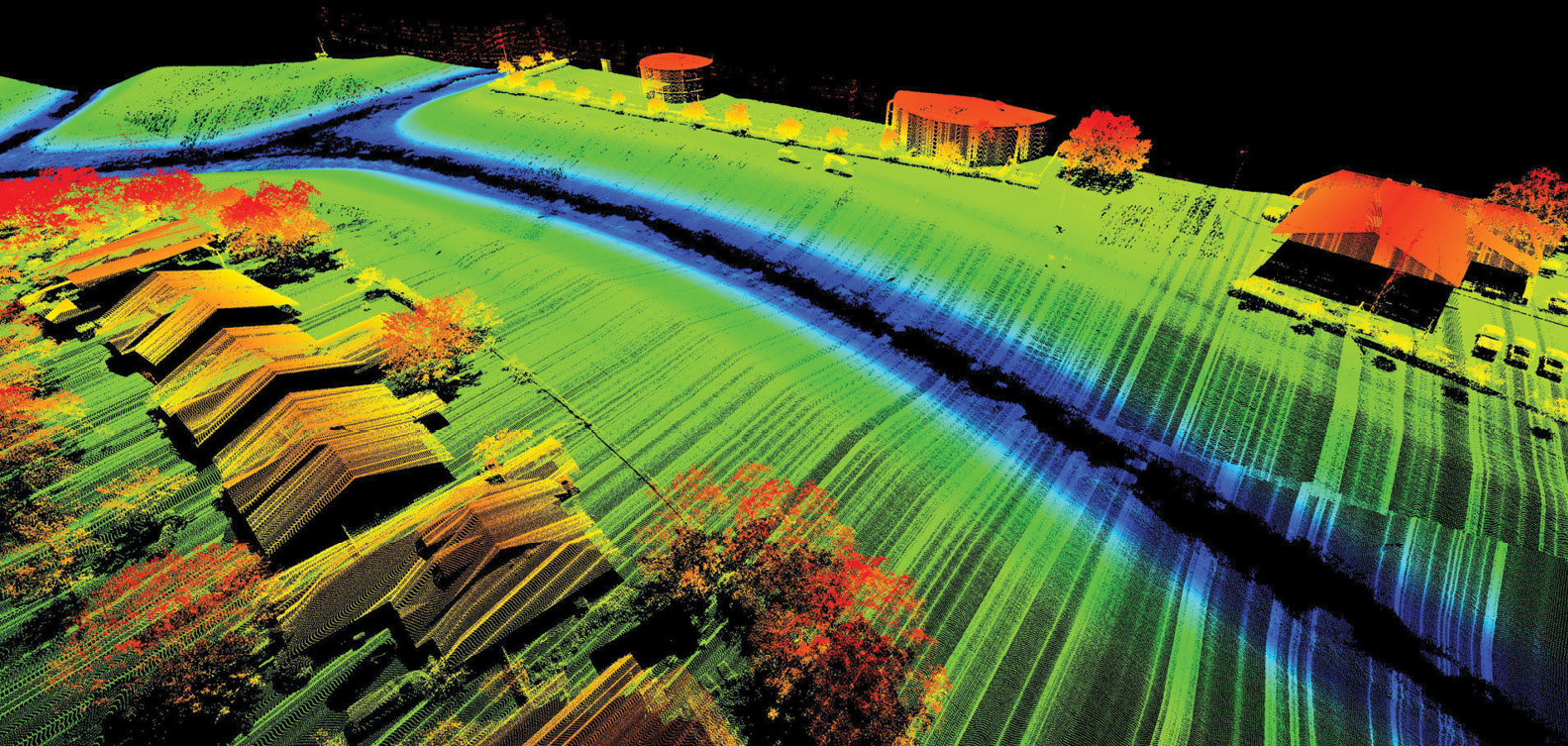
Typical deliverables from Precision Aerial: oblique view of lidar point cloud, color-coded by elevation (bottom) and by RGB values from imagery (top).
With approximately 99 miles of levees in Fort Bend County2, the various Levee Improvement Districts (LIDs) and Municipal Utility Districts (MUDs) are responsible for the construction, management and maintenance of their respective levee systems. Over time, the levees are subjected to periods of intense heat and sometimes considerable drought conditions like those experienced in 2012. These conditions make the clay-based substrate compress and dry out, reducing the overall height and volume of the levee. Once the droughts subside and the levee is again exposed to periods of copious rainfall, this substrate swells as the water is absorbed. Unfortunately, this re-hydration of the substrate does not replace the full volume of what was lost during the drying and compression period, so the levee is reduced from its required mass, height and slope angle. This becomes critical in the management of the levee, because these three key elements—height, mass and slope angle—are essential to its viability as a barrier.
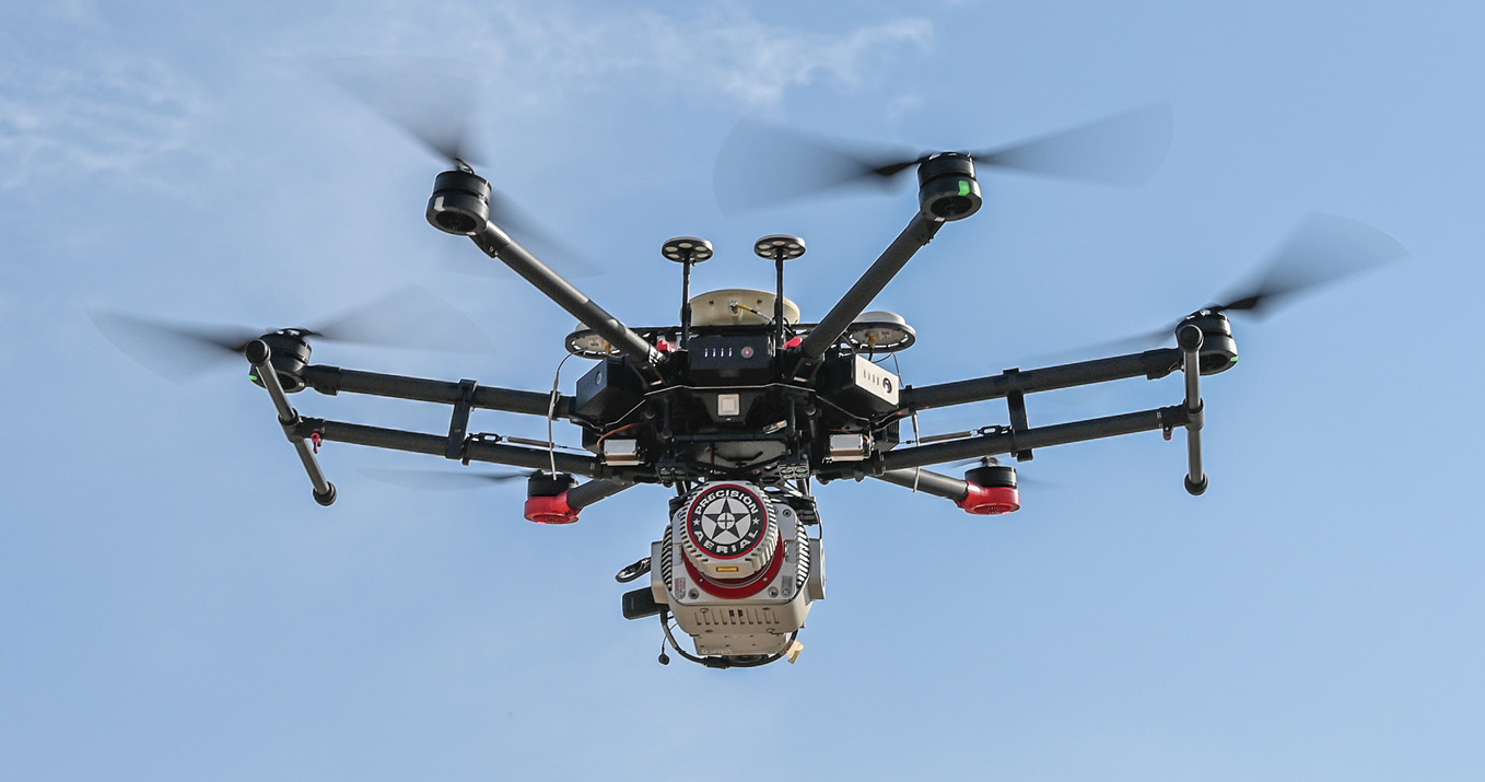
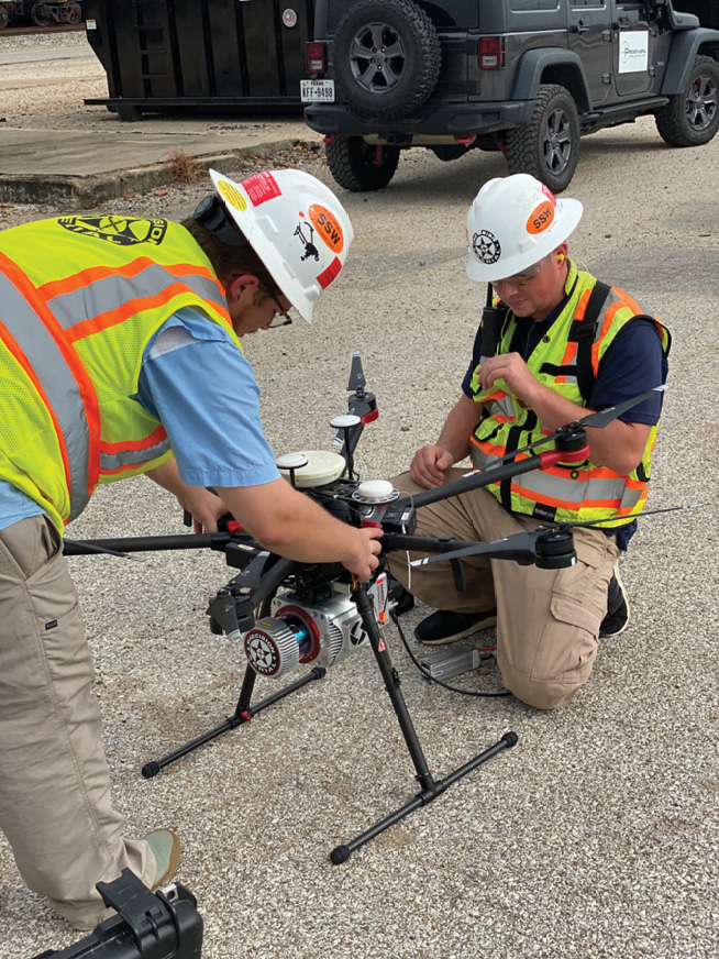
Precision Aerial’s RANGER system in operation. This system, based on DJI M600 UAV and RIEGL lidar sensor, was supplied by Phoenix LiDAR Systems, Los Angeles, CA.
Traditionally, surveys of the levees to assess the above criteria were performed by professional surveying companies utilizing RTK-GNSS sampling in grids with spacings of 100-150 feet. This data was used to calculate the height, mass and slope angle of the levees in question. Such sampling surveys have been the standard of the industry for decades and, although very accurate, are very time-consuming and expensive.
The solution
Precision Aerial Compliance Solutions, a Texas-based UAV services company, was contacted in late 2017 by a Houston area township to perform a UAV-lidar survey of its drainage system. The purpose was to assist in the modeling of the system and determine how it had been affected by the large volume of flood water that flowed through the town during Harvey and pinpoint the major damage areas from the hurricane. Precision Aerial was able to complete the task, which would have required months of traditional survey, in little over a week and proved that UAV-lidar provided a viable means of delivering critical, accurate data from difficult-to-reach areas in a short period of time.
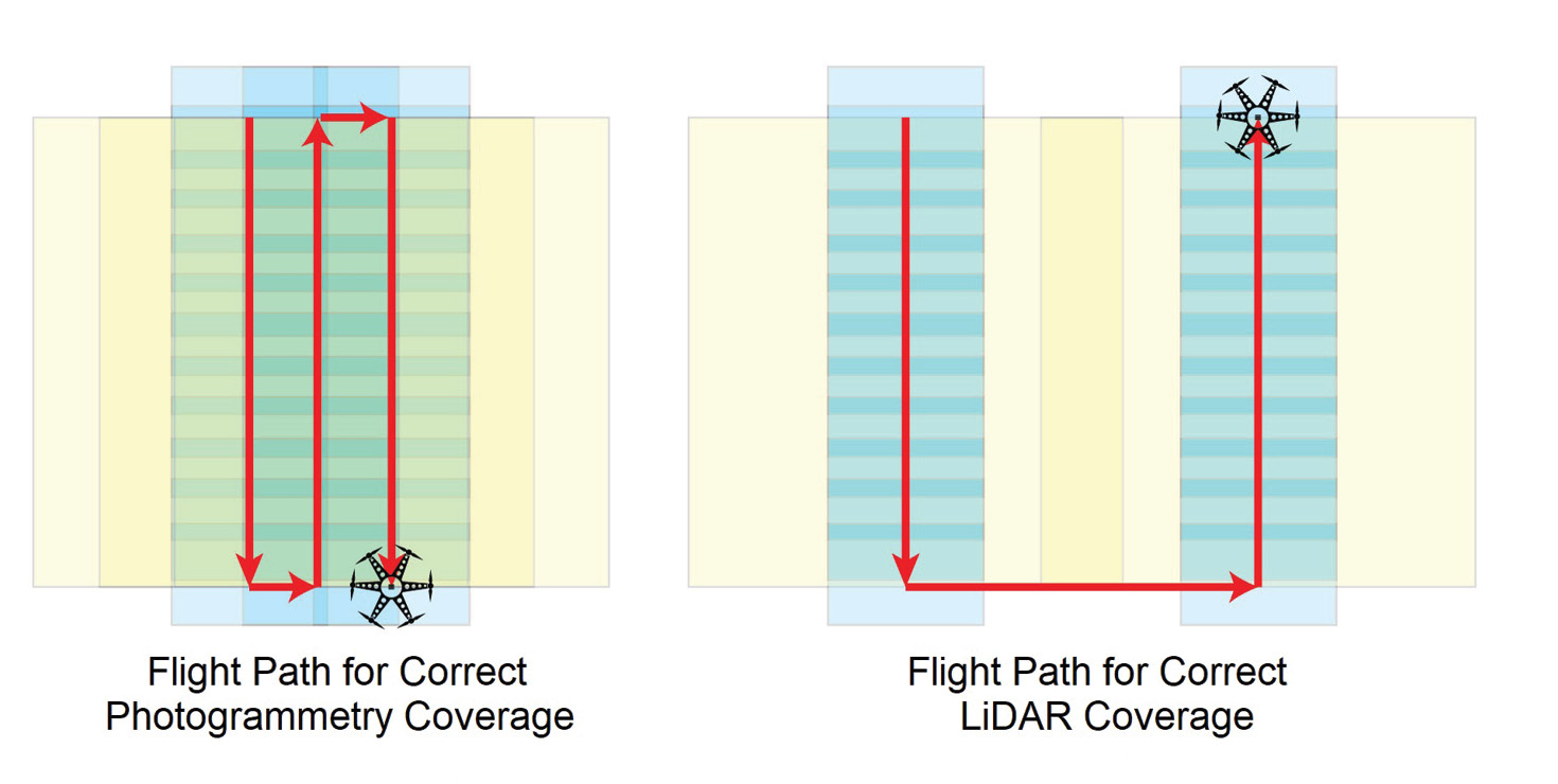
Phoenix Flight Planner enables clients to build flight plans that optimize data collection based on factors such as laser strength, vegetation, terrain, and more. The resulting KMZ can be uploaded for autonomous UAV flight, further simplifying the lidar workflow.
In 2019 Precision Aerial was asked to perform three levee surveys utilizing its UAV-lidar systems as a result of the proven accuracy and efficacy of its previous work on post-Harvey projects. The goal was to provide accurate and far more granular data than had previously been provided by traditional methods. Precision Aerial chose to utilize its recently purchased RANGER from Phoenix LiDAR Systems, comprising a DJI Matrice 600 Pro with RTK GNSS, RIEGL VUX-1 lidar sensor and Sony A6000 36.4 megapixel camera. The Phoenix RANGER is capable of 500,000 laser pulses per second with up to seven returns and a near-infrared laser. The calibrated Sony A6000 can acquire images every 1.8-2.0 seconds, resulting in a rectified orthomosaic that can be accurately overlaid on the lidar data to colorize the lidar data points. The end result is a dense, accurate deliverable that resembles a video, but is a three-dimensional fly-through of the data environment as seen in the example to the left.
To achieve this accuracy when combining the two different forms of data requires both the sensor and the camera to be precisely bore-sighted for alignment as close to perfect as possible. It should be noted that the swath width of the lidar sensor on the ground is considerably greater than that of the imagery from the Sony. Therefore the pilot and flight planner must adjust the flight plan grid accordingly, so that the photos will be compatible with the lidar data and overlay perfectly. See an example overleaf of correct flight plan spacing.
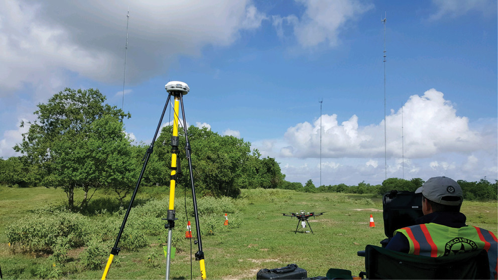
The first project Precision Aerial flew was for a Fort Bend County LID that was responsible for approximately 11 miles of levee. Precision Aerial’s alpha team flew a precise four-leg linear grid pattern parallel to the levee in 1.5 mile segments. The full extent of the levee and corresponding areas of interest were completed in one work-day with the Phoenix RANGER. A GNSS base station was used in conjunction with an onboard RTK system to provide real-time corrections for the grid pattern flown by the Matrice 600. In concert with the Trimble R8 base station, the Phoenix RANGER becomes a flying rover.
Precision Aerial was contracted later in the summer of 2019 to supply lidar data and imagery for two areas that contained levees and drainage ditches, and required a 300-foot additional swath beyond the borders of these assets. These two areas of interest posed a more intricate challenge: although separate data sets were required, the areas were aligned contiguously and had their levee and drainage systems intertwined. A scout mission was flown to acquire aerial imagery of the areas. After evaluating this data, Precision Aerial chose to utilize both alpha and bravo teams to fly the respective overlapping areas. It was decided to deploy the two Phoenix MiniRANGER systems so that the data would be easier to rectify during post-production. The MiniRANGERs utilized the DJI Matrice 600 multirotor as the sensor’s flight platform. Imagery for photogrammetry was provided by Precision Aerial’s two Eclipse RTK fixed-wing UAVs that utilize the Sony RX100 24-megapixel camera. Precision Aerial flew these two projects in very close proximity to a local airport, where a portion of the mission was in “zero airspace”. Fortunately, Precision Aerial’s close relationship and history with the tower enabled it to fly the missions at 200´ AGL. Constant contact was maintained with the tower before, during and after the mission.
Precision Aerial was able to complete both lidar missions and both imaging missions in one day. This encompassed over 20 miles of levee and 7 miles of drainage ditch. The data collected was exactly what the clients needed and will help them to plan for future flood events.
While UAV systems flying advanced lidar sensors aren’t a complete replacement for traditional survey, and check shots by a PLS are still required, they have ushered in a new age of rapid and accurate data collection never before available. UAV-lidar provides considerable acceleration to the survey workflow and makes surveys like the above possible in a fraction of the time and generally at a considerable cost savings. With this option available to the many LIDs and MUDs in Texas and elsewhere, future planners and commissioners tasked with the responsibility of mitigating and responding to the effects of flooding, hurricanes and other natural disasters will now have a new, powerful and disruptive tool at their disposal.
Scott McGowan is president and CEO of Precision Aerial Compliance Solutions, LLC (precisionaerial.co). The company was founded by Scott McGowan and Jason Nicholas in 2015. Precision Aerial was an original FAA 333 exemption holder and one of the first UAV companies to be credentialed by the National UAS Credentialing Program. Precision Aerial is based in Conroe, Texas and operates throughout the USA and abroad.
1 https://www.sugarlandtx.gov/1695/History-of-Fort-Bend-County.