 Waterloo, Canada, November 19, 2019 – 2G Robotics has released a Data Module for their ViewLS software which enables the automatic enhancement of laser point cloud and stills image data. This solution provides a simple and efficient post-survey workflow for customers of all experience levels.
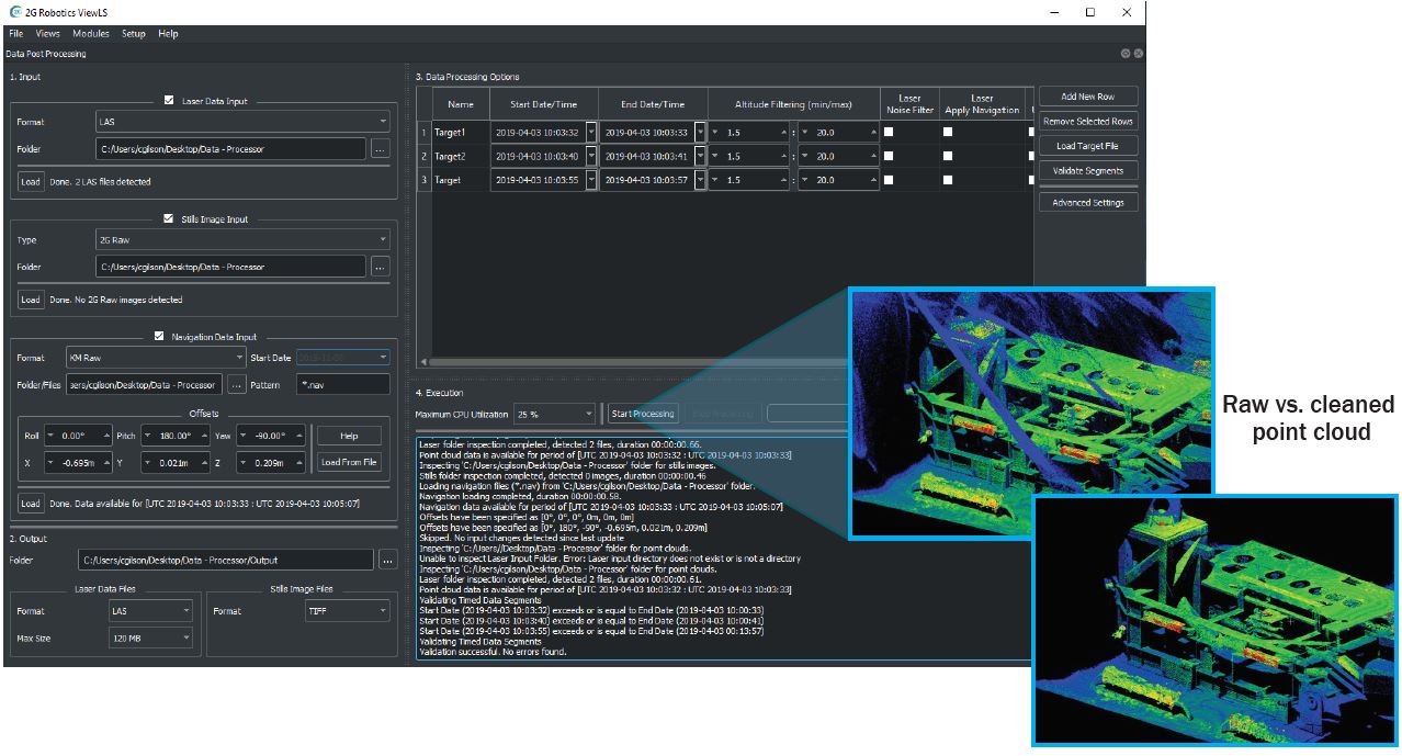
The ViewLS Data Module combines raw laser data with navigational data from industry standard sensors to create geo-referenced laser models in significantly less time than typical survey software. The resulting laser data is automatically filtered using statistical outlier rejection and range limiting to remove the effects of turbidity and noise. Targets of interest can be extracted from large datasets into an organized file structure by inputting event times, or loading a target file. This provides a simple and application specific data processing solution for ROV and AUV operators that requires minimal survey training or experience.
The Data Module also enables post-processing and enhancement of stills images. 2G images are enhanced in real-time onboard the vehicle, and the ViewLS module enables more advanced contrast enhancement and colour correction on targets or segments of interest.
“The release of the new 2G Data Module removes a significant barrier to adoption for new customers, allowing them to quickly manipulate and clean laser data with minimal training,” says Chris Gilson (Product Development Manager for 2G). “This will enable AUV and ROV operators without survey experience to efficiently use 3D laser data.”
The product is now available as an add-on subscription to the 2G Robotics free ViewLS data acquisition software. 2G will be hosting a live webinar on December 11th to showcase the new module, contact 2G Robotics to find out more.
About 2G Robotics
2G Robotics provides industry-leading laser scanning and imaging solutions that enable our clients to confidently complete subsea inspections, surveys, and mapping to ensure the preservation and security of the world’s critical infrastructure and marine environments. 2G’s systems capture millimetric resolution 3D models and high resolution images that provide a detailed baseline for monitoring and predicting changes in subsea assets and environments.
