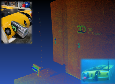
Consistently, 3D at Depth subsea LiDAR laser scans effectively generated survey grade measurements, detected leaks, and provided a unique benefit of infield navigation from the same sensing package. Each subsea LiDAR survey scan mode produced reliable results from a hovering inspection platform while being able to repeat very high resolutions slow scans, as well as lower resolution fast scans. X, Y, Z differences between the static and hovering platform scans ranged between 1mm and 3mm. Each scan mode was completely configurable for resolution to the targets. Scan modes took 3 minutes or 5 seconds per sector respectively.
The program successfully demonstrated that from controlled survey markers (targets) placed around the survey location, 3D at Depth’s unique subsea LiDAR controlled beam repeatably acquired survey grade measurements in single sector scans while hovering. Simultaneously during the data acquisition, a small simulated gas leak was also detected – supporting 3D at Depth’s subsea LiDAR capability already observed in multiple open water surveys of subsea assets.
“Resident solutions that provide reliable survey grade measurements while capturing additional integrity measurements are the future for offshore field management,” said Neil Manning, Chief Operating Officer, 3D at Depth Inc. “Subsea LiDAR’s key differentiator is the ability to simultaneously provide accurate digital twin point clouds along with other data integrity information. These technical demonstrations show it’s possible to reliably acquire survey grade quality data by combining 3D at Depth Subsea LiDAR with a resident or remote sensing system when it is available. Solutions like these can potentially help oil and gas operators reduce costs, lower risk, and possibly decrease the loss of production period downtimes. “
For more information on the demonstration visit www.3datdepth.com or contact Tiffany Long at 3D at Depth, – sales@3datdepth.com
About 3D at Depth:
3D at Depth, Inc. provides advanced subsea LiDAR (SL) laser systems, survey support services, and 3D point cloud collection, visualization, and analysis solutions to help clients optimize marine, underwater and offshore survey campaigns. The precise, repeatable, millimetric 3D point clouds acquired through patented SL laser technology provide greater insight to measure, map, and evaluate underwater assets, resources, and environments. From data collection and processing, through visualization and analysis, clients can “measure in 3D and manage in 4D” to increase operational efficiencies and reduce downtime. The Company’s locations in Australia, Europe, and the United States support customer survey operations around the world. For more information and a broader listing of services visit us at www.3datdepth.com and LinkedIn, or follow us on twitter @3DatDepth.