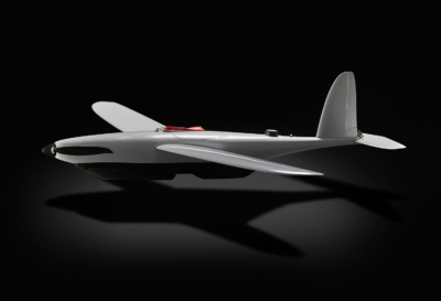
“Entering the partnership with Skyline Globe to bundle the software products Skyline PhotoMesh, Skyline TerraExplorer and Skyline GlobeServer with our Heidrun UAV Mapping solution has strengthened our product offering to the defense and security market even more. The partnership helps us to deliver the best turn key UAV mapping application for enhanced intelligence to the market, enabling clients to plan successful missions much faster and with high degree of certainty based on up-to-date high-res 2D and 3D models of the mission environment,” said Mr. Martin Schousboe, CEO of Sky-Watch A/S
The SkylineGlobe software suite sets the standard for 3D desktop and web-based applications, enabling an enterprise to build, edit, navigate, query and analyze realistic 3D environments and rapidly and efficiently distribute them to users. The SkylineGlobe suite includes all the software necessary to set up customized, privately-hosted 2D & 3D visualization environments. Flexible deployment options allow clients to scale their solution as required.
“For over 20 years Skyline Software Systems has been successfully supporting military organizations with our best-in-class 3D geospatial mapping solutions. We’re very excited to be entering into this partnership with Sky-Watch A/S, and we look forward to providing added value to their Heidrun UAV Mapping solution and supporting their company goal to fulfill their client’s mission,” said, Bob Peters, CEO of Skyline Software Systems
The combination of Skyline and Sky-Watch product solutions will create and powerful, superior product offering for Defense & Security clients looking to increase speed and precision in operational decision making and awareness, as well as save lives and resources.
About Sky-Watch A/S
Through state-of-the art and market leading innovations and technology integration in mini / close range UAV solutions, Sky-Watch aims to be a driving force in shaping and facilitating a new dimension in defense, security and battlefield management. Based in Denmark Sky-Watch is developing, manufacturing and delivering mission critical UAV solutions based on its fixed wing product group under the name “Heidrun”, delivering applications within Intelligence, Surveillance & Reconnaissance (ISR), Geospatial mapping (GEO & Image Intelligence) for mission planning and Radio Relaying in complex non-line-of-sight environments to defense and security clients worldwide. The Sky-Watch UAV solutions increases speed and precision in operational decision making, from the front line to central command, maintain operational momentum, aggressively stretch operational awareness, save resources, and save lives. For more information or questions please contact CEO Mr. Martin Schousboe, or Head of Marketing Mr. Thomas Bruun.
About Skyline Software Systems
Founded in 1997, Skyline Software Systems, Inc. is a leading provider of 3D earth visualization software and services. The company offers a comprehensive platform of applications, tools and services that enable the creation and dissemination of interactive, photo-realistic 3D environments. Skyline has built a “best of breed” set of tools that remain focused on the needs of our customers including flexibility, efficiency and robustness. Skyline is the only company on the market that can provide the scalability needed for today’s geospatial mapping needs. SkylineGlobe UK is a subsidiary of Skyline Software Systems.
Learn more at www.skylinesoft.com
Follow Skyline on Facebook. LinkedIn, Twitter, Instagram
#PhotoMesh #Skyline #TerraExplorer #UAV