 Edinburgh, UK – September 18, 2019 – NCTech, a developer of virtual data technology, today announced that its iSTAR Pulsar camera system has been integrated into the new ZEB Discovery from GeoSLAM.
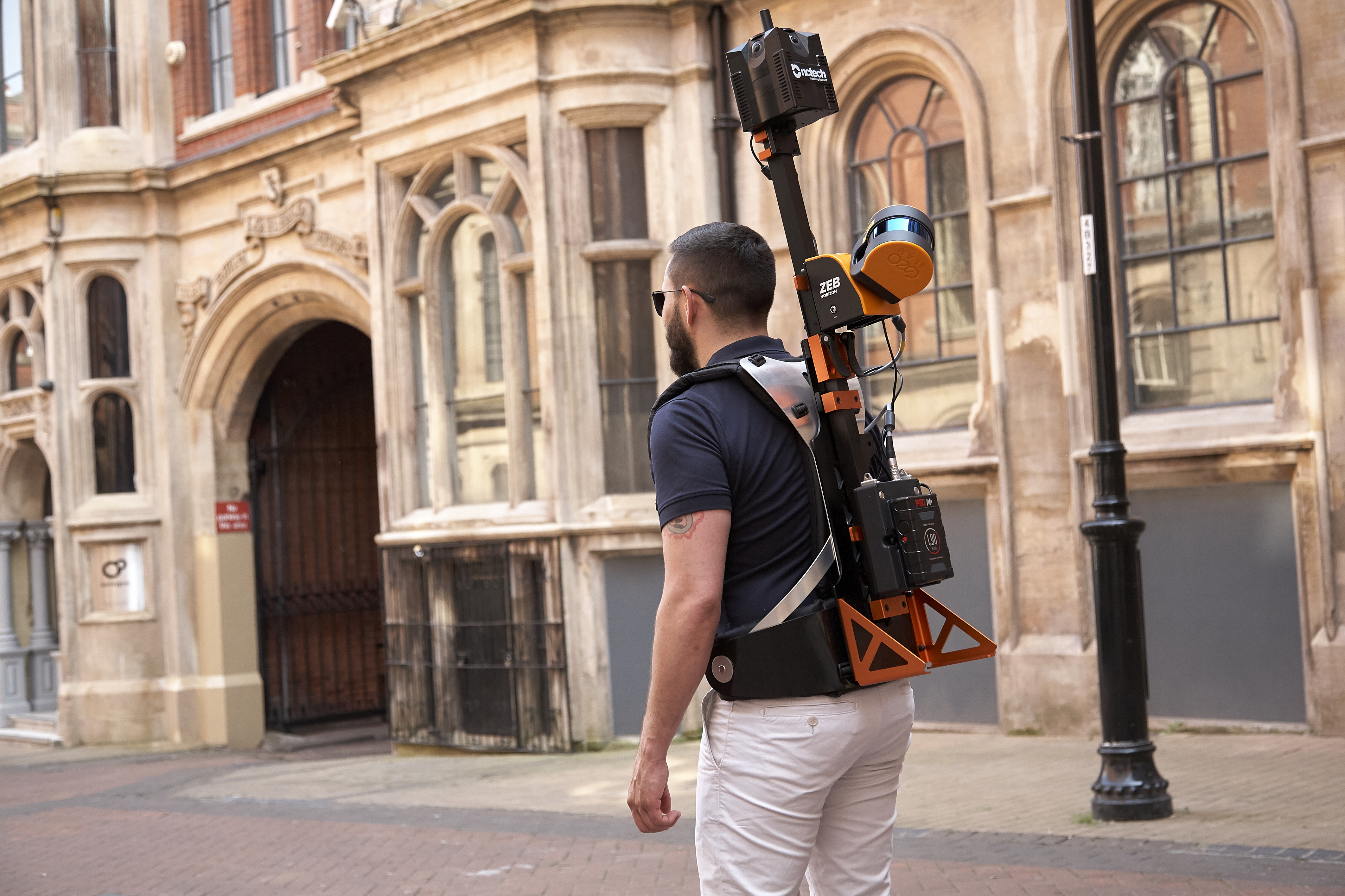
The ZEB Discovery rapidly captures intricate data using GeoSLAM’s industry-leading SLAM (simultaneous localisation and mapping) technology and the iSTAR Pulsar panoramic camera for ultra-high definition image capture.
The end-to-end solution automatically synchronises the point cloud with imagery to create a unique walkthrough of the area of data captured. Combining the two data sources into one view brings a new way to visualise reality for a wide variety of occupations – from surveyors to environmentalists.
 iSTAR Pulsar is a big data capture system optimized for capture on the move. It is specifically designed to capture 360-degree data while mounted on a vehicle, drone or on foot.
The ZEB Discovery integrates laser and image data together to help a number of industries and sectors, from planners modeling smart cities to utilities operators looking to survey existing or planned assets. With automatic localization of imagery in the point cloud, the scanner can detect the operator’s exact location using in-built GNSS, and each second the solution emits 300,000 points per second.
Cameron Ure, CEO – NCTech said “The ZEB Discovery signifies a new era in data capture and integration of a point cloud with high resolution imagery. This integration shows the value of utilising the high resolution output from our iSTAR range in complementary solutions and we anticipate announcing further integrations in the future. We look forward to supporting the success of the ZEB Discovery and building on our partnership with GeoSLAM.”
About NCTech
NCTech is a virtual data company, offering an all-encompassing solution which features an interplay between data capture, formation and interrogation. Our capture products lead the industry and enable our layered data services, which provide a fully realised virtual world through machine learning and AI. Working with global partners, we aim to make the creation and access of virtual worlds possible for everyone. www.nctechimaging.com
