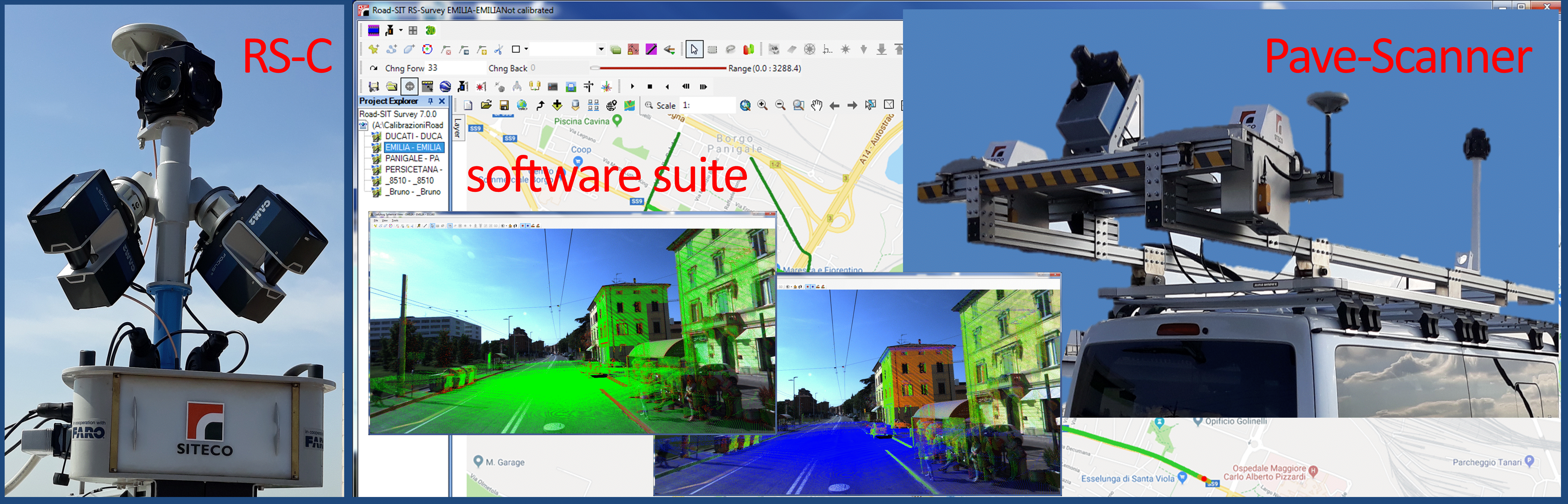
 10 September, 2019, Bologna Italy – SITECO Infomatica SRL will be attending Intergeo 2019 in Stuttgart, Hall 3, Stand B3.025, showcasing the Road-Scanner family of Mobile Mapping Systems and the NEW software release of Road-SIT Survey.
Road-SIT Survey is the mobile mapping data application developed by Siteco, fully compatible with the most widespread mobile mapping systems like the Optech-Lynx, Riegl-VMX, Topcon IPS3 and Leica Pegasus. And of course with the well-known Siteco’s Road-Scanner.
 Road-SIT Survey, v. 7.5, developed in collaboration with the Bologna University Computer Vision Lab (https://www.vision.deis.unibo.it/), has been enhanced by integrating new advanced features and smart functionalities. The main key points are the following:
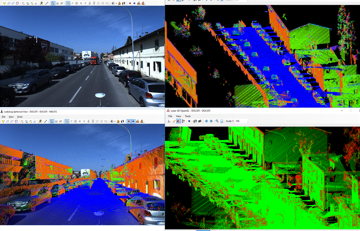
- Point cloud coloring, quick coloring process and high-quality final result.
It is possible to select the cameras that have produced sharper images, avoiding shadow and frame overlapping. A new option allows the batch coloring of a whole project thanks to the new multiple-selection command.
A dedicated command allows the calculation of the normals through the analysis of the point cloud of each laser, and provides information on curvature and direction of the normal at each point. - Calculation of planes, for the identification of the planes that best approximate, locally, the point clouds produced with each laser, through the development of best-fitting algorithms. This feature is particularly useful for extracting planar features such as roads, sidewalks, and building walls.
- Classificationor semantic segmentation of a 3D point cloud, this process assigns, to each cloud point a class based on the point location area or the object type. Two classification approaches are available: the first one based on the use of points, the second one based on a voxel grid (cubic volumes of about 15 cm per side).
- Line extraction, a new function that automatically digitizes the position of the sidewalks. Two lines are automatically drawn, corresponding to the lower edge (red line) and higher edge (green line) of the sidewalk respectively.
- New Filters allowing the upload of the point cloud according to the normal direction:
 – vertically downwards to identify, for example, the beams of an overpass
– vertically upwards to identify all horizontal surfaces, such as the road surface
– horizontal direction to identify vertical planes such as building facades.
More filters:
– Curvature, filtering the curvature radius
– Intensity, filtering reflectance, useful, for example, to isolate the laser data from the road marking
– Classification, filtering all the objects automatically identified with the semantic segmentation.
The Technical Director of SITECO, Mr. Augusto Burchi, stated: “Great results have been achieved in the development of features that really ease the work of editing point clouds, extracting and classifying objects, thanks to automated commands and without penalizing the accuracy level that has always been a strength of our company policy”
About Siteco Informatica srl
A unit of the Gavio Group, one of Italy’s top industrial groups. Siteco was established in 1995 as a civil engineering infrastructure, software and technical consulting firm. In 2005 they developed the first scalable, high performance fully integrated mobile mapping system and have since been delivering the most flexible roadway management mobile mappers in price, performance and software flexibility on the market.
