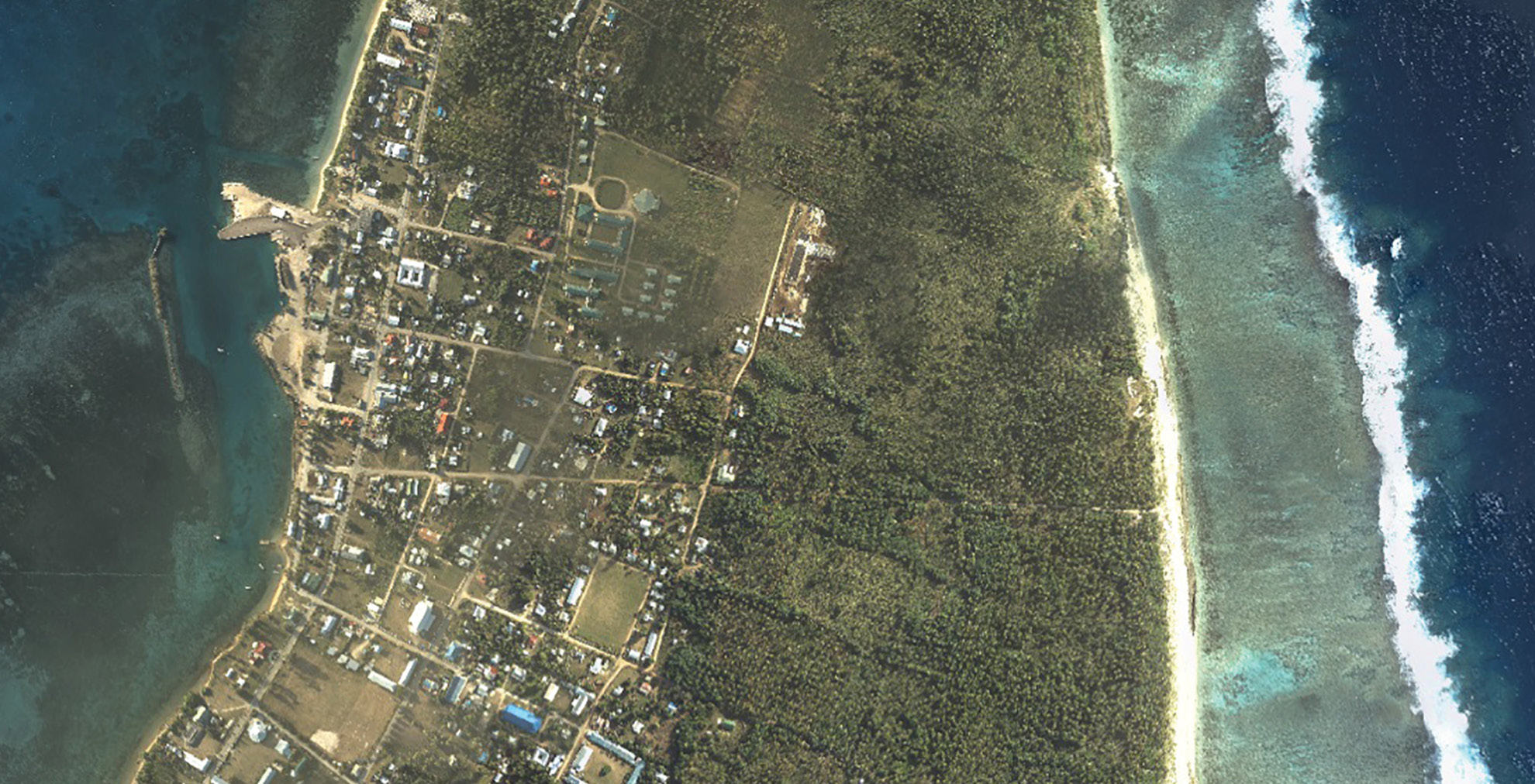
Lidar can be used to accurately assess impervious surface area to determine the stormwater runoff generated by each residence or business parcel to mitigate and prepare for potential flooding. These assessments can be used to generate funding to support those efforts. Courtesy of the New Zealand Hydrographic Authority
Coastal resilience is defined by the National Oceanic and Atmospheric Administration (NOAA) National Ocean Service as proactively building a community’s capacity to “bounce back” from hazardous events such as hurricanes, coastal storms and flooding before a disaster takes place. For a state like Florida, whose geography, elevation and topography make it vulnerable to storm surges, susceptible to hurricanes and predisposed to sinkholes, coastal resilience is not an option—it’s a necessity.
NOAA’s Office for Coastal Management reports that roughly 40% of the U.S. population, or 126 million people, live in coastal counties, which produce more than $8.3 trillion in goods and services, account for 56 million jobs and pay $3.4 trillion in wages.
In Florida, 14.4 million of the state’s 21.6 million population—or nearly 70% —live within its 8,436 miles of coastal counties. From 1980-2018, the Sunshine State also sustained 53 separate billion-dollar weather and climate disasters. In March 2019, NOAA reported that the Atlantic Ocean remains in a “high-activity” era of increased hurricane activity, with a propensity for more, stronger and longer-lasting storms. Historically, these high-activity periods last 25-40 years.
In heavily populated Miami, the highest tides of the year, called “king tides,” annually flood roads and disrupt life in low-lying areas of the South Florida community. The federally conducted Third National Climate Assessment pinpointed the Tampa Bay area, another large population center, as particularly vulnerable to rising sea levels. Broward County’s coastal areas are part of a Federal Emergency Management Agency multiyear study on flooding caused by coastal storms.
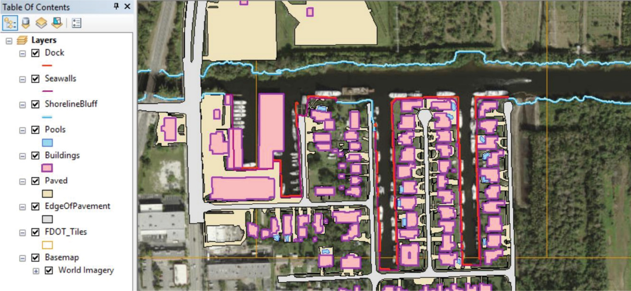
This resilience bundle of 3D features was mapped utilizing Woolpert’s trademarked remote sensing solution. Courtesy of Woolpert.
Given these statistics, the need for coastal resilience planning is repeatedly and unquestionably clear; fortunately, the route to support this need is equally apparent. Up-to-date, highly accurate lidar data and orthoimagery provide the information needed for creating storm-surge models to adequately prepare for disaster in the coastal environment. This elevation data leads to the precise delineation of coastal lands, roads and infrastructure, and enables officials to identify areas most vulnerable to inundation and destruction. The application of this data can help communities most effectively weather natural disasters and can be used to generate funding to support these vital efforts.
Lidar collections and applications throughout Florida
Highly accurate lidar data is currently being collected across the country and around the world through multiple efforts. In Florida in 2018, federal partner agencies contracted for the acquisition and processing of Quality Level 1 (QL1) lidar data across 34,873 square miles.
The QL1 data will be used to create the most accurate surface model the state has ever had. In addition to hundreds of statewide initiatives, this project will be available to help federal, state and local agencies to effectively address disaster response and flood-related issues, asset management, impervious surface mapping for stormwater management, property valuation, risk management and other mapping needs specific to the wide range of topographies across the country.
The Florida Division of Emergency Management (FDEM) has long valued the collection and application of lidar data and high-resolution imagery in its disaster preparedness, response and recovery efforts. The organization provides links to several internet-accessible lidar portals on its website at floridadisaster.org and works with the Florida Department of Transportation (FDOT) and representatives from all five Florida Water Management Districts to support the collection and application of this data.
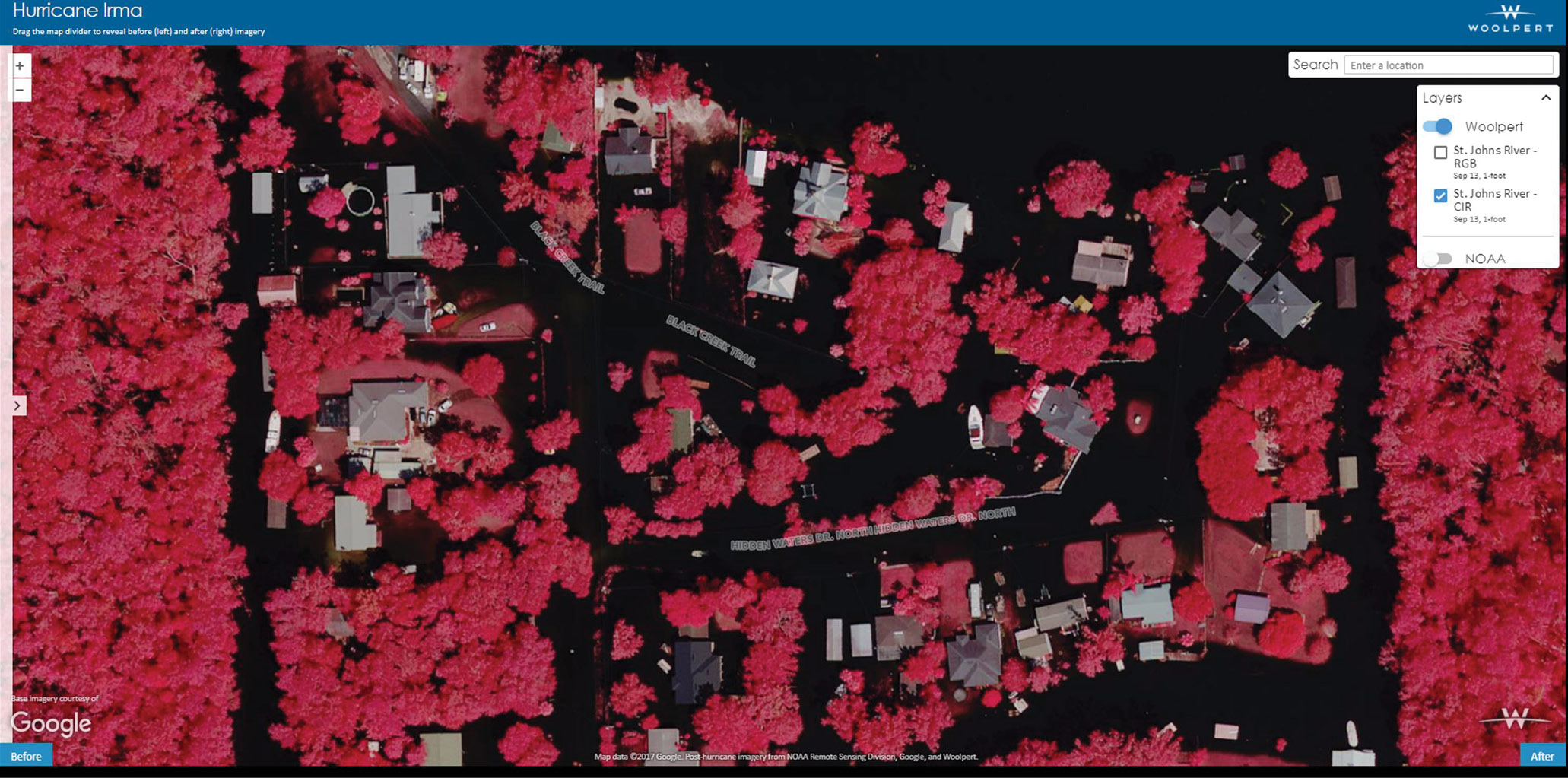
When Hurricane Irma hit Florida in 2017, Woolpert collected immediate post-storm orthoimagery contracted through its five-year statewide contract with the Florida Department of Transportation, as well as through Miami-Dade County, to document damage assessment and current flood conditions. Courtesy of Woolpert.
In addition, FDOT contracts for the collection of lidar data and supporting imagery to help determine the infrastructure most in need of strengthening prior to disaster and to determine the safest evacuation and emergency response routes post-disaster. The data can identify which roads and bridges will be accessible at various flood surge levels and how regions should be prioritized, appropriately updating emergency preparedness and response plans.
The accurate maps and models generated by geospatial data have routinely proved their value, especially in the wake of recent Florida disasters. In September 2017, for instance, when Hurricane Irma hit the state, Woolpert collected immediate post-storm orthoimagery contracted through its five-year statewide contract with FDOT, as well as through Miami-Dade County, to document damage assessment and current flood conditions. The information, aggregated with data from NOAA and Google, was shared and incorporated into rescue and recovery efforts within hours of the event for anyone affected by the storm.
Counties and groups band together to coordinate resilience planning
On the federal level, NOAA’s Digital Coast aggregates the input of its member partners to provide public safety, emergency response and economic resources to coastal communities through imagery, data, tools and training.
In Florida, the need for coastal resilience planning is so critical to its southern and eastern coastal communities that, in 2010, the counties of Broward, Miami-Dade, Monroe and Palm Beach formed an alliance called the Southeast Florida Regional Climate Change Compact to work together to coordinate mitigation and to respond across county lines. The Compact works with federal, state, regional, municipal, nonprofit, academic and private sector partners, and represents “one of the nation’s leading examples of regional-scale climate action”1 through workshops, summits and programs. The Compact discusses lidar and imagery applications and incorporates data from its counties’ work with the U.S. Geological Survey (USGS) to develop hydrologic modeling, illustrating the impact of sea level rise and extreme flooding on the region. It then shares those models with other jurisdictions.
Florida’s Office of Resilience and Coastal Protection, operating within the Florida Department of Environmental Protection (FDEP), was also created to help coastal communities prepare for the impact they may face from rising sea levels caused by hurricanes, storms or flooding. FDEP administers the Florida Resilient Coastlines Program, which is an initiative to allocate millions of dollars in grants to local governments to assist them with coastal resilience projects. Communities awarded funds for coastal resiliency projects utilize geospatial data to set the foundation for effective stormwater planning, withstanding disaster and adapting to changing sea levels.
Lidar’s role in generating funding for coastal resilience and stormwater utilities
Municipalities across the U.S. measure their impervious surface areas to determine the stormwater runoff generated by each residence or business parcel to mitigate and prepare for potential flooding. If this data is outdated or insufficient, it can make an already bad situation much more devastating. For example, studies done after Hurricane Harvey, a Category 4 storm that killed 68 and caused $125 billion in damage in Houston, Texas, in 2017, directly fault the city’s growth and increasing miles of impervious surfaces for the subsequent flooding. Princeton University and University of Iowa researchers estimated Houston’s risk for extreme flooding during the hurricane was 21 times greater because of the city’s development.
In addition to saving lives, these assessments also can support stormwater utilities by charging a fee based on the amount of impervious surface created by development to help fund the operation, construction and management of stormwater services. These measurements historically have been calculated using a manual digitization method that produces a standard, average rate. It has proved, however, to be labor intensive and prone to human error, making the data inconsistent and unreliable and the results subject to debate.
Florida is perennially among the fastest growing states, and therefore has seen consistent and exponential growth in its impervious surface area. The state has used manual digitization of impervious surface method for years, but independent reviews of that system show a stark need for improvement. On its 2016 Report Card for America’s Infrastructure, the American Society of Civil Engineers gave Florida a stormwater grade of “D.” At the same time, the Florida Stormwater Association’s 2016 Stormwater Utility Report found the state’s capital improvement needs for stormwater management to be $1.1 billion through 2019.
To improve this process, better manage stormwater and mitigate subsequent flooding, a more accurate assessment system of impervious surface area is required. That’s where lidar comes in. By using a semi-automated feature extraction method incorporating both digital orthoimagery and lidar, precise impervious surface measurements can be collected that not only support a fair and equitable stormwater fee structure, but most effectively prepare communities for disaster—whether they are in the Midwest, the mountains or on the coast.
Although we can’t stop natural disasters from occurring, we can and should use proven geospatial technology to protect ourselves.
Mike Zoltek, PSM, CP, CFedS, GISP, is a senior project manager in Woolpert’s Government Solutions market. A licensed land surveyor in Florida for over 22 years, the University of Florida graduate is a licensed professional surveyor in 26 states, an American Society for Photogrammetry and Remote Sensing (ASPRS) Certified Photogrammetrist, a Certified Federal Surveyor and a geographic information systems (GIS) professional with nearly 30 years of experience in the geospatial field. Zoltek is on Florida’s State Board of Professional Surveyors and Mappers and the ASPRS Florida Region Board of Directors, and was recently selected to chair the ASPRS Evaluation for Certification Committee.
Sam Moffat, GISP, is a geospatial project director in Woolpert’s Government Solutions market. The geographic information systems (GIS) professional has expertise that encompasses all aspects of the industry, with specialized knowledge of large-scale state, local government and federal mapping efforts. Moffat has served on the Tennessee Geographic Information Council (TNGIC) for 10 years and this year will serve as president elect.