
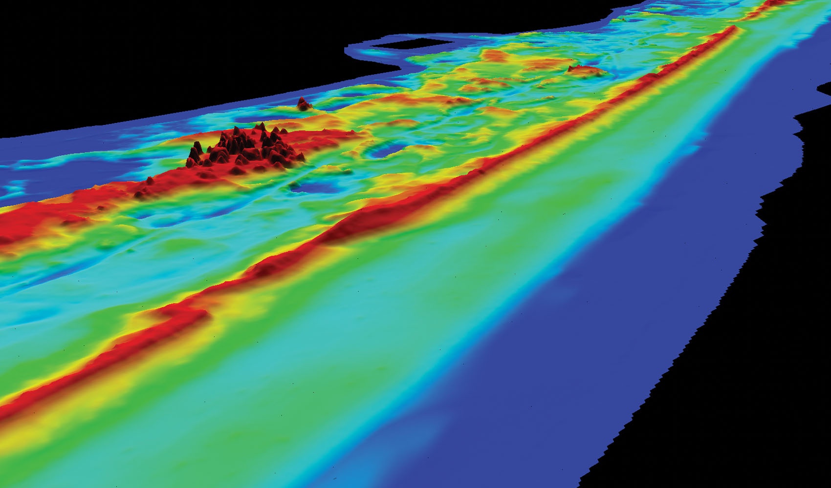
Bare-earth DEM, created using lidar data flown for a wildlife preservation study.
Changes in technology are a frequent occurrence in today’s geospatial services world. Companies utilizing these technologies find themselves striving to stay ahead of the curve. The need to be the best and brightest in the industry to stay competitive and be considered as a leading expert in the field is met by organizations who not only deploy the best in technology but employ the best of people.
One of the companies which is successfully navigating the field and providing the highest in quality technology, services, and support for its end users is AXIS GeoSpatial. AXIS relies on its core values of honesty, integrity, accountability, reliability, respectfulness, and teamwork, to govern the way in which it conducts business and ensures they are truly reflected in everything it does.
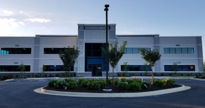
Figure 1: AXIS headquarters in Easton, Maryland. AXIS moved to Mary’s Ct. in Easton in 2017 to meet the space requirements of its growing team and technological investments.
AXIS GeoSpatial Companies
Headquartered in Easton, Maryland (Figure 1) with additional locations in Colorado, Delaware, Florida and Virginia, AXIS GeoSpatial employs over 60 individuals with aggressive plans to hire for an additional 10-20 positions during 2019. Founded in 2001 by Justin Lahman and Dave Rorrer, AXIS GeoSpatial1 has been employing innovative remote sensing and measurement technologies to capture geospatial data for integration into civil engineering, land surveying and GIS applications for the past 18 years.
Its sister company for aerial acquisition services, AXIS GeoAviation, was established in 2012 with operating locations in Easton, Maryland and Ormond Beach, Florida, and 15 employees. AXIS GeoSpatial’s Southeast operating unit is a group formerly known as MRG GEO Inc. and based in Ormond Beach, which was acquired in October 2018. Both organizations fall under the “AXIS GeoSpatial Companies” brand and are helping to expand AXIS’s reach throughout the United States.

Figure 2: AXIS principals (left to right) Justin Lahman, Barry Gleissner, Allan Blades and Dave Rorrer.
Important team members who ensure that their customers are receiving the most innovative solutions for their projects include Justin Lahman, Barry Gleissner, Allan Blades, Dave Rorrer (Figure 2) and Derik Callaway.
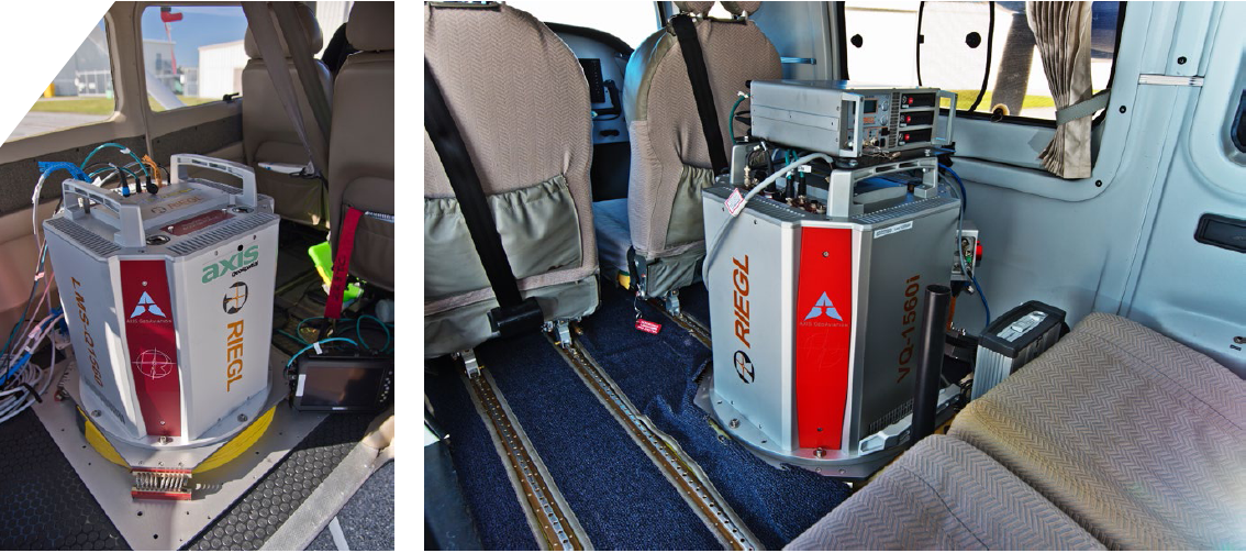
Figure 3: RIEGL LMS-Q1560 lidar sensor mounted in the company’s Piper Navajo aircraft (left) and RIEGL LMS-Q1560 lidar sensor mounted in Vulcan Air p68C (middle) and Vexcel UltraCam Eagle F100 (right).
Lahman, CEO, AXIS GeoSpatial and AXIS GeoAviation, brings twenty-eight years of geospatial industry experience with him, having managed projects to nearly every state within the domestic United States, as well as internationally. His varied involvement in the geospatial industry, with project experience consisting of photogrammetry, remote sensing, GIS, cadaster, and several other mapping sciences, brings a wealth of knowledge and skill to his clients and end users that showcases the diversity of work AXIS is doing for them. Gleissner, Director of Surveying & Mapping at AXIS GeoSpatial, has 40 years of experience in land surveying and mapping. Holding PLS licensure in Delaware and New Jersey, Gleissner directs the day-to-day operations of AXIS’ Surveying and Mapping department. Blades, Vice President of Sales and Marketing at AXIS GeoSpatial, is responsible for the daily activities of the Sales and Marketing  department, providing leadership in developing people and project teams that achieve results for stakeholders. Blades has more than 24 years of experience in geospatial acquisition and production services and more than 16 within the DoD/Intelligence community, achieving multiple successes in delivering results for a variety of federal, state, local, and private customers. Callaway, Operations Manager at AXIS GeoAviation, has over 20 years of mapping expertise and project management experience, and manages the aviation team’s daily activities and ever-changing schedule to achieve optimal efficiency.
Some of the services offered by the organization include airborne lidar acquisition and processing, ground survey support, landscape and terrain modeling, topographic mapping, planimetric mapping, ortho imagery, and UAS services. These services and projects require cutting-edge technology to acquire, capture, process, and deliver superior data to clients and end users.

Figure 4: The AXIS fleet, from top to bottom—single-engine Cessna 206H, twin-engine Vulcan Air p68C (the newest addition), and one twin-engine Piper Navajo.
Leading the way with lidar
To accomplish and deliver the high-density, high-accuracy projects that its end users need, AXIS purchased its first RIEGL lidar system in 2011. RIEGL’s density, precision and accuracy were so impressive that AXIS was able to develop an approach to design-scale mapping applications whereby the lidar accuracy rivaled field surveyed data.
Owing to it successes with applying RIEGL lidar technology to multiple engineering and surveying applications, AXIS has continued to make significant investments by adding further RIEGL sensors to its line-up. Having years of extensive research and development in this technology and its application to design-scale mapping, AXIS has yet to find another commercially available lidar sensor which provides similar density, precision and accuracy. Commented Lahman, “We at AXIS see lidar as a rapidly evolving technology trend that will transform the way in which civil engineers, architects, infrastructure managers, and GIS professionals plan and design solutions for tomorrow’s geospatial needs. Our latest expansion and investments in RIEGL sensors are based on our predictions of the innovations that will redefine the scope of work in tomorrow’s surveying, engineering and geospatial markets.”

Figure 5: Lidar point-cloud data collected for state DOT projects.

Figure 6: Colorized point cloud of an airport terminal (left) was collected for a FAA 18C obstruction analysis. This view is a combination of the lidar data plus the imagery collected on the same flight. The lidar elevation view of the same airport terminal is shown below.
The sensors AXIS currently employs are the RIEGL LMS-Q1560 full waveform digitizing, dual channel airborne lidar scanning system, two RIEGL VQ-1560i dual channel waveform processing airborne lidar scanning systems, and the UltraCam Eagle F100 digital aerial camera (Figure 3). RIEGL sensors allow lidar and imagery to be captured in a single flight, saving AXIS time and reducing costs for the client. The company’s team can provide all Quality Levels of lidar data (QL1, QL2 and QL3) in addition to Hi-Definition LiDAR (HD-LiDAR, a term coined by AXIS GeoSpatial), in which the datasets are suitable for design-scale engineering at 40 points per square meter or more. AXIS utilizes Cessna 206H, Vulcan Air P68C and one Piper Navajo aircraft (Figure 4) to ensure that it is providing the best solution from ground to cloud for its client base. These aircraft were chosen specifically for their load carrying capacity, rough field landing ability and low speed performance characteristics, as well as reasonably high cruising speed. The aircraft are specially configured and capable of carrying the RIEGL systems, pilot, system operator/pilot and a law enforcement officer (when in restricted airspace) without compromising the performance or safety of the lidar system being flown. The aircraft are staffed by two pilots, who are highly rated and very experienced in the intricacies of flying around complex, and at times, challenging airspace: two sets of eyes and ears can monitor the airspace around the aircraft and maintain a close watch on communications with air traffic control. This attention to every detail  guarantees that AXIS can provide the best in geospatial solutions and adhere to project scope and schedule for a multitude of industries.
Project experience
Given the company’s vast wealth of experience, the projects that it has performed showcase the professional work and knowledge shared within the organization. AXIS has performed state DOT work for New Jersey, Maryland, Virginia, Delaware and Florida (Figure 5). The level of accuracy in the data provided
to the client is so attractive that some state agencies have begun specifically requesting “HD-LiDAR” in their RFPs.
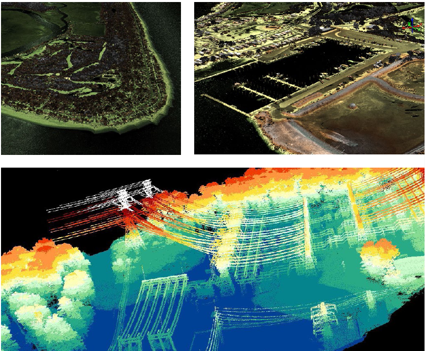
Figure 7: Further applications of HD-LiDAR (from left to right) lidar point-cloud image of a stretch of beach in South Carolina captured for a shoreline study project; lidar point-cloud image of a marsh and marina for a watershed study; raw lidar data collected for a transmission line mapping project.
AXIS has mapped several airports using HD-LiDAR technology to provide data for land use/land cover classification of runways, buildings, parking lots and roads (Figure 6). AXIS has provided impervious surface models for elevation to address drainage concerns in areas prone to flooding that affect airport operations. HD-LiDAR is also excellent for identifying runway surface conditions that may become problematic. Additionally, FAA 18C obstruction analysis can easily be completed using HD-LiDAR data to identify tree tops, buildings and antennae that may pose a risk to traffic in the area. Furthermore, AXIS has used HD-LiDAR to map sites for environmental studies, including wildlife habitat preservation, stream restoration, and watershed and coastline studies (Figure 7).
These projects are examples of the superb work that AXIS GeoSpatial has provided both to its end users and to the industry. Working diligently every day to maintain its status as a championship quality team of geospatial data professionals, providing innovative and reliable solutions to multiple industries while achieving the highest in quality and results, AXIS delivers this promise through commitment and integrity. Its focus on delivering exceptional customer service shows how it is revered as a technology leader not only in the industry but also within its community, staying ahead of the curve and establishing itself as the HD-LiDAR leader.
1 More detail is available at www.axisgeospatial.com.