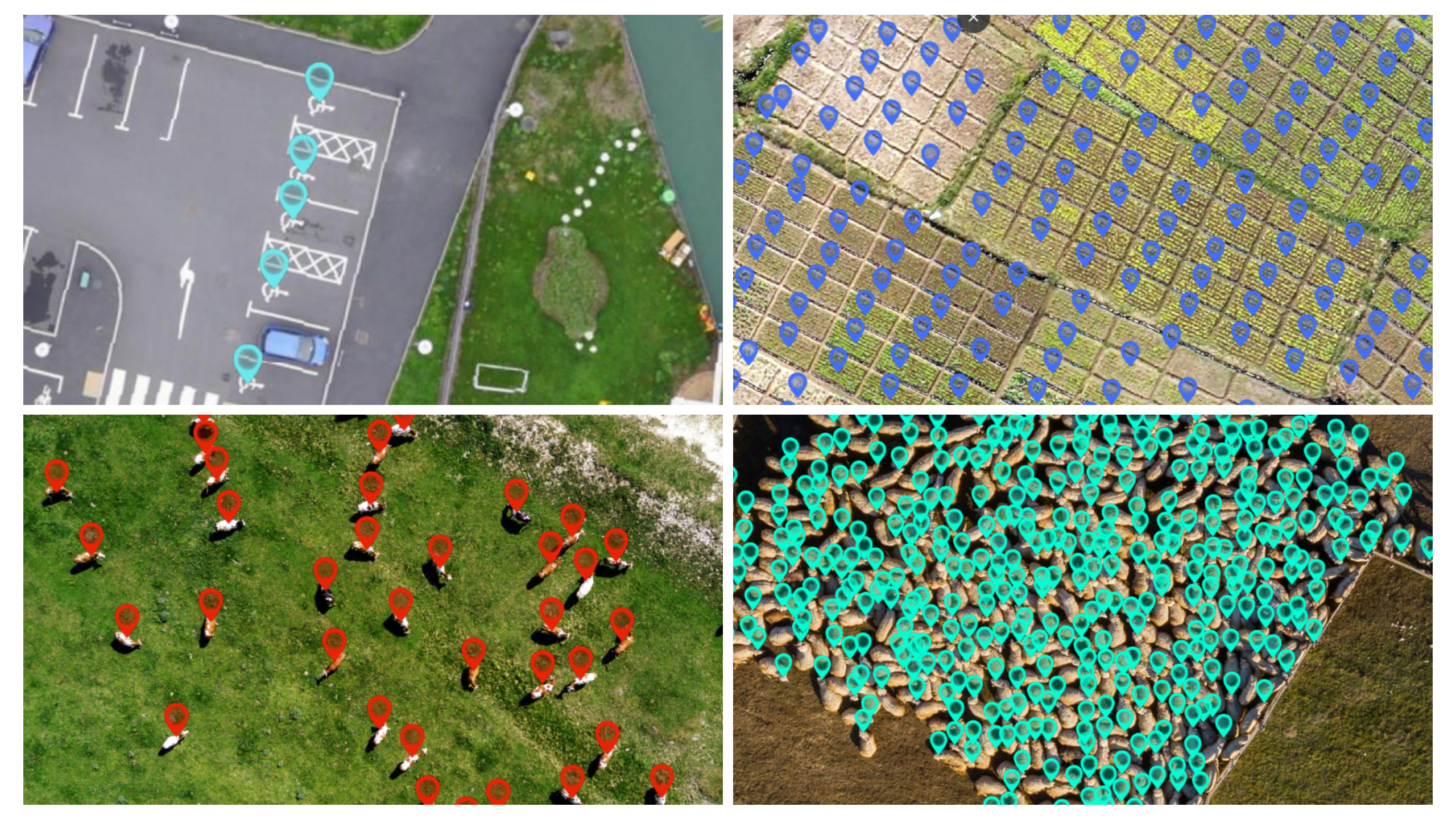
Diverse detection outputs
In a competitive and data-driven world, where satellite, aerial, and drone imaging is accessible at an increasingly lower cost, deriving geospatial insights from this data is typically done manually, representing a time-consuming and labor-intensive process. On the other hand, developing an in-house Artificial Intelligence program to automate and scale-up geospatial analytics workflows represents a very high upfront investment in expertise and infrastructure, and only very large organizations can afford to do it with still the difficulties of hiring AI and machine learning experts.
To render the benefits of AI accessible to everyone, Picterra developed an online platform that allows users —without machine-learning or programming expertise— to easily plug AI into their image analysis and geospatial analytics workflow.
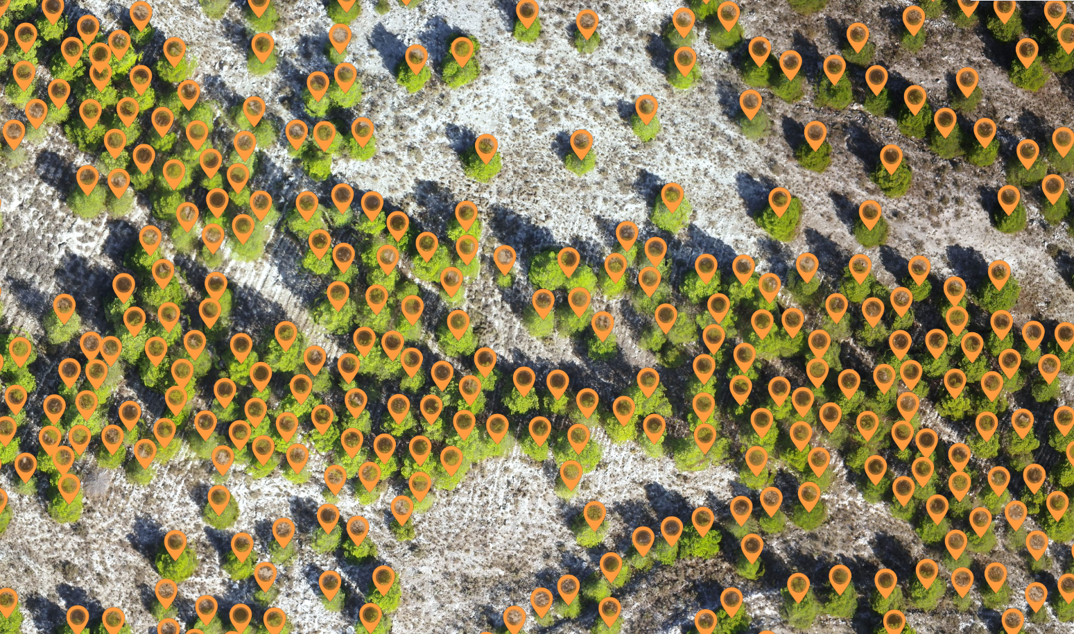
Tree detection
What started in June last year as a beta version of an AI-powered image analysis platform, quickly turned into a geospatial analytics hub serving thousands of users.
“I’ve been looking for a solution like @picterraCH since 2014. Proof: https://goo.gl/Y265RC. Picterra’s approach is brilliant: combining deep & transfer learning and satellite & aerial imagery to quickly & easily automate feature detection. Perfect for http://flyinglabs.org!” Patrick Meier – WeRobotics
“It is intuitive and easy to become productive quickly.” Jeff Lawrence – GeoJobe
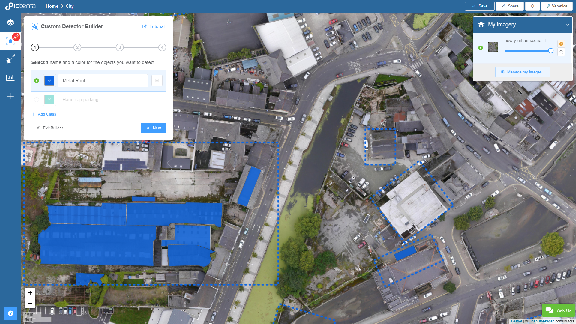
Custom detector creation screen
Over the last months, Picterra’s user base has grown very diverse, including large commercial and non-profit organizations —to whom geospatial analytics are at the heart of their operations—, independent professionals, researchers, and engaged citizens.
In light of this, to answer to different organizational needs, today Picterra is launching two new plans with increased processing and storage capabilities as well as additional features.
Following their promise of democratizing the access to Artificial Intelligence and making Earth Observation Information accessible to everyone, Picterra will continue to offer a free plan.
For a detailed overview of the plans visit https://picterra.ch/pricing/.
About Picterra:
Picterra is a Swiss startup based in Lausanne, co-founded in 2016 by Frank de Morsier, CTO —with a Ph.D. in Machine learning applied to Remote Sensing imagery— and Pierrick Poulenas, CEO, —with a background in International Affairs and Business Strategy. Picterra’s mission is to change the way we understand Earth. In 2018, the company launched a self-serve Artificial Intelligence as a Service (AIaaS)platform that makes the combined power of Earth Observation and Artificial Intelligence easily accessible to everyone. Picterra’s ambition is to provide access to large-scale AI-powered geospatial analytics without the need for a large initial investment in in-house expertise or infrastructure.
