
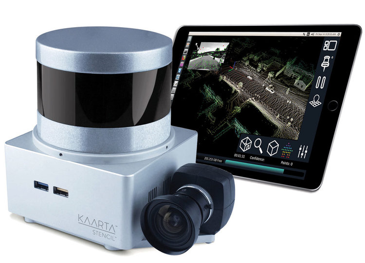
Kaarta Stencil
Pittsburgh, PA, March 21, 2019 – Kaarta, Inc., the innovator of real-time mobile 3D reality capture, announced today that it has raised US$6.5 million to accelerate the growth of its mobile mapping and localization technology. Kaarta’s innovative technology enables built environment, geospatial, and autonomous robotics professionals to map and model indoor and outdoor spaces up to 10x faster and less expensive than traditional mapping methods.
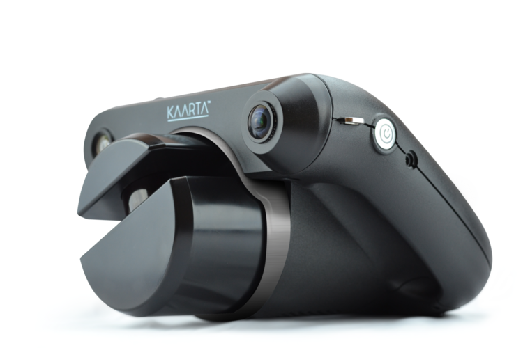
Kaarta Contour
Real estate technology venture capital fund GreenSoil Building Innovation Fund (GBIF) led the round with participation from Riverfront Ventures, Zamagias Properties, Quaker Capital Investments, and Startbot. As part of the financing, Susan McArthur, Partner, GBIF joins the board. The funding will be used to fuel sales and marketing initiatives, expand talent acquisition, and further invest in research and development.
Kaarta products are in use today across a myriad of applications in architecture, engineering, construction, operations, industrial planning, civil & transportation infrastructure, security & threat assessment, mining, archeology and autonomous technologies.
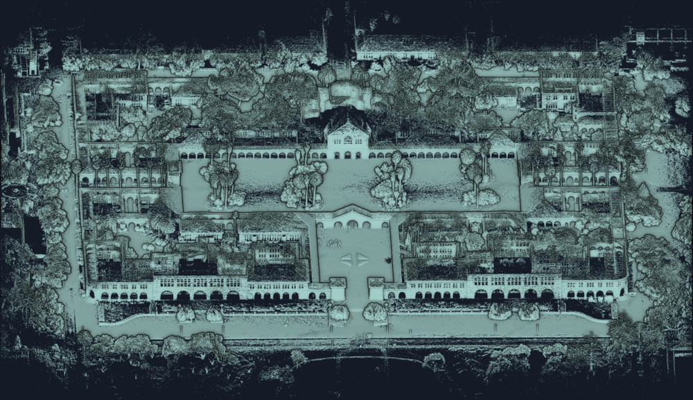
Point cloud of Stanford Quad captured in 30 minutes with Kaarta Stencil being hand carried.
In its three full years of operation, Kaarta has demonstrated impressive market traction and leadership in the real-time 3D mapping space. It has built a global distribution network and has an expanding addressable market which provides a great opportunity for accelerated growth.
Kevin Dowling, Kaarta CEO:
“Our investor group brings deep strategic expertise in property development, asset management, and commercial real estate as well insights into the robotics and AI space. Pittsburgh, with its world-renowned robotics institutions, access to technical talent, and abundance of industry partners is the ideal place for the further advancement of our technologies.”
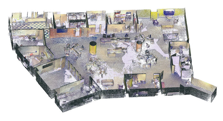
Color point cloud of office space captured in under 10 minutes with Kaarta Contour.
Susan McArthur, GreenSoil Building Innovation Fund:
“Kaarta’s technology and the team behind it are exceptional. We believe Kaarta will accelerate the adoption and utilization of 3D digital maps including digital twinning in the built world. We look forward to being a part of this next exciting phase of Kaarta’s growth.”
Geoff Perkins, President, Concourse Federal, a consulting partner to large Federal clients and commercial enterprise:
“With Kaarta, we are able to quickly provide any property owner/operator or management official with the space layouts and measurements that are critically important to manage and report on their capital and real estate assets. Kaarta is efficient, allowing Concourse to map an entire space in a matter of minutes, saving our clients time and money and delivering the level of accuracy they expect.”
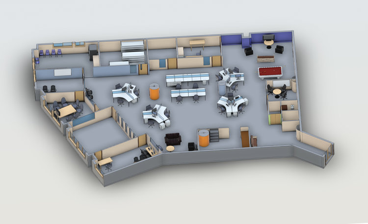
Revit BIM model created from point cloud captured with Kaarta Contour.
Mark Shake, Badger Technologies, a product division of Jabil:
“Badger Technologies uses Kaarta’s mapping system to create a master map of grocery and other retail stores, allowing our autonomous robot to intelligently navigate the store as it focuses on identifying mispriced, misplaced, or out-of-stock inventory as well as spills and other hazards. Using Kaarta, we can map a 60,000 sq ft (5,600 sq m) store in an hour or less. We have already captured over 400 retail locations for our first customer and are excited to expand our roll out, plus develop new opportunities in the retail space.”
About Kaarta
Kaarta is the innovator of real-time mobile 3D reality capture, mapping complex environments with unprecedented speed, fidelity and ease. Kaarta works without external signal infrastructure such as GPS or Wi-Fi. Kaarta’s patent-pending technology, rooted in advanced robotics, accurately transforms the real world into multi-dimensional 3D digital models, streamlining workflow, reducing time, lowering cost, and providing a new level of understanding of spaces for humans and autonomous machines alike. Now the spectrum of stakeholders across architecture, engineering, construction, and property owner/operators, facilities planners and managers, and mobile robotics developers can work from the same truth. Additional information is available at www.kaarta.com.
