 Rotterdam, January 17th, 2019 – At TUS Expo Europe, Picterra introduced the custom detector, a tool that allows users of their online platform to build their own artificial intelligence model to detect objects in aerial and satellite images.
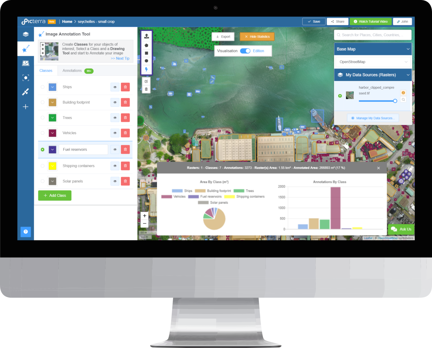
Without any previous machine learning experience, the new tool allows users to create their own AI detection model and train it to identify their specific objects of interest in just a few easy steps.
The custom model then detects the type of objects defined by the user. It is possible to export these detections and incorporate them into any geospatial analytics workflow as a .csv file or in a variety of georeferenced formats (KML, GeoJSON, and Shapefile) for mapping applications.
The tool has a broad variety of possible uses; detecting buildings, tracking farming plots, counting cattle, identifying solar panels, and many more types of objects and applications defined by the users of the platform themselves.
After trying out the new tool, some users of the platform shared their feedback:
 “So far I am beyond impressed by the quality of the results we are obtaining from this service. Within a day, I was able to upload my imagery and run the analysis on about 15/60 (25%) of them. The data being output by the program is matching up with what I was expecting and I am already nearing the point of being ready to calculate statistics. It’s a huge time saver!” Andrew E. Ortega, Pilot & Data Processing Specialist, UF Unmanned Aircraft Systems Research Program
“Holy crap this actually works!
Some tips: It needs a sharp image to work from and when drawing annotations around your objects the best is to keep polygons tight.” Murray m Chapple, Owner, Sterling Lumber Co Ltd
About Picterra
Picterra is a Swiss startup based in Lausanne, co-founded in 2016 by Frank de Morsier, CTO —with a Ph.D. in Machine learning applied to Remote Sensing imagery— and Pierrick Poulenas, CEO, —with a background in International Affairs and Business Strategy. Picterra’s mission is to change the way we understand Earth. In 2018, the company launched a self-serve online platform that makes the combined power of Earth Observation and Artificial Intelligence easily accessible to everyone. In parallel, Picterra also offers Artificial Intelligence as a Service (AIaaS) to allow organizations to test and implement large-scale AI-powered geospatial analytics programs without the need for a large initial investment in in-house expertise or infrastructure.
