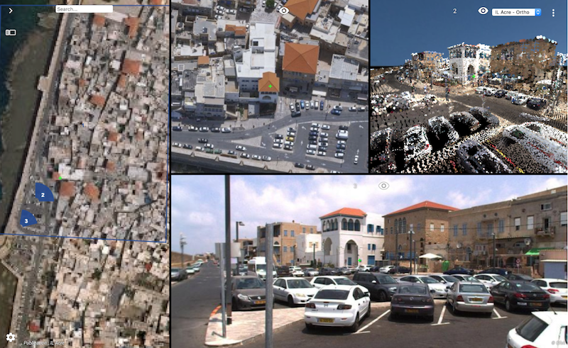
3D Mapping Cloud combining Aerial Oblique, Streetlevel sphericals & LiDAR, Textured mesh. Data © Ofek.
Lokeren, Belgium, January 17th, 2019 – Orbit GT will exhibit at the joint ILMF, MAPPS and ASPRS conference Denver, CO.
“Always happy to return to ILMF, a great yearly event!”, says Peter Bonne, CEO of Orbit GT. “Sensor & data fusion, from Street Level Mobile Mapping to Aerial Oblique Imagery, is still a major obstacle for many construction companies, surveyors, contractors, and governments. Orbit GT’s solutions change this today. Come have alook as Orbit GT will be showing the latest version 19 releases and major improvements of 3dmapping.cloud.”
Version 19 continues the road of seamless fusion of various sensors from any data capture method, street level Mobile Mapping can be instantly combined with Aerial Oblique, UAV and Terrestrial data collection, offering rich data analysis capabilities. Semi- and full auto detection tools speed up conversion of raw 3D capture data to actionable information in day-to-day operations.
Come visit us in booth 600 !
As we experience many of Orbit GT customers are using several techniques of reality capture, such as Mobile Mapping, Terrestrial scanning, Aerial Oblique and UAS Mapping, we worked towards an integration of our portfolio to offer a single product line covering the needs for each of these domains. This native integration is a sure win for every customer and user.
About Orbit GeoSpatial Technologies
Orbit Geospatial Technologies is world leader in solutions for exploiting 3D Mapping content in managing, viewing, extracting, publishing, sharing and embedding in workflows, either desktop or cloud based. Orbit GT specializes in 3D Mapping solutions for Mobile Mapping, UAS Mapping, Indoor Mapping and Aerial Oblique Mapping, replacing the big data dilemma with ease of use. Orbit GT is headquartered in Lokeren, Belgium, and enjoys a global business network.