 Large Format camera plus LiDAR? No way! Please enjoy our latest news.
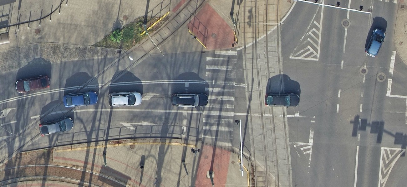
The vast majority of city mapping projects we have been doing were meeting current ‘de facto’ standard of 5cm GSD. It has been proven multiple times that this resolution and product is sufficient and optimal but municipalities soon realised that adding oblique images and LiDAR scanning bring great advantage. For large cities, metropolitan areas and even counties, the new standard established as 7cm GSD orthophoto. The Polish geospatial market is pretty demanding to work in due to high quality standards, strict airspace regulations and also many formal hurdles. It may be one of the toughest in Europe in fact.
‘Mission Impossible’ Why is no one doing it?
When our customer said that they are after ‘leaf-off’ LiDAR capture but also very high resolution orthophoto to map entire city, we didn’t say no. We never do. Our team have seen this as both a challenge and opportunity to find a solution no one else in Europe is providing.
We have integrated large format camera with high performance LiDAR scanner on our largest aeroplane, a combination that is rarely seen. Typically you can have either one or the other and laser scanning is paired with DSLR or medium format photogrammetric cameras. This is dictated by the limitation of aircraft survey hatch size, a problem that didn’t constrain us. We have raised the bar and come forward to meet our clients expectations this autumn, offering something new and unique. This time, as it become our speciality, we have integrated two sensors that are rarely paired. On board of our fact twin-engine aircraft we have installed a large format camera and LiDAR scanner for a pretty unique simultaneous capture.
This solution gives high quality nadir orthophoto and great density of point cloud saving capital expense of multiple flights. Combination of latest and greatest of both worlds, photogrammetry and active laser ranging, as well as our specially modified aircraft have allowed us to offer and deliver 3cm GSD orthomosaic and simultaneous point cloud with min. of 12ppm2. This setup has already proven itself realising 3 large city projects in recent weeks.
This year’s capture, compared to some years before, have resulted in little less pretty imagery, simply due to late season and low sun angles but this is more than compensated by high dynamic range of large frame sensor and it frankly contains more useful information due to lack of leaves, both on trees or under them, and higher resolution. It was however the requirement of our contract to fly in November, increasing penetration of LiDAR to ground surface.
One example in Bialystok City where we had to capture with sun angle above 30deg, gave us literally minutes of suitable windows, considering the typical weather variability. But we have accomplished this ‘mission impossible’ partly due to few lucky days of sun but most importantly due to our readiness of sensors, aircraft and mobilisation.
 The sensitivity and dynamic range of large format sensor was vital to achieve good results in low light conditions of late November. It also proved that images contain much more valuable information as one can see through the canopy. Similarly the high density terrain model from LiDAR sensor has same advantages of penetrating to ground where otherwise leaves wouldn’t let it. The result is amazing; 3cm GSD orthophoto and 12ppm point cloud obtained in very short time from a single flight mission. We have used this solution to map three cities already, but we are sure there are many more to come.
The review of acquired data have showed its quality and worth and unlike most aerial survey providers, who already stabled their aircraft in hangars, we keep on pushing the boundaries of what’s possible and achievable. Combination of 3cm orthophoto of large format sensor with dense point cloud from one flight is not something of common, but MGGP Aero’s innovative solutions never were.
