 Barcelona, Spain, November 13th, 2018 – Orbit GT upgrades 3D Mapping Cloud to support Textured Meshes and DEMs.
“I’m pleased to announce yet another great update for our popular SaaS platform from the Smart City Expo and World Congress in Barcelona”, says Peter Bonne, CEO of Orbit GT. “Already providing the widest support for 3D Mapping content, we now add visualisation and usage of textured meshes, use of DEM’s to drape terrain imagery, and many other new features.”
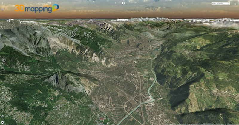
3D Mapping Cloud is the ultimate one-stop software solution to exploit all types of reality capture content. By adding Textured Meshes, interpretation of various content becomes even easier for the non-trained eye.
Highlights of new features are :
- Support for meshes (unlimited and streaming)
- Support for DEMs
- Drape flat imagery on DEMs
- Include annotations in Bookmarks !
- Many operation improvements on data management and viewing experience
All updates are available today.
About Orbit GeoSpatial Technologies
Orbit GT is synonymous to Smart 3D Mapping, for Mobile Mapping, UAS Mapping, Indoor Mapping, Aerial Oblique Mapping, and Terrestrial scanning, replacing the big data dilemma with ease of use. Orbit GT is world leader in solutions and expertise for use of 3D Mapping content in managing, viewing, extracting, operating, publishing, sharing and embedding solutions in in workflows, either desktop, on premise and cloud based. Orbit GT is headquartered in Lokeren, Belgium, and enjoys a global business network. Reality Capture is fast moving to an integrated experience, fusing massive data from various collection techniques such as Mobile Mapping, UAS Mapping, Aerial LiDAR and Oblique Mapping, Indoor and Terrestrial scanning. Orbit GT provides native and real-time fusion, optimized storage and maximum performance on its desktop and online portfolio.
