 Frankfurt, October 16th, 2018 – At INTERGEO 2018, Picterra introduced the BETA version of their AI object-detection and analytics platform to the professional geospatial community.
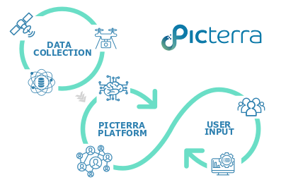
We are currently in an age where Earth observation data —captured daily by satellites, drones, and other data collection platforms— is abundant and research in artificial intelligence for object detection is booming but still exploitable only by machine learning experts. To bridge this gap, Picterra has built an online platform making AI object detection on Earth observation imagery simple and accessible to everyone.
Simplifying complexity, making AI usable and useful
Picterra’s solution is an interactive, self-service AI platform designed to extract and deliver structured insights from satellite and aerial imagery.
The platform allows users to upload their own imagery, access trusted satellite data sources and tap into a powerful yet easy-to-use AI-powered toolkit to process and analyze this data. This enables them to derive meaningful insights, monitor trends and reveal time-bound shifts.
The platform aims to serve geospatial professionals, business, NGOs, researchers, and Public Sector Organizations looking for highly-specialized geospatial analytics to support and empower their decision-making.
At the same time, Picterra’s goal is to make available an easy-to-use system gives engaged citizens and journalists access to a number of exciting tools. This includes accessing satellite imagery from anywhere in the world, detecting critical features, identifying trends, running analytics to quantify their impact and monitoring change over time.
“Picterra platform is directly inspired by geospatial professional needs. It’s the ultimate self-serve tool that makes deep learning technology ready to use to create a high added-value product and get immediate ROI”, says Pierrick Poulenas, CEO at Picterra.
“Machine learning has been kept away from ‘normal’ people for too long and for no real reason. We strongly believe that it is time to provide AI Tools to empower anyone with an interest in geospatial imagery by enabling them to truly zoom in on their data to reveal what the Earth’s surface has to say”, says Frank de Morsier, CTO at Picterra.
The registration to the BETA version of the platform is open and free of charge.
About Picterra
Picterra is a Swiss startup company, based in Lausanne, at the Innovation Park of EPFL. It was co-founded in 2016 by Frank de Morsier, CTO —with a background in Electrical Engineering— and Pierrick Poulenas, CEO, —with a background in International Affairs and Business Strategy. Picterra provides AI as a service for Earth observation imagery, with the aim to put powerful deep learning models at users’ fingertips. Picterra’s technology is built upon the intersection of two majors revolutions: Artificial Intelligence and the increasing availability of Earth observation imagery from drones and satellites. Through its platform, Picterra proposes a unique and disruptive approach to extract structured and valuable information; a partnership between human discriminating intelligence and the analytics power of AI. Picterra aims at democratizing the use of this Earth observation imagery by allowing customization of deep learning models in an easy and interactive manner by end-users. The variety of industries’ needs can be directly addressed and allow users to build tailored geospatial analytics to monitor activities and trends across the Earth’s surface.
