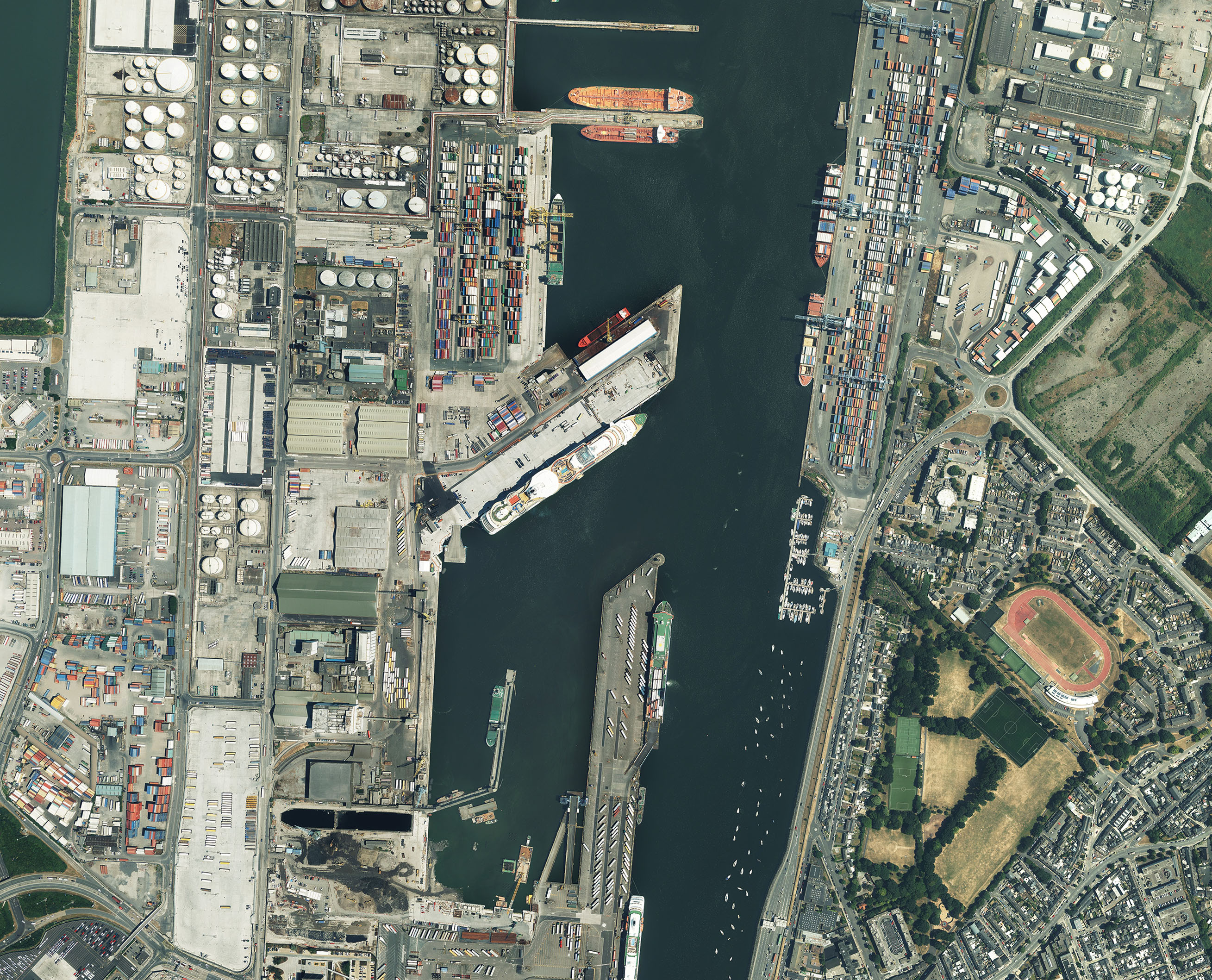
 Leicestershire, 14 August 2018 – Aerial mapping company Bluesky Ireland has captured the first ever 12.5 centimetre resolution aerial photography coverage of the whole of the Greater Dublin area. Covering a total of 1,850 square kilometres the imagery is so detailed road markings, street furniture and property boundaries are all easily visible and is accurate for use in Geographical Information System (GIS) and desktop mapping software. In another first for the Republic of Ireland, the data is also being made available through a dedicated WMS (Web Mapping Service), allowing users to stream the imagery directly into their GIS or other compatible software.
“This is a first for Ireland and is a result of the hard work and persistence of the Bluesky Ireland team to capture what is quite a difficult area to fly due to air traffic restrictions,” commented Rachel Tidmarsh, Managing Director of Bluesky International. “As the data is processed it will be delivered to clients under existing contracts and will be available online at www.bluesky-world.ie where visitors can search for, view and download their choice of data.”
Using state of the art survey equipment Bluesky captured and is currently processing the images to the highest ‘true orthorectified’ standard. A geometric process, this adjusts the raw photographs to compensate for lens distortion, camera tilt and the effects of topographical relief. This eliminates building lean, and possible obscuration of detail within the images, and any displacement of features within the imagery.
The 2018 Dublin aerial dataset, together with additional data capture within the Republic of Ireland during the summer of 2018, brings Bluesky’s ambitious plan to capture the whole country to virtual completion. Since 2015 Bluesky has captured almost 95 per cent of the total area, of 25 centimetre and 12.5 centimetre resolution aerial photography. Detailed height models, Digital Terrain Models (DTM) and Digital Surface Models (DSM) at 2 metre and 25 centimetre resolutions respectively, are also available as is Colour Infrared (CIR) imagery which provides a valuable tool for vegetation studies and other effects of human activity on the earth and its environment.
Bluesky data is already in use within government departments, local councils, utility companies, engineers and environment consultants across Ireland. Earlier this year the Department for Agriculture, Food and the Marine (DAFM) awarded Bluesky a three year contract to supply geographic data with applications expected to include rural farm payments and forestry. Bluesky data is also helping organisations such as Limerick and Waterford Councils, environmental consultancy company RPS Group and Kilgallen consulting engineers. Several counties are also already making use of the WMS now offered by Bluesky Ireland.
www.bluesky-world.ie provides an easy to use search facility with visitors able to view areas of interest by coordinate or by place name, in both Irish and English spelling. Professional users can also upload GIS files, such as ESRI.shp and KMZ files, to accurately identify their areas of interest. The preview window automatically displays a standard resolution aerial image of the chosen location; however, users can choose higher resolution imagery if available or select from the other geographic data products on offer.
Purchasing of data is simple, straightforward and secure by credit card, with account options also available. Data can be purchased with a range of easy to understand licence options, and can even be purchased on behalf of a third party with the option of a Sub Contractor Licence.
Bluesky Ireland is a specialist in aerial survey using the very latest technology to capture and process aerial photography and LiDAR. Bluesky Ireland offers unrivalled speeds of capture coupled with high accuracy and quality, underpinned by more than 30 years’ experience in aerial surveying.
Having begun an ambitious national data capture programme in 2015, Bluesky Ireland has captured high resolution aerial photography of a significant area of the country, with surveying expected to be completed in 2018. Bluesky Ireland is already working with many high profile organisations in the Irish geospatial market including the Department of Agriculture, Food and the Marine, the Department of Culture, Heritage and the Gaeltacht, the Geological Survey of Ireland and the semi-state forestry company Coillte, as well as a host of local authorities.
Bluesky Geospatial – trading as Bluesky Ireland – is a wholly owned subsidiary of Bluesky International and part of the global Bluesky organisation which also includes Col-East in the USA and Bluesky Geotech PVT, India.
