 Leicestershire, UK, 01 August 2018 – Aerial mapping company Bluesky has captured aerial photography and 3D map coverage of Malta. Working alongside tender lead IIC Technologies and Ordnance Survey, Bluesky captured ultra-high resolution aerial photography together with high density LiDAR measurements. Part of project SIntegraM – Spatial Data Integration for the Maltese Islands, the data will be used across various government departments and entities as part of the ERDF.02.030; a Maltese Government project led by the Planning Authority through ERDF Funding.
“It is a real honour to be such an integral part of a project to build both data and services that will reform the use of geographic information within the Maltese government,” commented Rachel Tidmarsh, Managing Director of Bluesky International. “We are also delighted to be working alongside IIC Technologies and the Ordnance Survey to complete this project within the project timeframes.”
 “The timely capture of such detailed aerial photography and height measurements by Bluesky is a first for Malta,” added Ashley Hili, SIntegraM Project Leader from the Planning Authority, Malta. “This will give us the best possible base mapping to move forward with our ambitious plans to create a geospatial infrastructure that will deliver real value to the nation.”
The 7 million Euro SIntegraM Project was announced in 2017 and is co-funded by the EU and the Government of Malta. The project aims to develop and implement a national spatial data infrastructure and enhance the capacity of geo-spatial/GIS technology expertise for Malta. Within the project scope is the creation of critical base datasets including new base mapping, at various scales, for the archipelago.
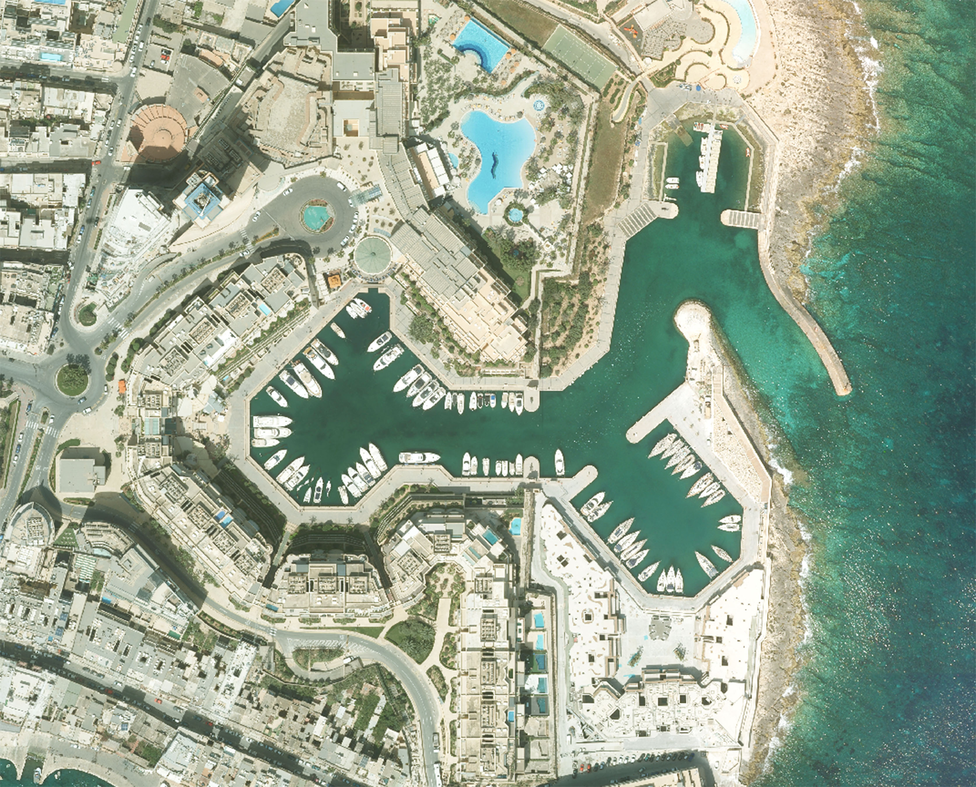
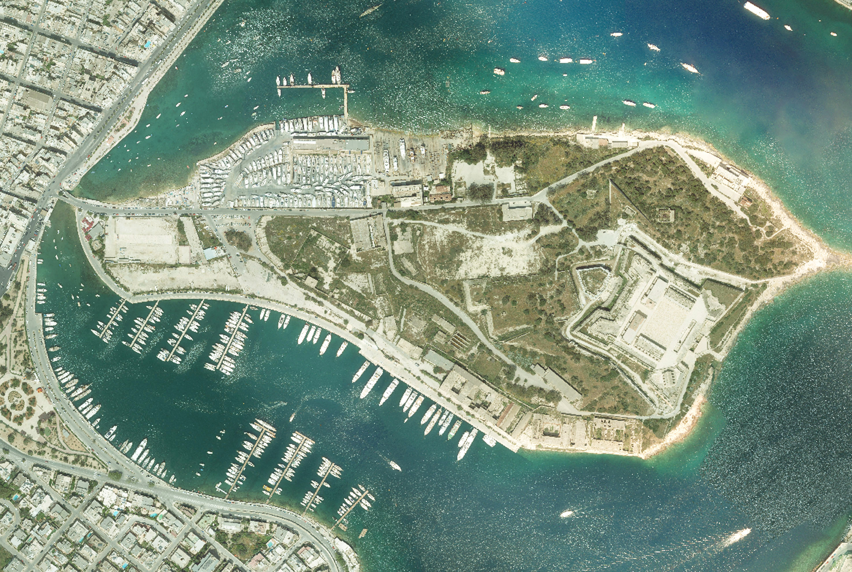
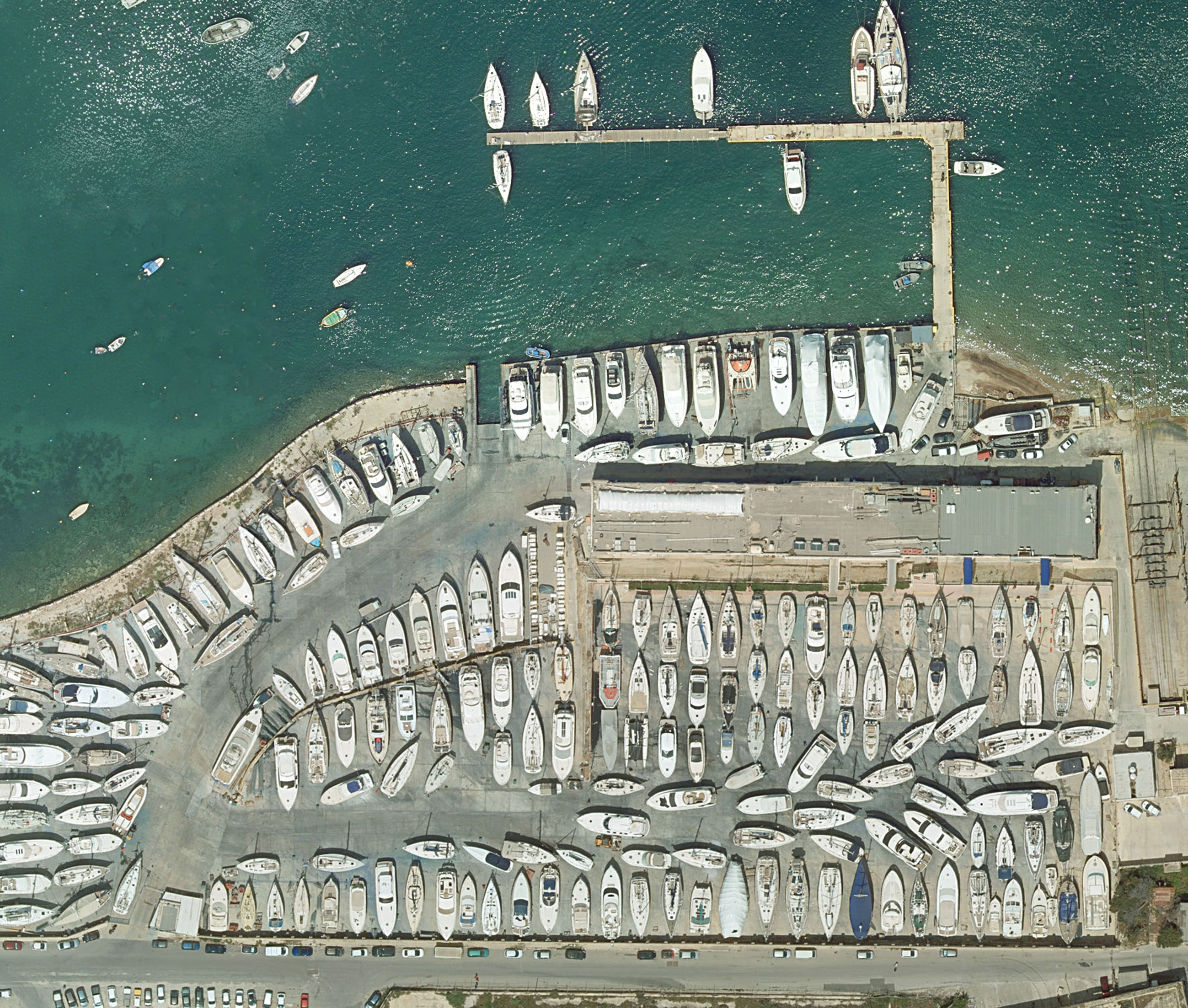 Based out of the Malta International Airport, Bluesky operated a specially equipped Cessna 404 survey aircraft. Using state of the art equipment, including an UltraCam Eagle camera and Optech Galaxy laser scanner, Bluesky captured high overlap, 6cm, multispectral (RGB & Near Infrared NIR) imagery for the five islands. Approximately 5,000 images were captured for the production of a true ortho digital dataset allowing for the elimination of building lean which means detail in the narrow streets, that might normally be obscured, will be visible.
Bluesky also captured a high density LiDAR dataset flying approximately 300 parallel flight lines over the islands. Totalling approximately 45 billion individual measurements the data will be used to produce a classified point cloud as well as dense, more than 40 points per metre, Digital Surface and Digital Terrain Models (DSM/DTM).
About Bluesky
Bluesky is a specialist in aerial survey including aerial photography, LiDAR and thermal data, using the very latest survey technology, including two UltraCam Eagles and a Teledyne Optech Galaxy LiDAR system integrated with a PhaseOne camera and thermal sensor. An internationally recognised leader with projects extending around the globe, Bluesky is proud to work with prestigious organisations such as Google, the BBC and Government Agencies. Bluesky has unrivalled expertise in the creation of seamless, digital aerial photography and maintains national “off the shelf” coverage of aerial photography, DTM and DSM through an ongoing three-year update programme. By purchasing a world first sensor for the simultaneous capture of LiDAR, Thermal and Aerial Photography data, Bluesky is in the enviable position of being able to provide customers with unique and cost effective solutions. Bluesky is leading the way in developing innovative solutions for environmental applications, including the UK’s first National Tree Map (NTM), solar mapping and citywide ‘heat loss’ maps and is currently developing noise and air quality mapping products. www.bluesky-world.com
