 Over the last five decades, few can claim to have devoted more to the development of lidar technology than Dr. Johannes Riegl, founder and CEO of the RIEGL group. The miniVUX-1UAV is a recent example of his team’s unique insight and ability. Prior to founding his namesake firm, Dr. Riegl focused on research and development work at the Vienna University of Technology from 1968-78. He started by developing high performance Avalanche Pulse Generators that are in principle still used in thousands of RIEGL instruments today for driving the semiconductor laser transmitter.
Editor’s note: A PDF of this article as it appeared in the magazine is available HERE.
In this article, I’ve opted to highlight some of RIEGL’s key milestones and innovations that led to the development of the miniVUX-1UAV:
1975: Pulsed laser radar rangefinder Eumig LARA for hydrographic surveying applications.
1978: Worldwide first pulsed laser radar distance sensor for industrial applications.
1979: Experimental setup of a pulsed semiconductor laser radar with digital echo signal processing.
1982: Laser Binoculars LR for hydrographic use.
1985: Development of an “add-on” rangefinder module for sniper use.
1986: LD90-2: industrial laser distance meter.
1987: LD90-2-GF: First industrial laser distance meter with glass-fiber coupled optical head.
1989: LARA90-2; LR90-2: Next generation of “laser-binoculars” providing reduced size and upgraded performance.
1991: Lasertape: Worldwide first pocket sized “laser-binoculars” for nonprofessional use (hunting, sporting, etc.).
1992: Not everyone’s darling: Laser “Speed Gun” for traffic law enforcement.
1993: LD-90-3: Next generation of distance and speed sensors for industrial use.
1995: LD90-3GF: Next generation of industrial distance and level sensors with glass-fiber coupled optical head.
1996: LASERTAPE FG21-HA: “Two in One” rangefinder & distance meter and RIEGL’s first Airborne Laser Scanner for corridor mapping
1997: ESA-Project “ASIS” (Active Surface Imaging System): definition, manufacturing, and testing of an advanced 3D laser sensor with a wide field of view (60 degree x 60 degree), first RIEGL “3D scanner” with rotating polygon mirror.
2000: LMS-Q140: improve airborne Laser scanner; ESA-Project “LRF” (Laser rangefinder for RV Sensor): development of a space qualified laser rangefinder for docking applications (ATV and HTV), manufacturing of engineering models, flown in April 2008.
2003: LMS-Q280: medium range airborne laser scanner and LMS Z420i High accuracy and long-range 3D laser imaging sensor.
2004: LPM-i800HA: high-accuracy and long-range laser profile measuring system; LMS -Q240: Airborne laser scanner, successor to LMS-Q140i; LMSQ560: the world’s first commercially available digitizing and Full Waveform processing airborne laser scanner.
2005: LMS-Q120: 2D laser scanner for industrial applications; LMS-Q160: Lightweight anti-collision sensor for UAV’s.
2006: RIEGL BP560: Airborne laser scanner system, belly-pod mounted on diamond DA42 MPP twin engine plane.
2007: LPM-321: Extremely long-range 3D profile measuring system.
2008/2009: LMS-Z620: Very long-range 3D terrestrial laser scanner optimized for long-range topography and mining applications; LMS-Z210ii-S: Rugged 3D imaging sensor for industrial applications; VZ-400: The World’s first online waveform processing 3D terrestrial laser scanner; LMS-Q680: World’s first airborne laser scanner offering RIEGL’s unique MTA (“multiple-time-around”) processing technology to benefit from the high laser pulse repetition rate (PRR) of up to 400kHz also from high flight altitudes, thus achieving up to 266,000 points on the ground per second.
2009/2010: RIEGL launches the VMX250 Mobile Laser Scanning System at InterGEO–a compact, innovative highperformance platform for high-speed mobile 3D data acquisition reducing the complexity of integration, installation, and post processing to a minimum. The NP680i is unveiled, in cooperation with Diamond Aircraft Industries, RIEGL develops an innovative “turnkey’ solution for surveying missions by directly integrating the LMS-Q680i airborne scanner into the “Universal Nose” of the twin-engine DA42 MPP. Later, the VZ-1000, a terrestrial scanner providing online waveform-processing for long range applications (1400m) is made available.
2011: VMX-450: With the VMX-450 Mobile Laser Scanning System, up to 1.1 million measurements and up to 400 scans are feasible per second in passing by. Using the optical camera system with up to 6 high resolution cameras, the records are complemented with time-stamped images; VZ-4000: Specially designed for applications in open pit mining and topography, the VZ-4000 provides a measurement range of up to 4,000 m sets new standards in terrestrial laser scanning.
2011/2012: VQ-820-G: Combined with new and innovative RIEGL software packages for calibration data acquisition and processing, RIEGL’s first hydrographic airborne laser scanner is excellently suited for combined land and hydrographic survey of coastlines and shallow waters. The software release included well-proven software for terrestrial, mobile and airborne solutions.
RIEGL launched RiPRECISION, RiSOLVE, and RiMTA offering completely new tasks.
LMS-Q780: This airborne laser scanner is the first one providing up to 10,000 feet flight altitude and up to 400kHz laser pulse repetition rate. Unique features of this instrument include the automated resolution of range ambiguities, typically occurring at large measurement ranges and high repetition rates.
2013: LMS-Q1560: Dual lidar Channel System: Ultra high performance, fully integrated and calibrated Airborne Mapping System for large scale, high altitude, complex environment mapping released in Vienna. VMX-450-Rail also released; a well proven, fully integrated high speed Mobile Laser Mapping System, optimized for railway applications.
2014 UAV lidar Scanners
2014: VUX-1: Marketed as the world’s first airborne laser scanner meeting the challenges of emerging surveying solutions by UAS, UAV, gyrocopters, and ultra-light aircraft, both in measurement performance and in system integration.
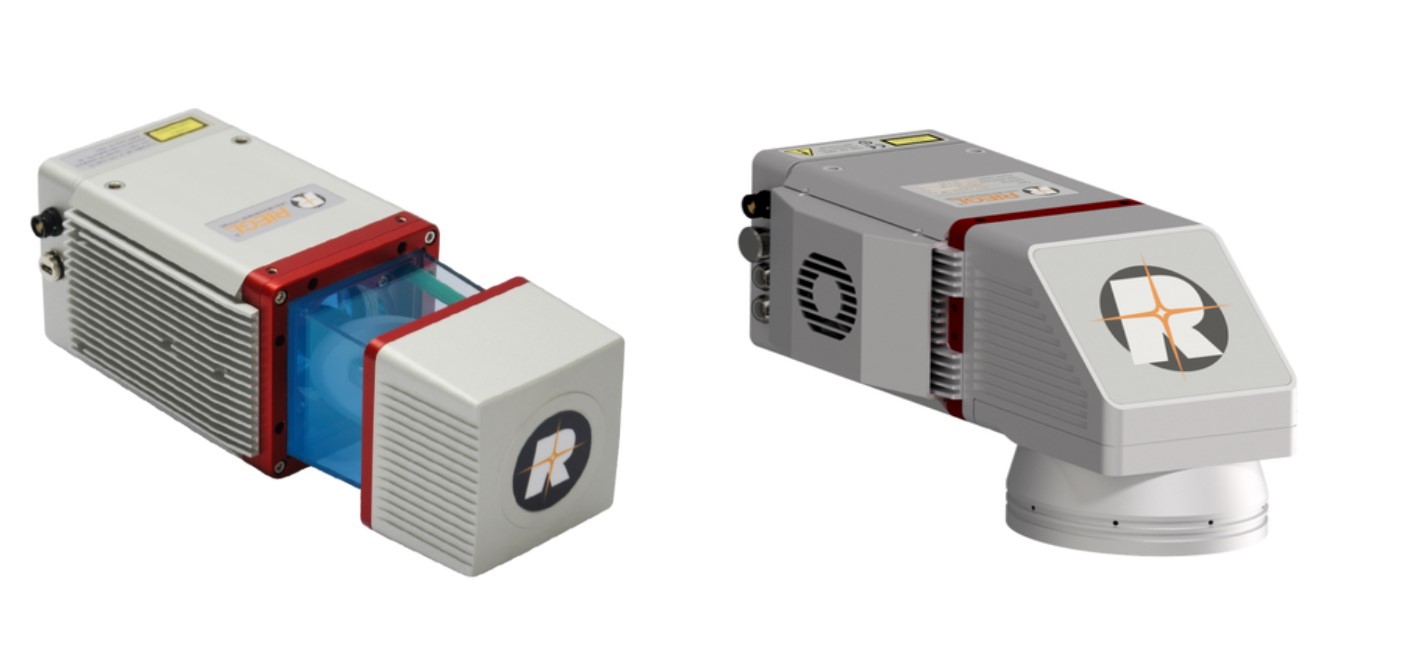
2016: miniVUX-1UAV: A very compact miniaturized 360-degree field of view lidar sensor with only 1.6 kilograms and especially developed for the implementation of emerging survey solutions by small UAS/UAV/RPAS. The new sensor offers multi-target capability and accuracy using echo digitization and online waveform processing for data acquisition. The sensor is capable of 100,000 measurements per second and offers a measurement capacity of up to 250 meters. Its small size and very low weight make it well suited for mounting under limited weight and space conditions. The user friendly and cost-efficient device allows UAV based acquisition of survey grade data.
2017: miniVUX-DL1: A sister device to the miniature UAV laser scanner miniVUX-1UAV. The added indicator “DL” means “downward looking” and refers to its special design tailored to meet the needs of corridor mapping tasks (downward looking, optimized field of view, small size). The DL is suited for tasks such as inspection, powerline and pipeline surveillance, or for infrastructure inspection as in highway or railway monitoring. The wedge prism scanner construction produces a FOV of 46 degrees and the circular scan pattern provides a very high point density and good point distribution.
PrecisionHawk currently employs the miniVUX-1UAV within all the vertical markets we service, including but not limited to Agriculture, Government, Insurance, Energy and Construction. PrecisionHawk’s servicing department picked the RIEGL miniVUX-1UAV because of the efficiencies it provides over other sensors. It can fly twice as high as other sensors in the same class and is supported by a premier suite of processing tools (software). It’s important to state that the accuracy this sensor provides is both absolute and relative; the manufacturer’s stated accuracy is 1.5cm absolute accuracy and 1.0cm in precision. The sensor provides up to 5 returns per pulse increasing the probability of reaching the ground significantly.
The main factor in selecting the RIEGL miniVUX-1UAV was the point repeatability and clarity of the data. It is well documented that RIEGL sensors are excellent at generating highly accurate, clean data sets. The data exceeded our expectations drastically and the point usability is significantly better than other sensors we’ve tried. What this means is more points that are generated from the miniVUX-1UAV can be used for the end-product as it relates to other drone lidar sensors. Typically, there is almost no noise in these data sets as compared to other drone lidar sensors that have significant noise. Although, the other manufactures market repetition rate and say how you can get 300,000 points per second or 600,000 points per second with a 2-return sensor versus the miniVUX-1UAV sensor at 100,000 points per second with 5 returns. The amount of noise in the associated data with the 300,000 to 600,000 points per meter sensor is significantly more than the miniVUX-1UAV. The associated noise is about 4 to 10 times in distance or say 4 to 10cm of noise versus the 1 cm of precision in the miniVUX-1UAV so that when you filter out the noise from the faster rep. rate sensor, the actual usable points are less that what is usable with the miniVUX-1UAV. An example of the accuracy for a project flown with the miniVUX-1UAV for one of PrecisionHawk’s engineering clients yielded an accuracy of 1.34cm RMSE. This project was flown at 80m above ground level with 50 percent overlap and yielded roughly 80 to 100 points per meter.
The miniVUX-1UAV sensor can quickly pay for itself if utilized efficiently. You’ll be hard pressed to find better accuracy, precision, reliability, ease of calibration and processing from other drone sensors. Celebrating their 40th anniversary in 2018, RIEGL continues to excel at developing outstanding equipment.