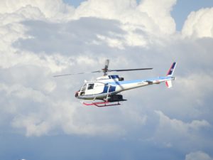
Ready to go! The new Topo-Hydrographic Airborne Laser Scanner RIEGL VQ-880-GH designed for helicopters integrated in Nakanihon Air Service’s “SAKURA 5”
Horn, Austria – June 7, 2018 – After successfully integrating and mobilizing a brand new RIEGL VQ-880-GH Topo-Hydrographic Laser Scanning System last year, NAKANIHON will report on their first experiences and results at this year’s Joint Airborne Bathymetry LiDAR Technical Center of Expertise (JALBTCX) workshop in Providence, Rhode Island.
The presentation will be given by Kohei Wakamatsu from NAKANIHON’s research-survey division on Tuesday, June 26, at 10 a.m. and will be backed up by Dr. Martin Pfennigbauer from RIEGL.
For details, see the full program: https://shoals.sam.usace.army.mil/Tech_Workshops.aspx
Nakanihon is a Japanese general aviation company and a long-time valued RIEGL customer with over 40 years of experience in the airborne research and survey field. In 2017, the 5th generation of the helicopter-based airborne LiDAR system, which is referred to as SAKURA (stands for “Cherry Blossom”), was launched.
The 5th SAKURA iteration (called “SAKURA-GH”) utilizes the Airborne Laser Scanning System, the VQ-880-GH, which was developed by RIEGL in the same year, to address the industry’s need for helicopter operations. Find more detailed information on this Waveform-LiDAR system especially designed for helicopter integration and its special features for combined hydrographic and topographic surveying at: www.riegl.com/vq-880-gh
In the presentation, Mr. Wakamatsu will highlight the benefits of helicopter-based airborne bathymetric LiDAR systems in terms of the topographic characteristics of Japan. Additionally, the installation carried out by Nakanihon and the technical realizations of a helicopter integration will be covered. Preliminary data examples and results will also be discussed.

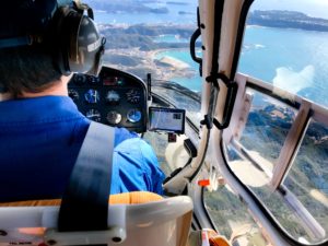
In flight: Helicopter platforms are the ideal solution for projects with difficult and diverse topography.

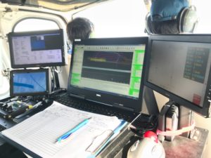
Everything under control! The operator’s workstation for flight guidance and camera / scanner control.
About RIEGL:
RIEGL is an international leading provider of cutting edge technology in airborne, mobile, terrestrial, industrial and unmanned laser scanning solutions.
RIEGL has been producing LiDAR systems commercially for almost 40 years and focuses on pulsed time-of-flight laser radar technology in multiple wavelengths.
RIEGL’s core Smart-Waveform technologies provide pure digital LiDAR signal processing, unique methodologies for resolving range ambiguities, multiple targets per laser shots, optimum distribution of measurements, calibrated amplitudes and reflectance estimates, as well as the seamless integration and calibration of systems.
RIEGL’s various 3D scanners offer a wide array of performance characteristics and serve as a platform for continuing ”Innovation in 3D” for the LiDAR industry.
From the first inquiry, to purchase and integration of the system, as well as training and support, RIEGL maintains an out-standing history of reliability and support to their customers.
Worldwide sales, training, support and services are delivered from RIEGL’s headquarters in Austria, main offices in the USA, Japan, and China, and by a worldwide network of representatives covering Europe, North and South America, Asia, Australia, and Africa.
For more information, visit www.riegl.com .
About Nakanihon:
Nakanihon Air Service Co, Ltd (NAKANIHON) is a Japanese general aviation company which was established in 1953, celebrating its 65th year this year. NAKANIHON is now operating over 60 aircrafts to offer transportation, emergency medical services, aircraft maintenance, repair services, and also airborne research and survey.
In the research and survey division, NAKANIHON widely covers airborne remote sensing including photogrammetry, hyperspectral and thermal imaging, and LiDAR survey by using RIEGL laser scanners such as the LMS-Q560, the LMS-Q680i, and the LMS-Q780. Analyzing the high performance LiDAR data, NAKANIHON provides customers with a wide variety of GIS products such as high resolution geographic maps and 3D city models for protecting secure and safe life of local residents.
Recently, NAKANIHON has been utilizing the VUX-1 in order to measure more detailed geographic features and offers ALB (Airborne LiDAR Bathymetry) to measure underwater in rivers and the shallow sea by integrating the VQ-880-GH on their survey helicopter.
For more information, visit https://www.nnk.co.jp/en/
